


White Pocket, Wrather Arch & A Thanksgiving Under the Stars
Picking Up Where We Left Off
This post continues our Thanksgiving adventure in Vermilion Cliffs National Monument. In Part 1, we traded Colorado snow for Utah sun, camped beneath a star-packed sky in the San Rafael Swell, and settled into Stateline Campground on the Utah–Arizona border—our home base at the edge of the Paria Plateau.
Part 2 steps deeper into the heart of the monument: wandering the surreal sandstone of White Pocket, visiting rock shelters and pictograph panels, standing at the rim of Wrather Canyon, watching California condors ride the cliffs, and ending the holiday with a desert Thanksgiving dinner under the stars.
DAY 3 — White Pocket, Ancient Art, and a Thanksgiving Under the Stars
Waking Up to Frost & Sunrise
We woke to a thin shimmer of frost clinging to the tent walls, the fabric glittering softly in the cold morning light. The desert was still half-asleep—quiet, pale, and holding onto the last breaths of night. Then, slowly, the sun began to rise over the cliffs, spilling warm color across the valley. Shadows retreated, the sagebrush took on hues of gold and rose, and the frozen beads on the tent roof began to melt into tiny, sparkling trails. In just a few breaths, the desert transformed from icy stillness to sunlit warmth, the landscape waking in layers of color.
The Road to White Pocket
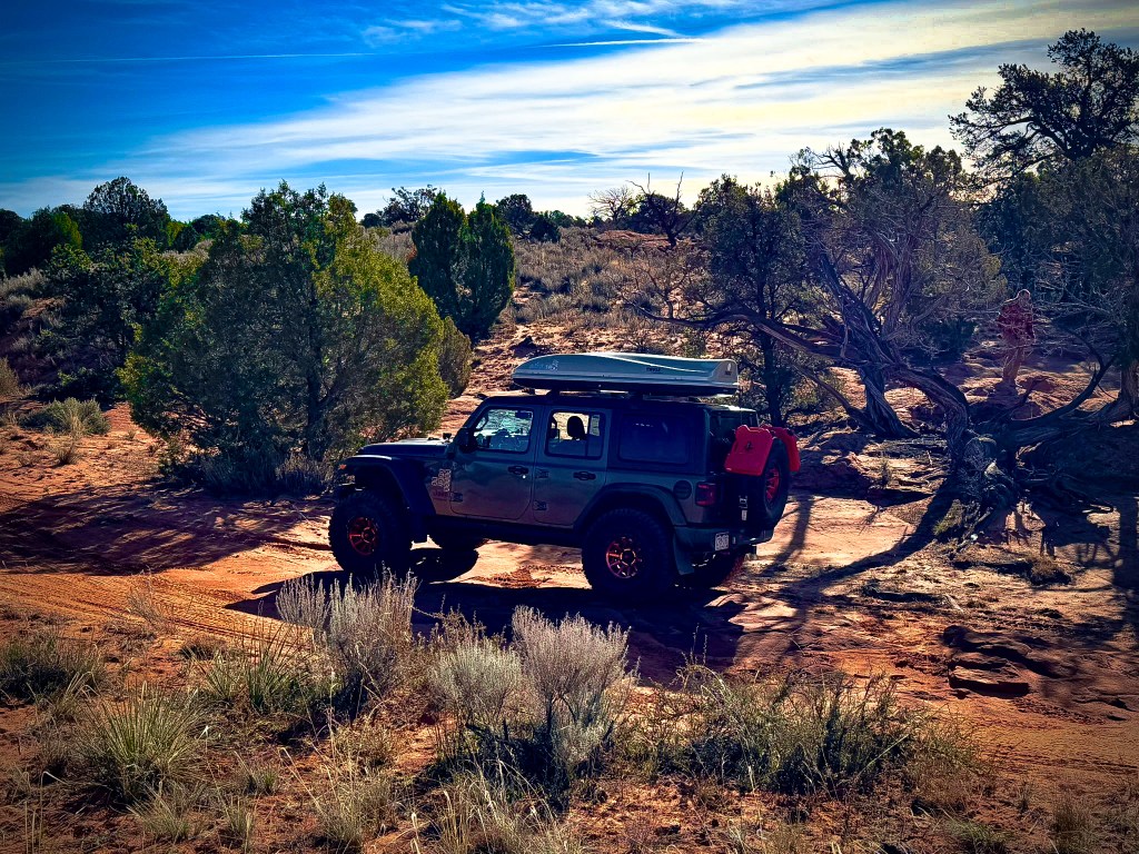
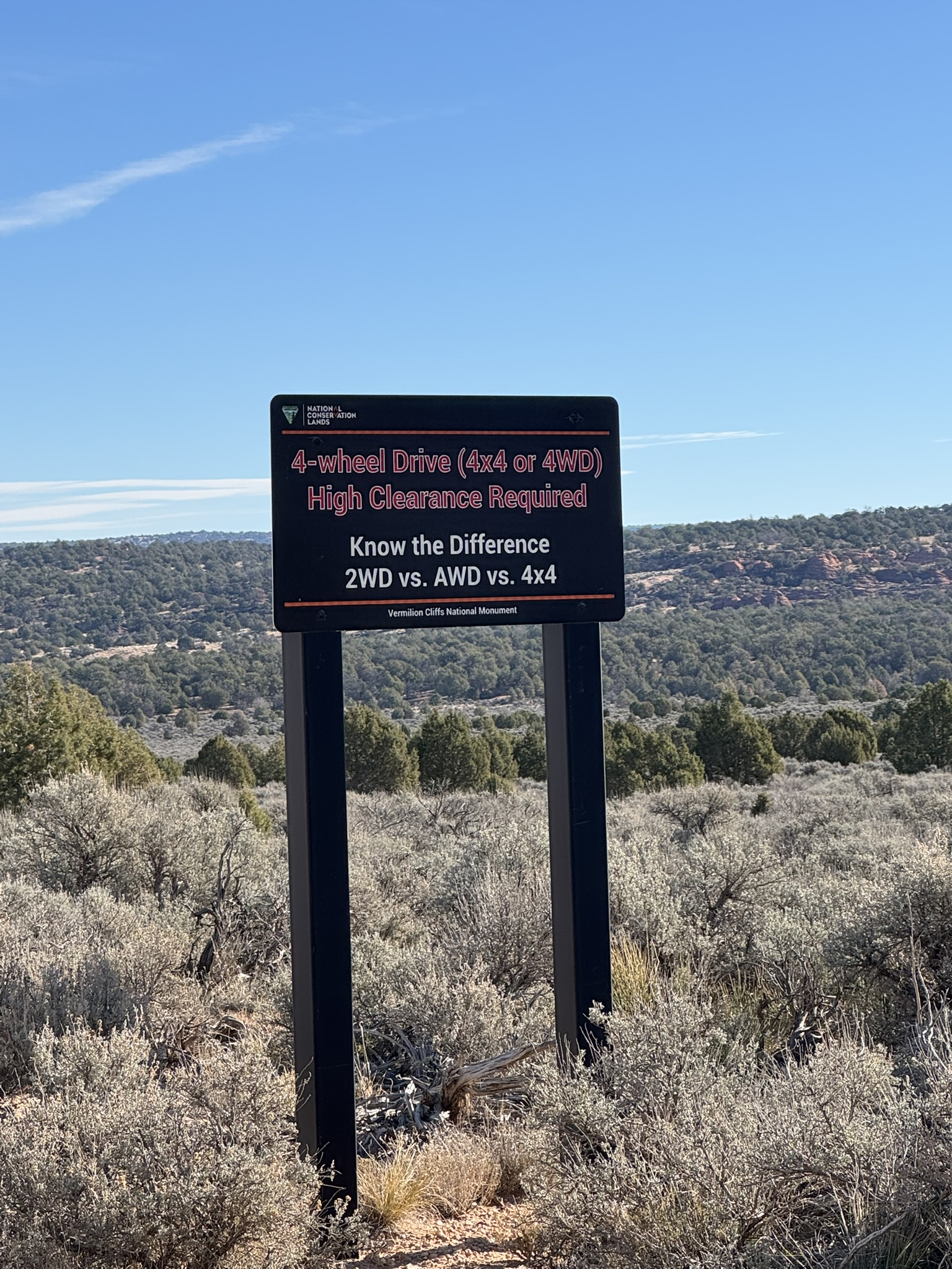
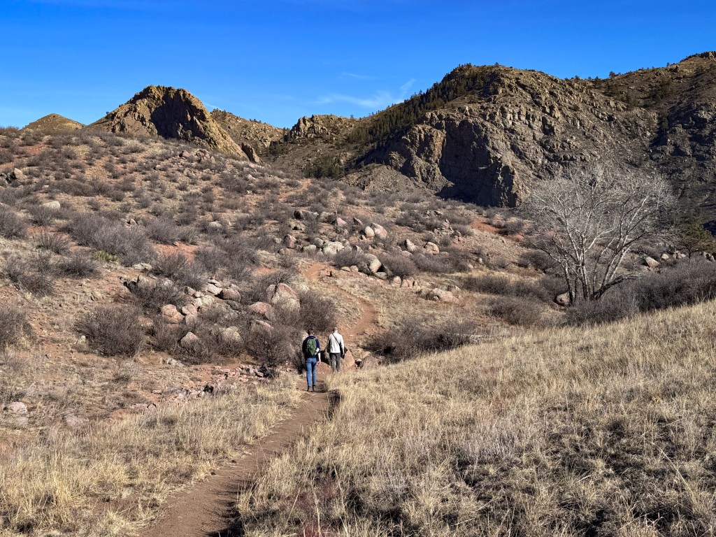
After breakfast, we pointed the Jeep toward White Pocket, a destination that’s as much about the journey as the destination itself. Turning onto BLM 1087, we passed the familiar warning sign: 4×4 High Clearance Required. Out here, those signs aren’t suggestions. Conditions shift constantly in the desert; what’s passable one day can swallow tires the next.
The road began with long stretches of washboard, then dipped into rutted sections carved by years of storms. Soon the sand deepened, the ruts growing over a foot tall in places, twisting and winding through juniper and open slickrock.
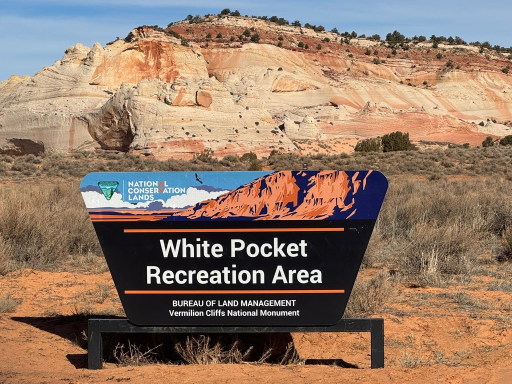
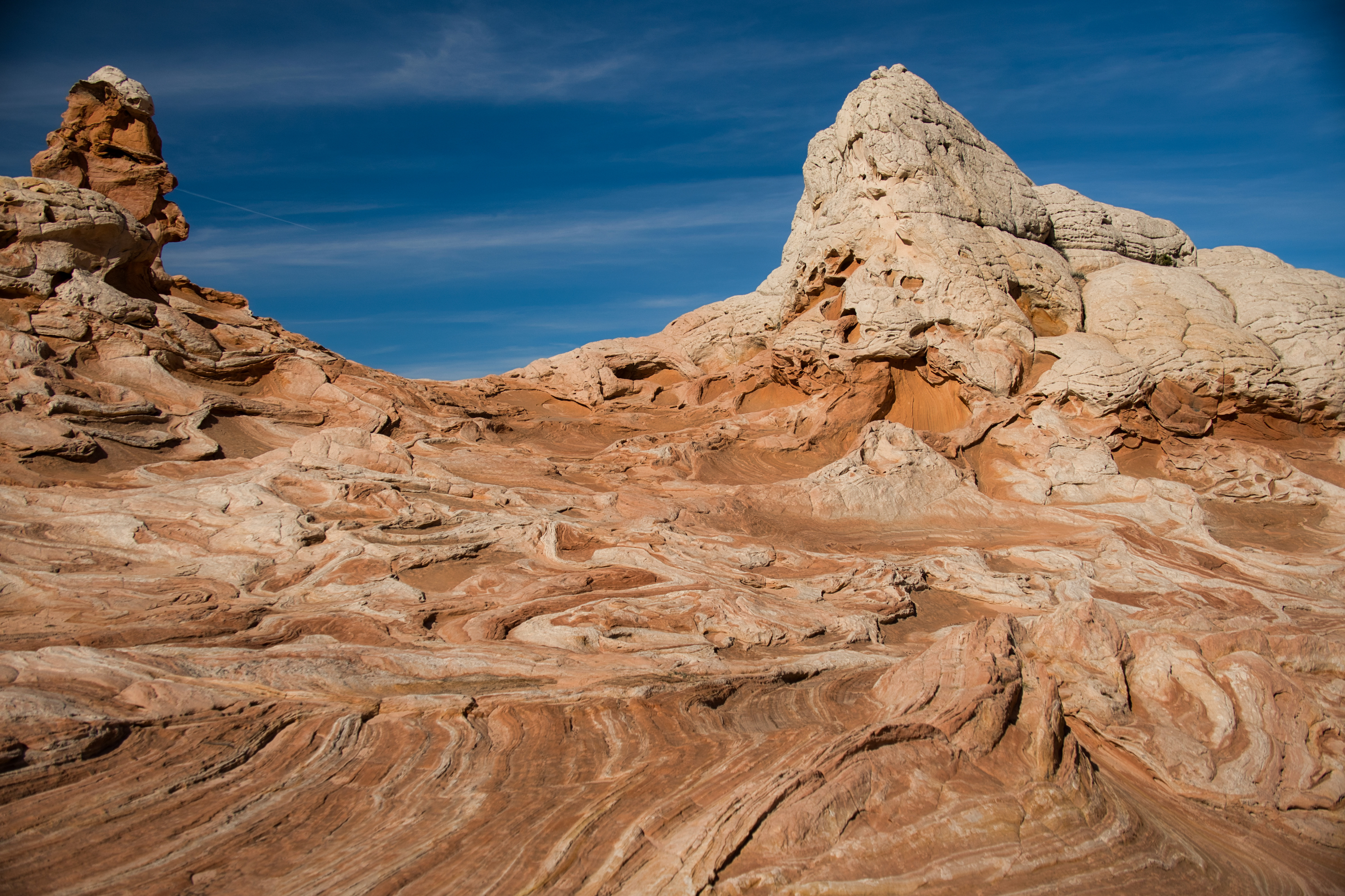
But the morning was beautiful—the sky a flawless blue, temperatures hovering in the mid-50s, and a silence so complete it felt like its own landscape. As the miles rolled on, the first hints of White Pocket appeared: pale stone rising abruptly from the desert floor, like a monolith surfacing from another world. And then, finally, the sign we’d been waiting for: White Pocket Recreation Area, standing proudly against a backdrop of swirling sandstone.
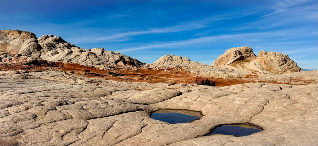
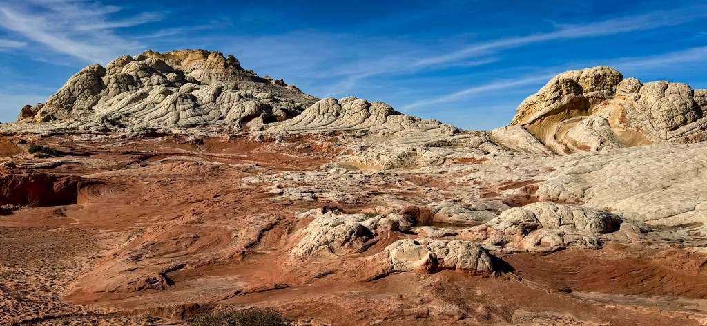
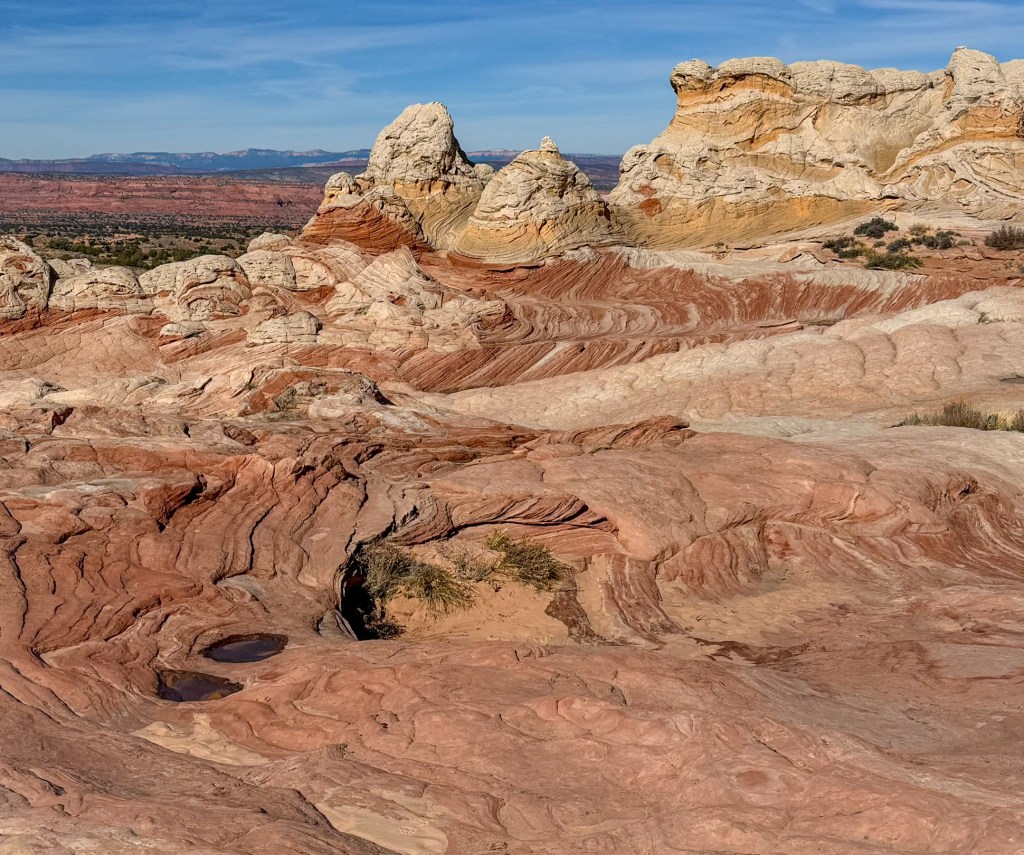
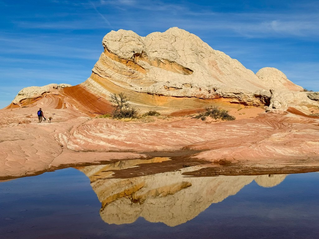
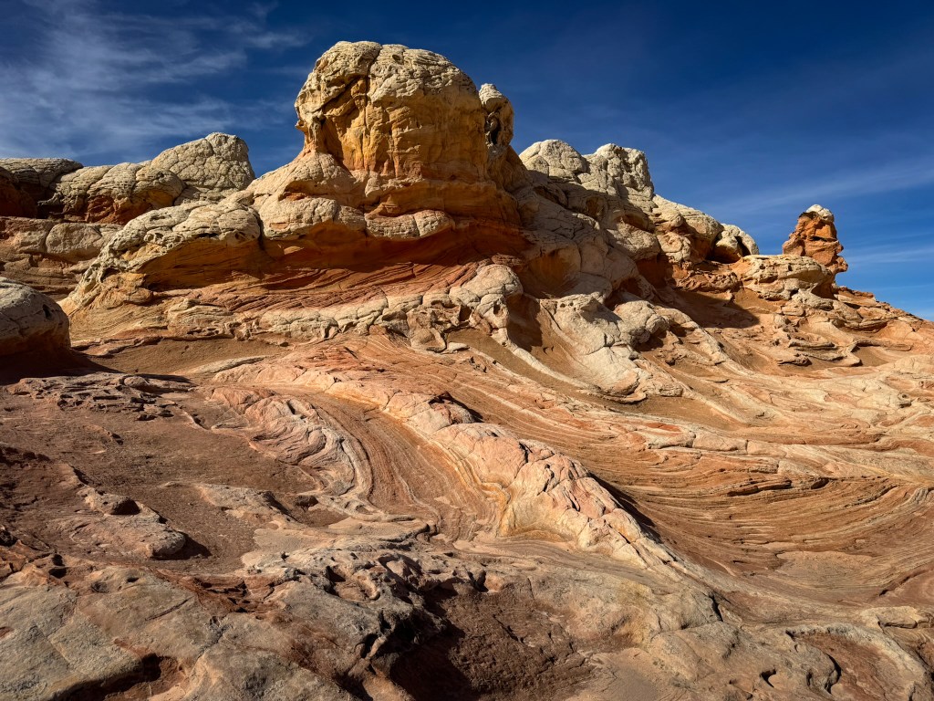
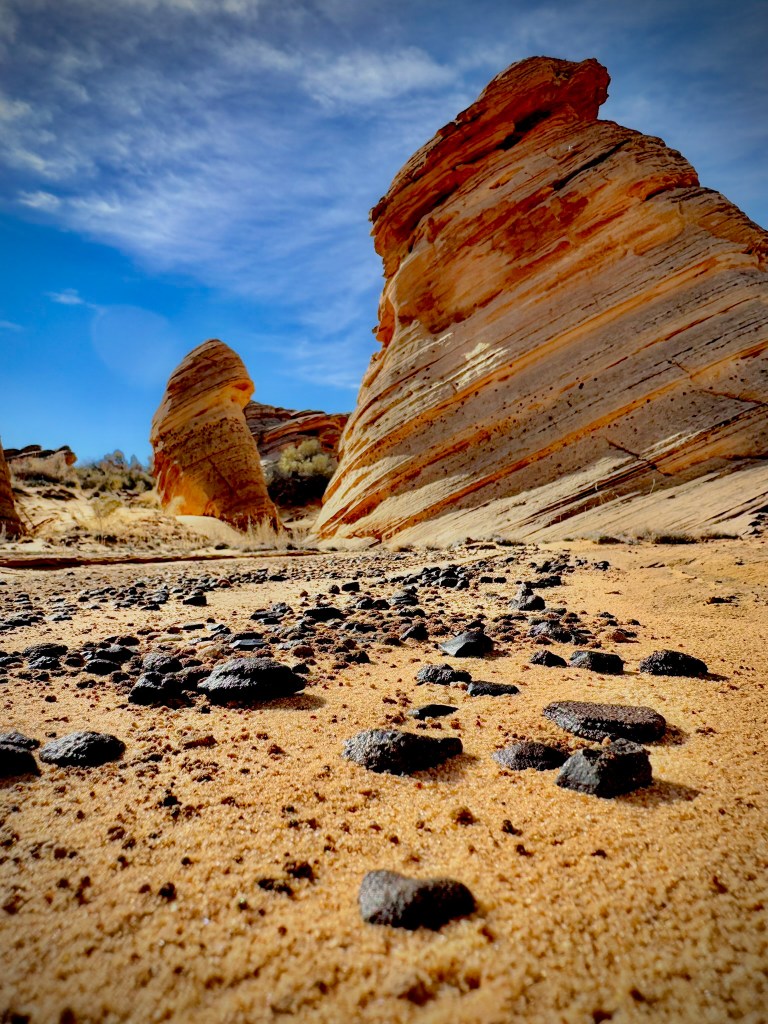
Entering White Pocket’s Otherworld
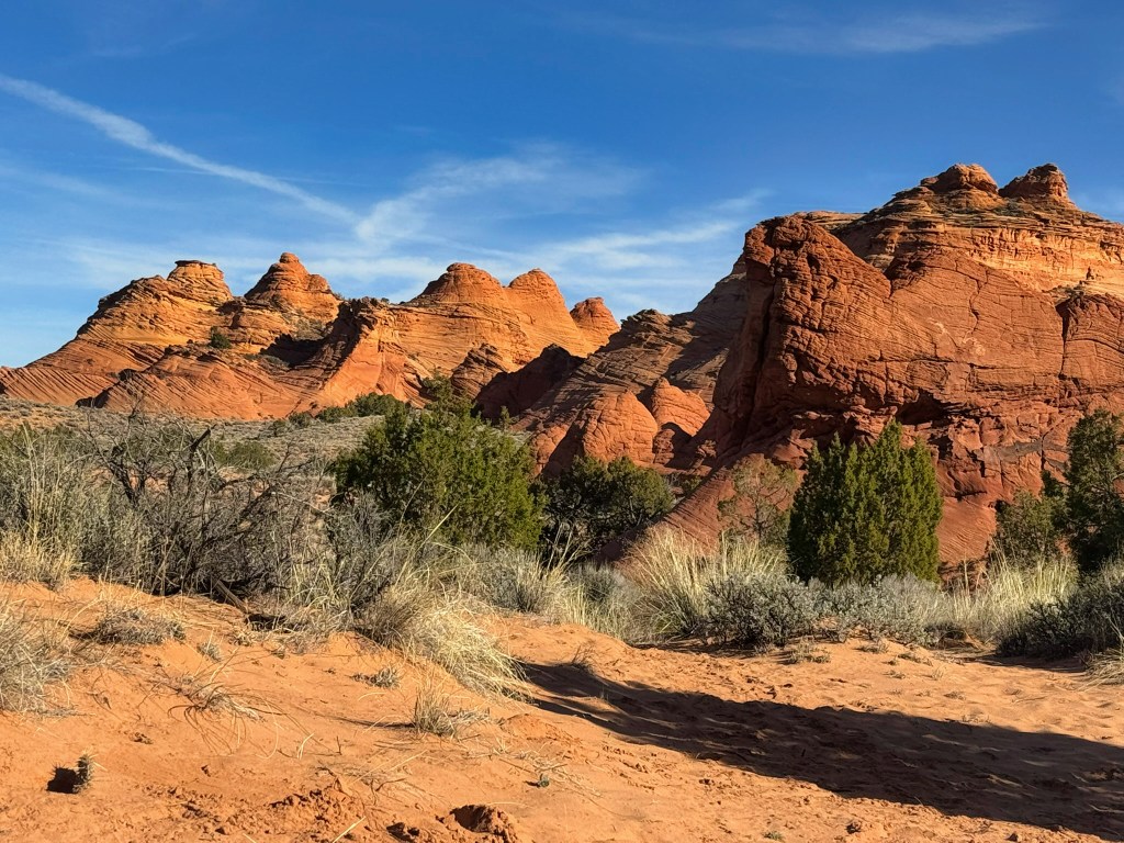
From the trailhead, we followed a short stretch of soft sand—just enough to make our boots sink a little with each step—before the terrain abruptly opened onto a vast sweep of slickrock. One moment we were walking through desert brush, and the next we were standing inside a world that didn’t seem entirely earthly.
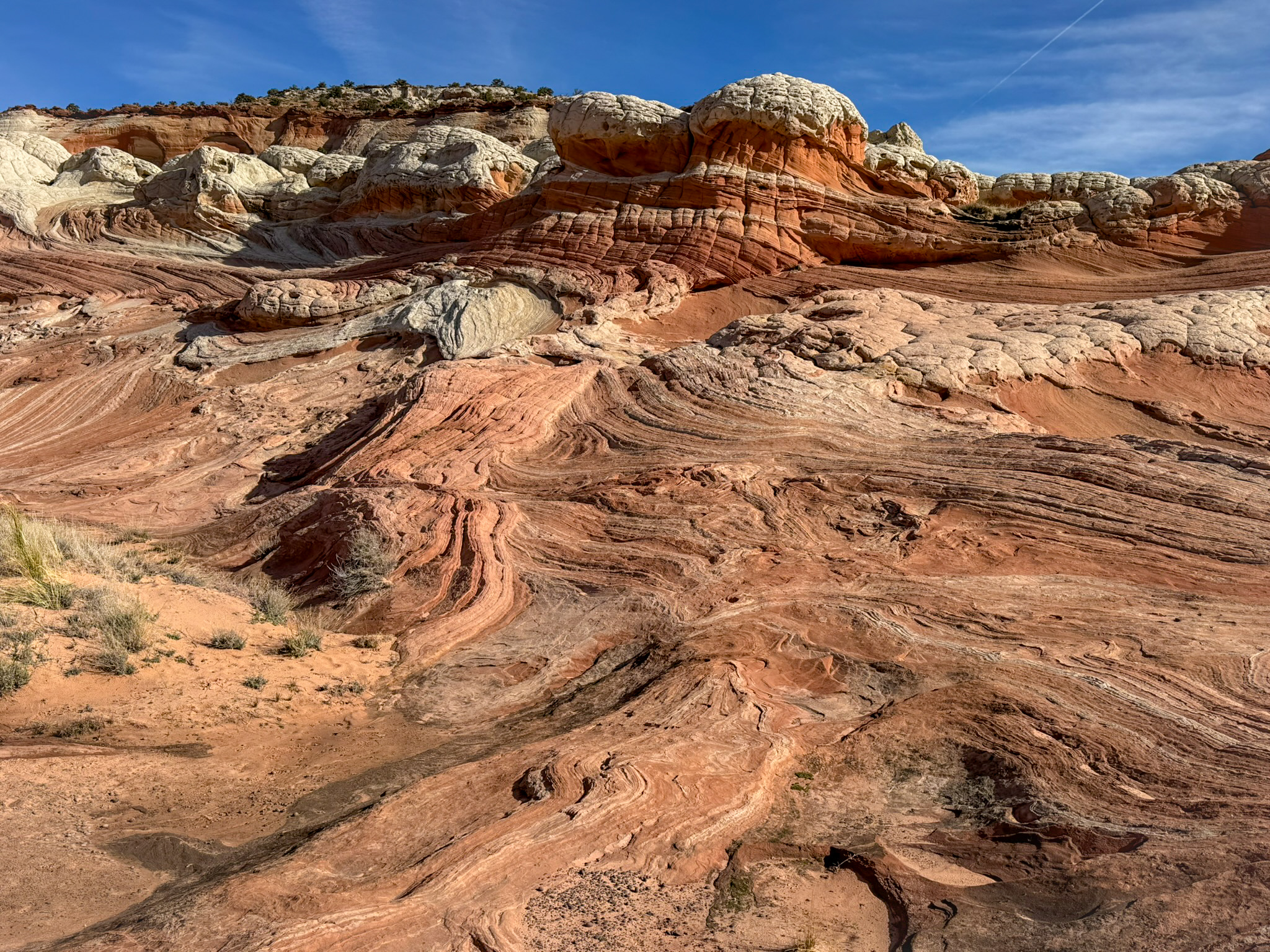
White Pocket spread out before us in waves of pale sandstone, sculpted into domes, folds, and bulbous shapes that looked like they had been poured rather than carved. Ribbons of red, peach, and buttery yellow curled through the rock like marbled clay, blending and separating in patterns that felt almost fluid. The stone rose and dipped in frozen motion, as if the whole landscape had been caught mid-swirl by some ancient force.
Shallow potholes held lingering pools from the last storm—still, clear mirrors reflecting the sky, the cliffs, and sometimes our own silhouettes drifting across their surface.
We wandered for hours, climbing rounded domes, tracing lines in the rock, photographing every shift in texture and color. As the sun arced higher, the landscape changed with it—whites brightening to silver, reds deepening to rust, shadows stretching and curling into the pockets and channels between the stone. It was a place that demanded slow exploration, not just to see it but to understand its rhythm.
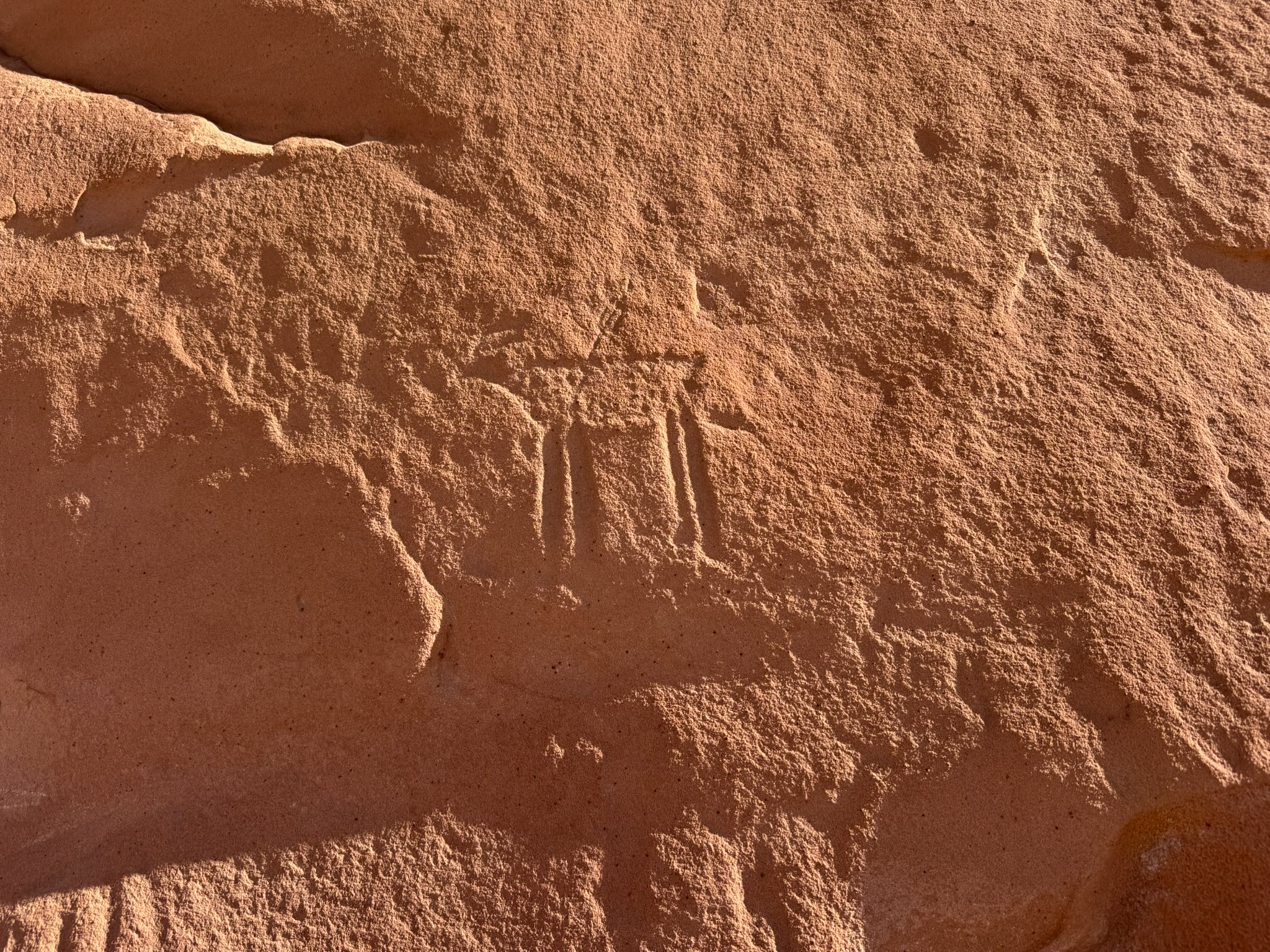
Petroglyphs & Ancient Artifacts
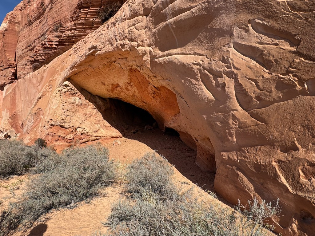
Nearby, we wandered into an Ancestral Puebloan rock shelter tucked beneath a sweeping alcove. Faint petroglyphs were etched across the sandstone wall—deer, shapes, and lines softened by centuries of wind and time. Inside the alcove lay a scatter of artifacts: pottery shards, tiny bones, nutshells, stone flakes, even what looked like remnants of ancient corn.
Standing there, surrounded by the quiet, it was impossible not to feel the weight of history. Long before any tracks or guidebooks existed, people lived, traveled, and thrived in this landscape—leaving behind stories carved in stone.


Windows in the Stone
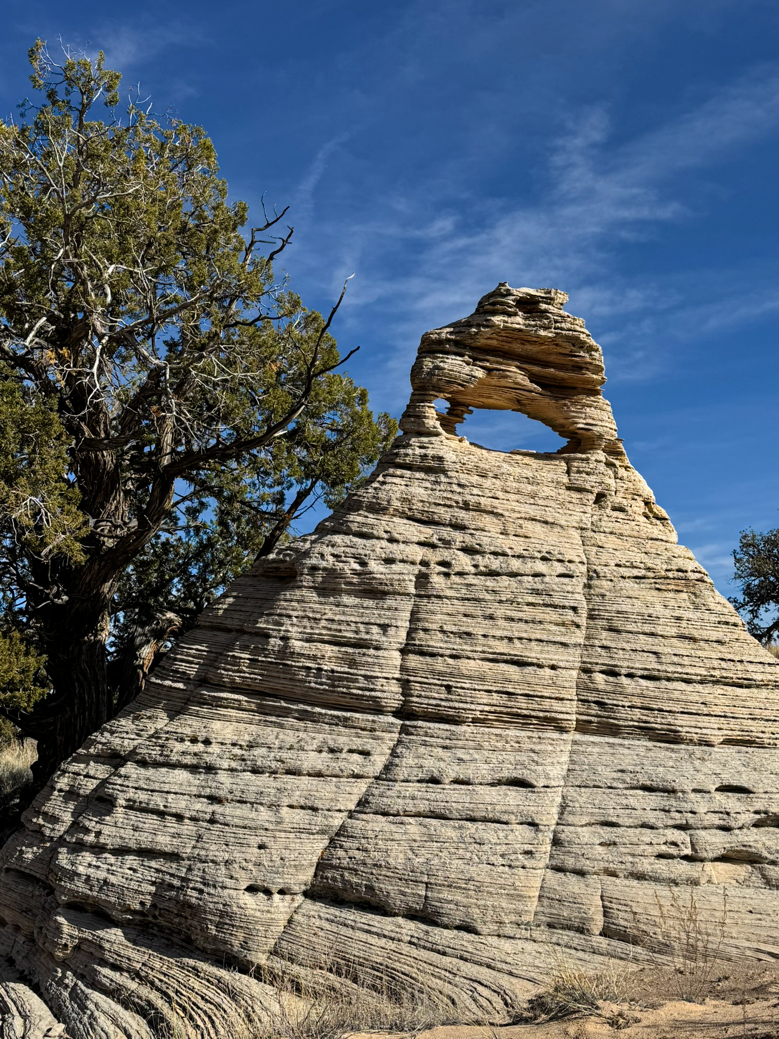
A short, sandy drive carried us onward, the road weaving between juniper stands and pastel-striped buttes. Before long, a small arch appeared on the horizon, a delicate window carved into a lone sandstone pinnacle. We jokingly named it “Baby Hole-In-The-Rock,” a tiny echo of what we were seeking.
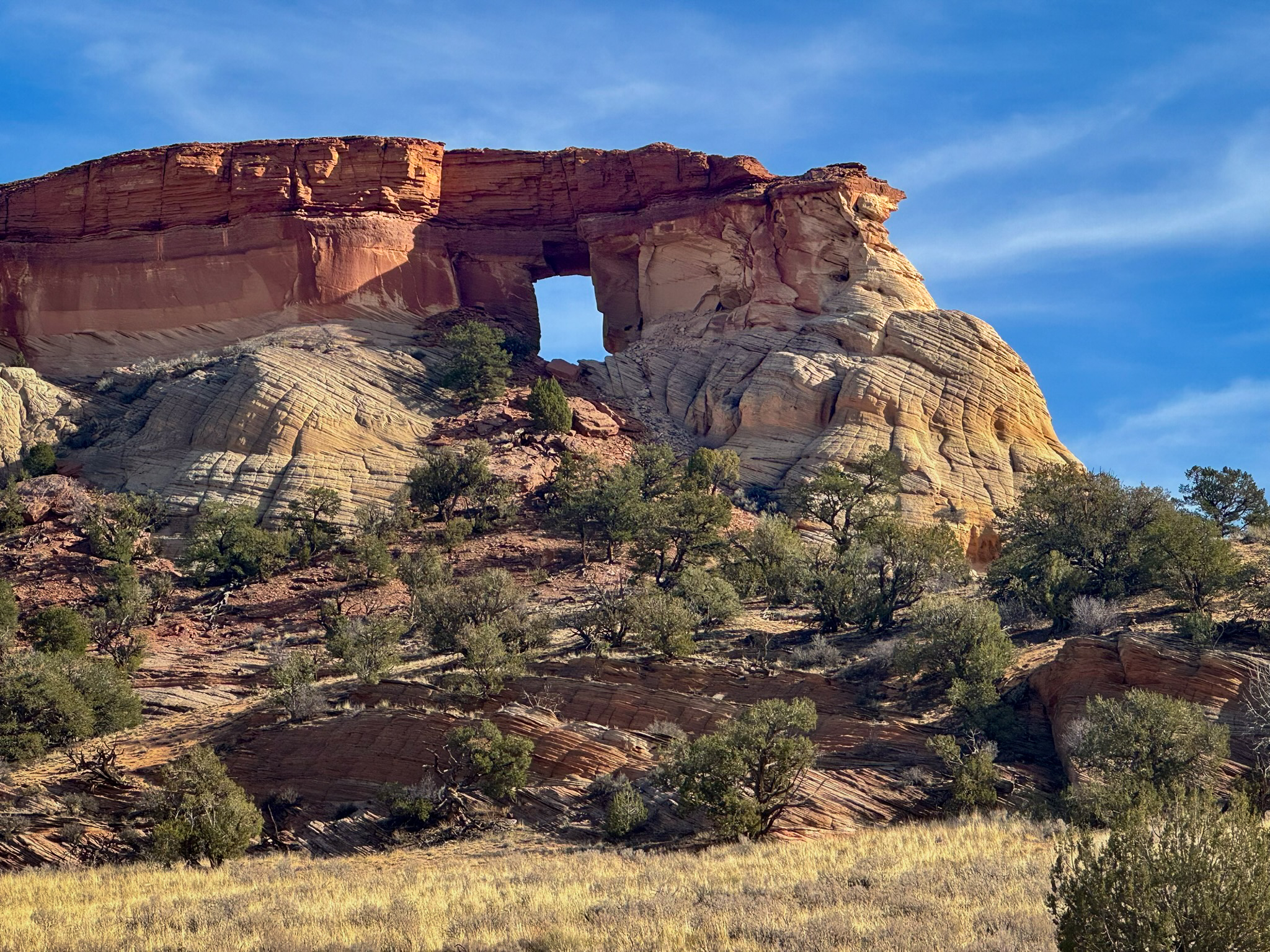
From there, the landscape grew grander. Layered cliffs rose in warm tones of cream and rust, twisting into towers and soft ridgelines. We followed the track around one final bend and there it was: Hole-In-The-Rock Arch, a massive cutout framed by sculpted stone, sunlight pouring straight through the opening like a spotlight on the desert floor.
Maze Rock Art Site
Later that afternoon, once we made it back to House Rock Valley Road, we began the drive toward camp—but the warm light and open desert were too tempting to ignore. We pulled over for one last hike, this time to the Maze Rock Art Site, a remarkable panel of pictographs tucked into a sandstone cliff.
The trail was gentle and quiet, winding through sagebrush and soft red sand as the cliffs around us glowed in late-day sun. When we reached the wall, the name made perfect sense: at the top of the panel was a maze-like symbol, carved with precision and surrounded by an energetic cluster of figures, spirals, animals, and geometric shapes.
The rock art is attributed to the Anasazi and is believed to date between A.D. 850 and 1300—a span of history that feels impossibly vast when you’re standing before the markings. It was easy to imagine people gathering here centuries ago, leaving stories etched into the stone for future travelers to find.


Thanksgiving Under the Stars
Back at camp, we pulled together our full Thanksgiving dinner, made possible thanks to all the prep we had done at home. Turkey, stuffing, mashed potatoes, green beans, cranberries, warm rolls… and yes, apple pie for dessert, because some traditions simply shouldn’t be skipped, even in the backcountry.
As twilight settled over the cliffs, the air cooled and the sky deepened into indigo. We ate by lantern light, the quiet of the desert wrapping around us like a blanket. The dogs curled up after their own turkey feast, exhausted from a day of adventure.
After cleaning up, we retreated into the tent for warmth, a shared movie, and the soft rustle of sleeping pups. Outside, the Vermilion Cliffs faded into darkness, and the stars—clearer and sharper than the night before—spilled across the sky.
It was a simple Thanksgiving, but somehow perfect: good food, a quiet desert, and the kind of day that fills you all the way to the edges.


DAY 4 — Wrather Arch, the Paria River & California Condors
A Morning Made for Wide Horizons
Dawn rose quietly over the plateau, brushing the sandstone in pale gold and signaling a day made for exploring the far edges of the map. Our final morning promised a little bit of everything—geology, water, wildlife, and, eventually, a classic diner meal to close the trip.

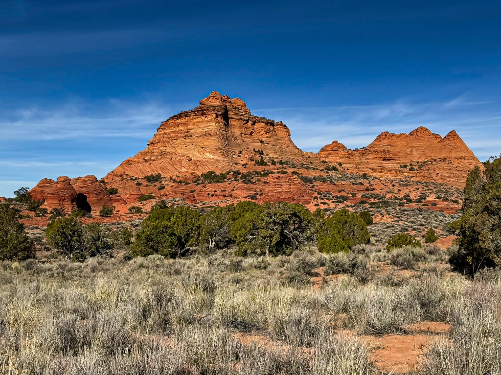
Sandstone Shapes & Sculpted Stone
Before aiming for Wrather Arch, we spent time wandering among a cluster of wind-sculpted formations—tilted layers of Navajo sandstone folded like pages of an ancient book, ridges capped in honey-gold, and long ribbons of petrified waves running beneath our feet. The dogs zigzagged between the ridges, their paws pattering softly over striped sandstone bands.
Scattered across the sand were moqui marbles—smooth, dark iron concretions that looked almost otherworldly against the pale stone. They gathered in small clusters like beads spilled from an unseen hand, tiny relics of geological alchemy formed over millions of years. Walking among them felt like moving through a quiet gallery of the desert’s oldest work.
It was a landscape of textures and contrasts, a place where every step revealed another pattern, another layer, another story held in stone.

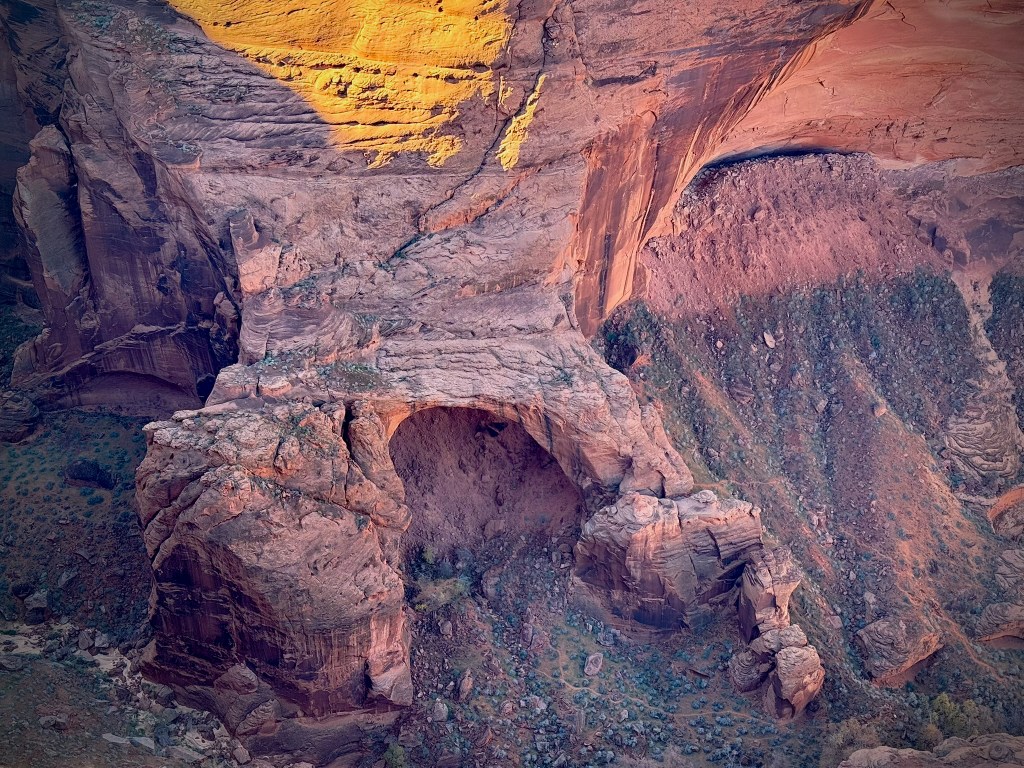
Toward the Rim of Wrather Canyon
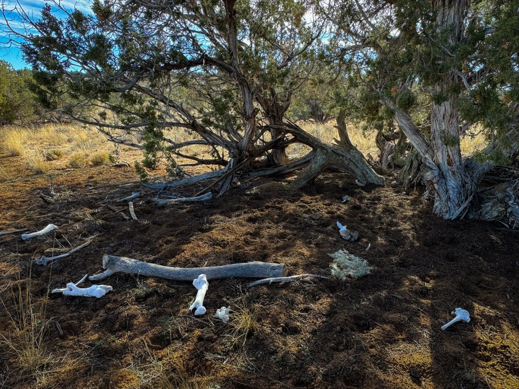
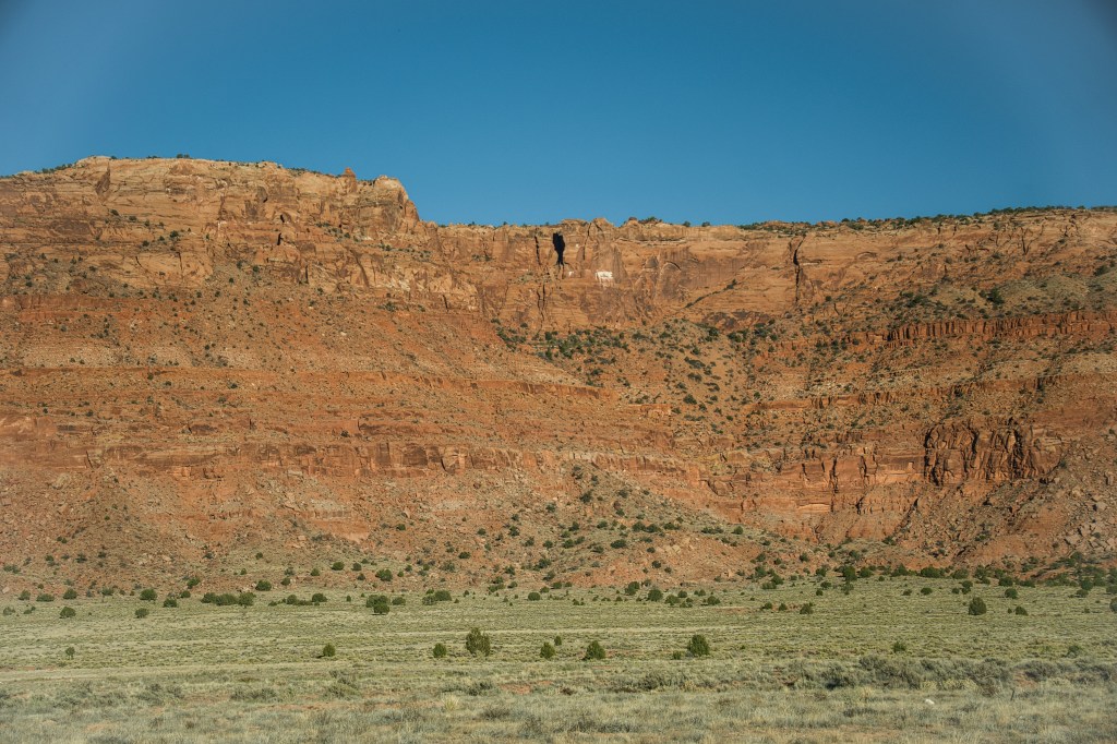
Next, we set our sights on the overlook for Wrather Arch, a massive cave-style natural arch tucked inside Wrather Canyon, a side canyon of Paria Canyon within the Vermilion Cliffs Wilderness, straddling both Utah and Arizona. Reaching it is an adventure in itself: 22 dusty miles of sandy tracks, faint two-tracks half swallowed by the desert, and long stretches of absolute quiet except for wind, the occasional cow, and the scatter of sun-bleached bones left behind.
Wrather Arch is one of the region’s giants, rising like a stone cathedral deep within the canyon. Back in 2020, Bill, Jackie, and I nearly reached it while backpacking Paria Canyon—so close—and ever since, I’d wanted to see it from above. The north rim offers a rare vantage point, typically viewed only by the most persistent hikers and off-road wanderers.
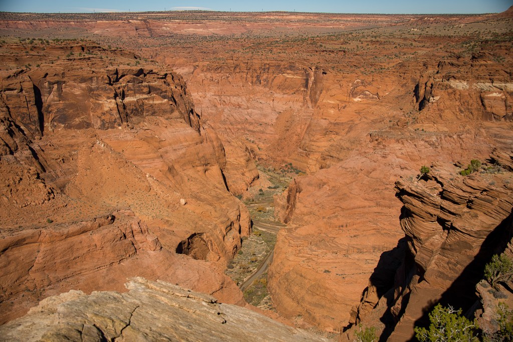
When we reached the end of the road, we hiked around the edge of Wrather Canyon to a point on the east side of the canyon’s mouth. Suddenly the ground dropped away into a sheer, 600-foot plunge. From there, the world opened into an immense tapestry of red walls, narrow corridors, and the winding line of the Paria River far below. I traced the bend where we’d once turned around on that backpacking trip and felt a flash of recognition—a momentary reunion with a trail that had shaped me.
Where the Condors Ride the Wind
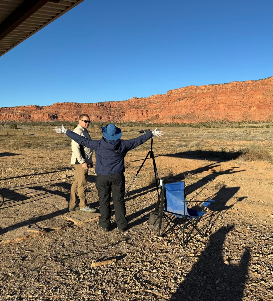
From there, we headed to the Condor Viewing Site, where the Vermilion Cliffs rise in rust-red towers and thermals lift the largest birds in North America into the sky. California condors—critically endangered, startlingly huge with wingspans stretching over nine feet—roost high along these cliffs.
We were fortunate to meet a biologist from the Peregrine Fund who was monitoring the population that morning. She let us look through her spotting scope, pointing out the release pens perched impossibly high on the cliff and a nesting site where a young condor tucked itself among the shadows. Listening to her describe the recovery efforts, you couldn’t help but feel awe for these prehistoric-looking birds returning, slowly, to the wild.


One Last Meal on the Road
As the sun fell behind the cliffs and the desert shifted from gold to rose, we drove toward Marble Canyon for one final meal. Lonely Jackrabbit Restaurant welcomed us with burgers, fries, and that perfect road-trip tiredness—the kind that settles in after days of sand, stone, and big skies.
It was the ideal ending to a Thanksgiving trip stitched together by remote roads, ancient canyons, and the quiet magic of the Vermilion Cliffs.

Closing Reflection: A Thanksgiving Woven in Stone
Some trips carve themselves into memory not through grand gestures, but through the quiet accumulation of moments—frost on a tent, the gold of first light, sand whispering under tires, ancient stories painted on stone, the soft weight of dogs sleeping after adventure.
This Thanksgiving wasn’t defined by a table or a timetable. It unfolded across mesas and canyons, under condor-shadowed skies and stars without boundaries.
The Vermilion Cliffs reminded us that gratitude often lives in the simplest things: warm sunlight, long roads, shared meals, and the wild places that ask nothing more of us than to slow down and look closely.
And as always, the desert offered its own kind of blessing—quiet, expansive, and full of promise for the journeys still ahead.


Exploring the Vermilion Cliffs: Journeys That Brought Us Here
This Thanksgiving trip felt like both a continuation and a homecoming. Over the years, Bill and I have returned to the Vermilion Cliffs region again and again—sometimes dropping deep into slot canyons, other times following rivers through sculpted corridors of stone. Each journey has revealed a different layer of this extraordinary landscape, slowly shaping the way we move through it and return to it.
If you’re curious to explore more of this area through our earlier adventures, these trips trace the path that led us back here:
- Vermilion Cliffs National Monument
Exploring the Mesmerizing Canyons of Vermilion Cliffs National Monument
→ A broad introduction to the canyon systems that first drew us into this wild, layered landscape. - Wire Pass Slot Canyon
Exploring the Wonders of Wire Pass Slot Canyon
→ A short but stunning introduction to slot canyon travel, packed with curves, light, and texture. - Buckskin Gulch
Conquering Buckskin Gulch: A Backpacking Adventure into the Heart of the Canyon
→ One of the longest and deepest slot canyons in the world, where narrow walls and flowing sand define the journey. - Paria Canyon
Into the Heart of Paria Canyon: Exploring Big Spring (Day 2)
→ Following the Paria River into one of the most water-shaped corridors in the region. - Paria Canyon
Journey Through Paria Canyon: Oasis in the Desert (Day 3)
→ Cottonwoods, flowing water, and long canyon days—an unforgettable stretch of the journey. - Paria Canyon
Farewell to the Canyon: Reflections on a 48-Mile Journey (Day 4)
→ Closing out a multi-day backpacking trip through one of the Southwest’s most iconic canyon systems.
Each return to this region feels different—new routes, new perspectives, familiar landmarks seen from a different angle. This Thanksgiving, standing above Wrather Canyon and wandering the otherworldly sandstone of White Pocket, it felt especially meaningful to realize how all of these journeys quietly connect.


Leave a comment