
Bears Ears, Davis Canyon & Lockhart Basin
Needles & Beyond: Backcountry Series — Post 1
Some landscapes seem built for wandering.
The Needles District of Canyonlands is one of them. It is a place where sandstone spires rise from the desert floor like ancient sentinels, narrow canyons twist deep into the earth, and every road seems to lead toward another layer of story.
On our recent trip, Bill and I traced 73 miles of backcountry roads over 4 days, winding through southeastern Utah from Bears Ears to Lockhart Basin and into the Needles District of Canyonlands. Along the way, we hiked beneath towering fins, climbed into hidden alcoves, followed dusty roads through canyon country, and watched the sun paint the desert in colors no camera can fully hold.
It wasn’t about checking off destinations. It was about following the landscape as it unfolded — one dusty mile at a time. This post begins a four-part backcountry series through Bears Ears, Lockhart Basin, and the Needles District of Canyonlands — a route that started with a quiet night north of Moab and quickly unfolded into ancient canyons, desert overlooks, sandy trails, and the road toward the heart of the Needles.
Day 1 — The Long Road to the Desert
Saturday, April 18
We left home beneath a crisp spring sky, the Front Range slowly fading behind us with every mile west.
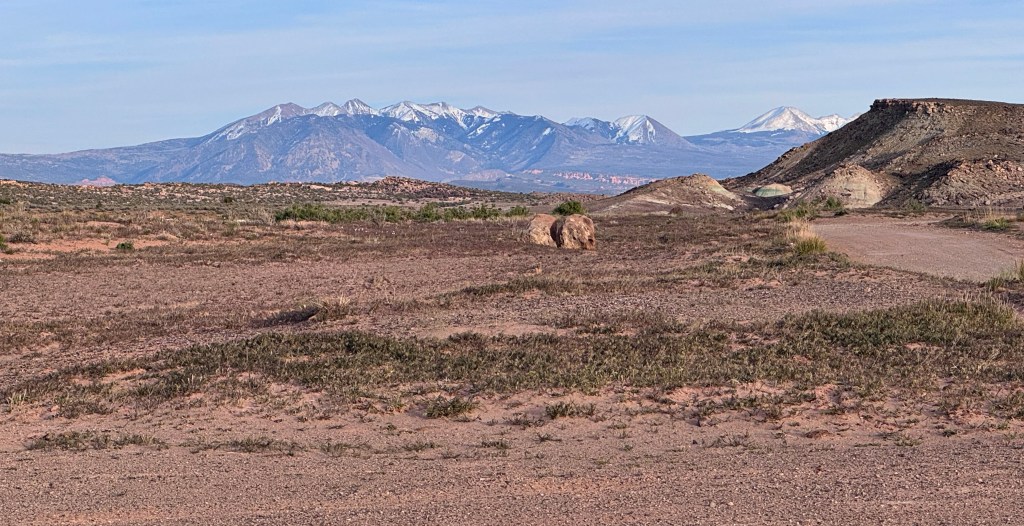
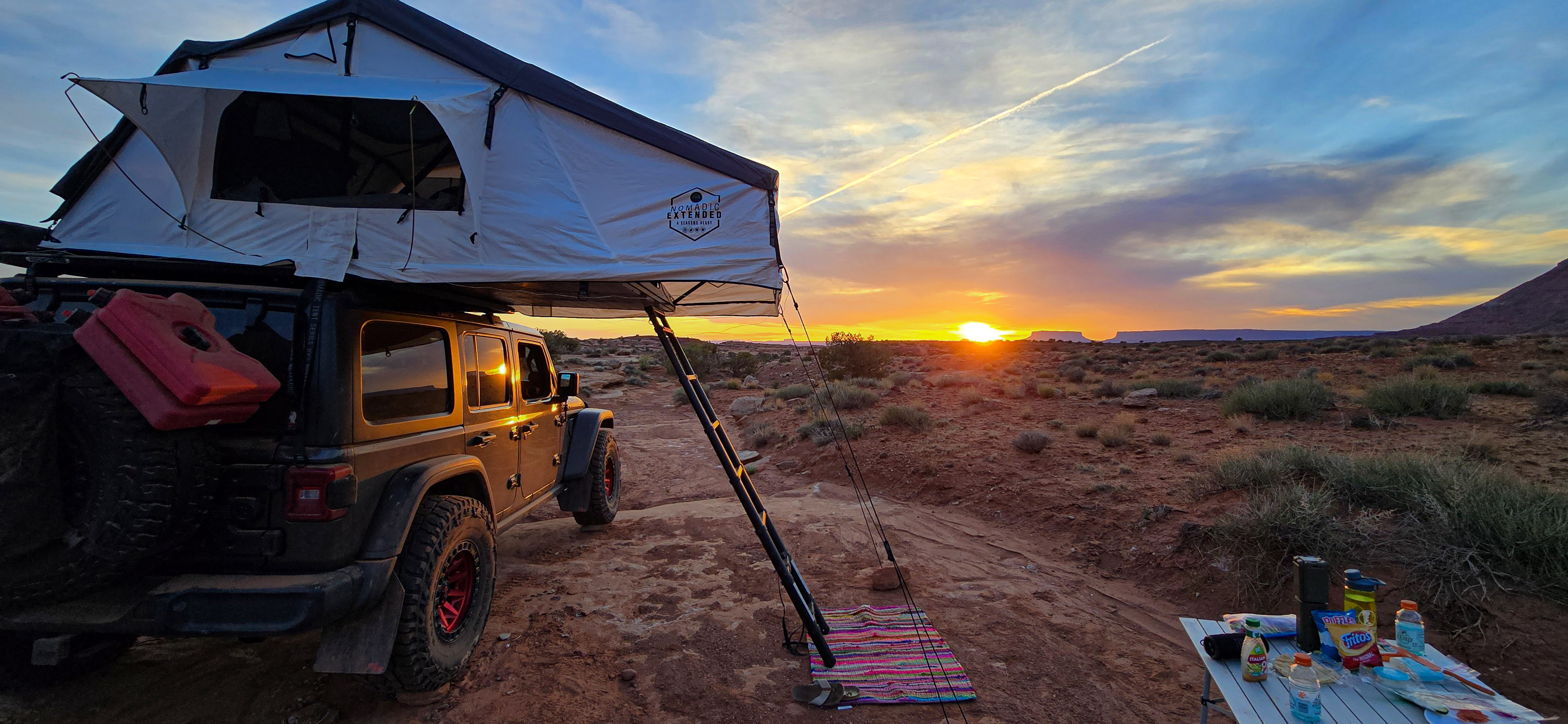
By late afternoon, the scenery had shifted from green giving way to red, mountains softening into mesas. We found ourselves driving along Klondike Bluff Road, just north of Moab. It had been a couple of years since Bill and I had camped in this area, and as the familiar silhouettes of the Marching Men formations came into view, it felt a little like returning to somewhere we already knew.
We tucked into a dispersed campsite with a wide-open view stretching toward Arches National Park. Somewhere beyond the horizon sat Tower Arch, hidden just out of sight — a quiet reminder of our 2021 trip exploring this same remote corner of the park.
It felt good to be back.
To the south, the La Sal Mountains still held onto winter, their snow-covered peaks rising unexpectedly above the desert floor. That blend of snow and sandstone, alpine peaks and dry desert air, is one of those Utah contrasts that never stops feeling surreal.
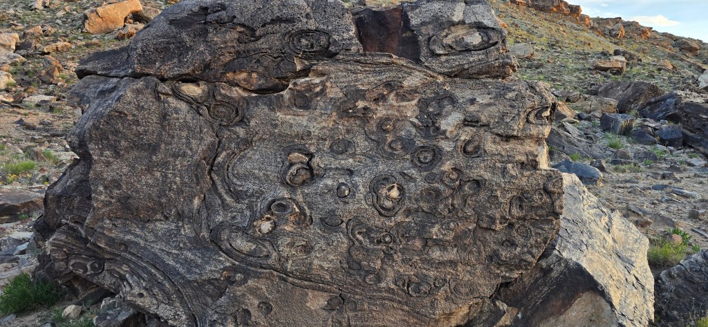
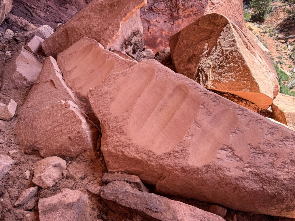
Camp came together easily. Bill moved through the familiar rhythm of setting things up, then spotted something unusual nearby — dark stone etched with strange circular patterns. As we wandered over to look, the smaller textures of the desert began to pull us in: wind-swept sand, scattered juniper, and those curious rings pressed into the rock.
Up close, the markings almost looked intentional, like carvings or ancient symbols. But rather than something shaped by human hands, they were natural formations called Liesegang rings, created over time as minerals moved through the sandstone and settled into repeating patterns. Swirls, loops, and imperfect circles spread across the stone like fingerprints left behind in the desert.
As the sun dropped lower, the rocks deepened into richer shades of red, shadows stretched long across the desert floor, and the horizon seemed to expand in every direction. We settled into that quiet kind of contentment that only seems to appear on the first night of a trip — when everything ahead still feels wide open.
Dinner was quick and simple. The air cooled quickly once the sun slipped below the horizon, and the last warmth of the day seemed to fade right out of the sandstone.
Above us, the first stars appeared one by one — a few quiet points of light at first, then hundreds, then more than we could count. The desert settled into that deep kind of silence that only seems to happen far from town, where the sky feels wider and the night feels closer.
By the time we crawled into bed, the long road behind us already felt distant. We had only just arrived, but the desert had begun to work its quiet spell.
Day 2 — Overlooks, Hidden Stories & the Road Into Canyon Country
Sunday, April 19
The next morning started with that gentle kind of camp rhythm — cool air, soft light, and the quiet routine of packing everything back into place. There was no rush, but the trip was just beginning. The first night had been about arriving. Day 2 would be about moving deeper.
We headed into Moab for one final gas stop and breakfast, then pointed the Jeep south toward Canyonlands and the long road into canyon country.
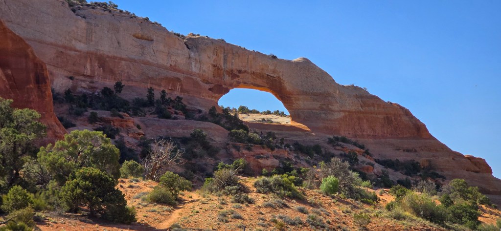
Wilson Arch
On the drive south, we made a quick stop at the Wilson Arch overlook. It is one of those places that is incredibly easy to access but almost impossible to drive past without pausing.
From the roadside, the massive sandstone opening framed the bright blue sky, its warm orange curve rising right above the highway. We didn’t need to hike up to appreciate it. Even from below, there was something striking about the way the arch seemed to appear suddenly from the landscape, turning an ordinary stretch of road into a moment worth stopping for.
It was a short stop, just long enough to stretch our legs and take in the view before the road pulled us south again.
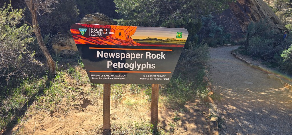
Newspaper Rock
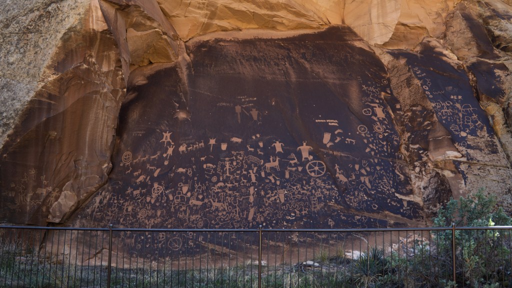
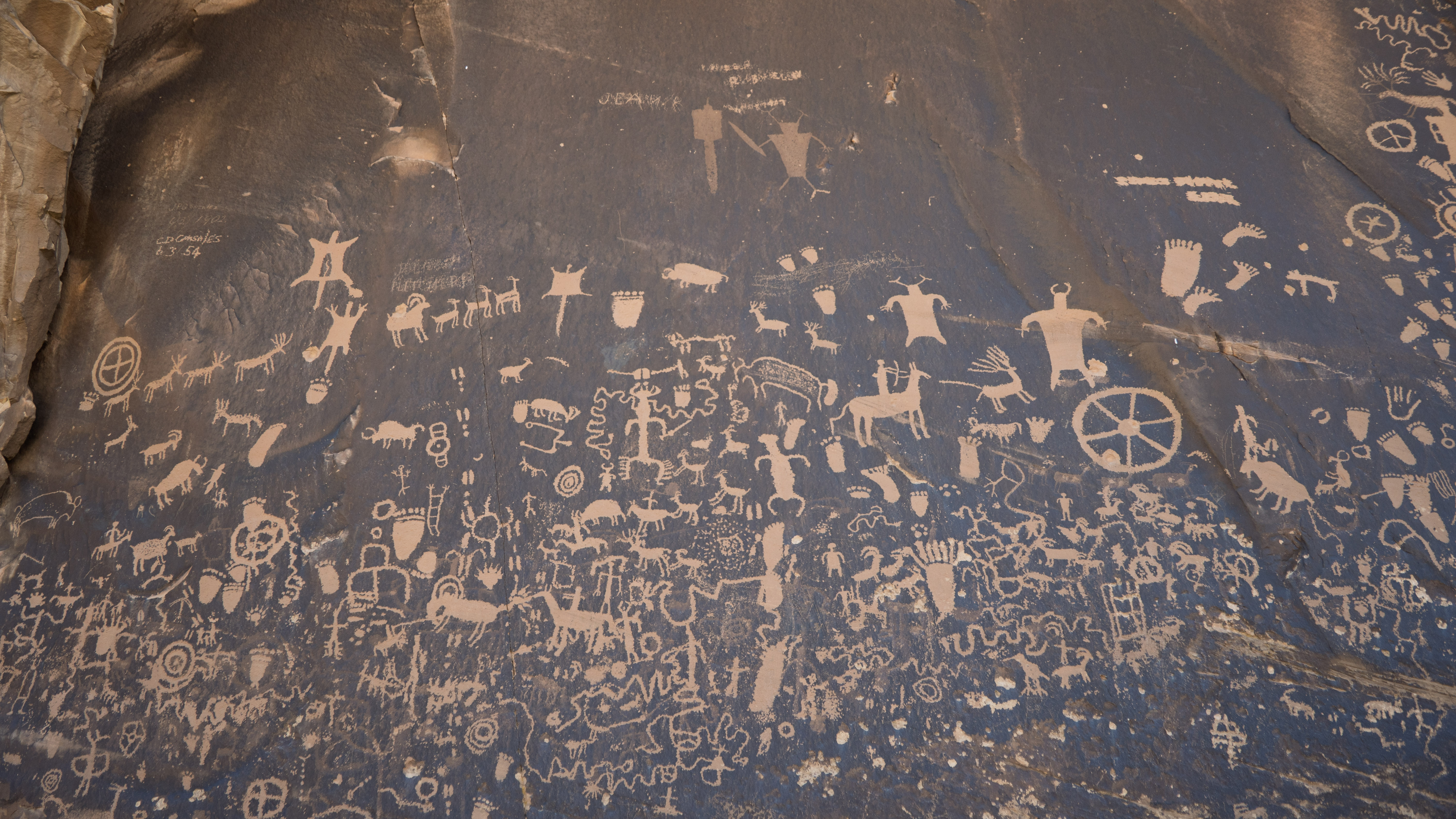
As we moved closer to Canyonlands, we stopped at Newspaper Rock — a massive petroglyph panel preserving nearly 2,000 years of human history.
Bill and I had stood here once before, back in 2018, during our first adventure together. This time, it felt like both a familiar pause and a threshold. Newspaper Rock was a place we knew, but beyond it, everything ahead of us would be new.
The panel itself is covered with symbols left behind by generations of Indigenous cultures, each adding their own markings over centuries. Figures, animals, handprints, patterns, and unfamiliar symbols layer across the dark stone like an ancient conversation — one we can witness, but never fully translate.
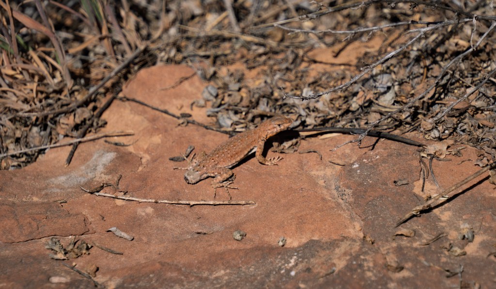
Nearby, a small lizard, missing part of its tail, paused briefly against the warm rock before disappearing back into the desert brush, a quiet reminder that this place is still very much alive.
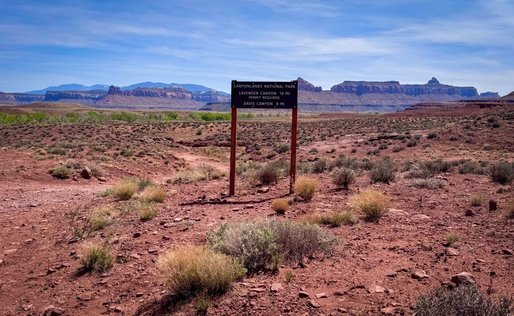
The Road to Davis Canyon
Before we ever stepped foot into Canyonlands National Park, the desert was already telling its own story.
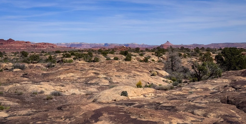
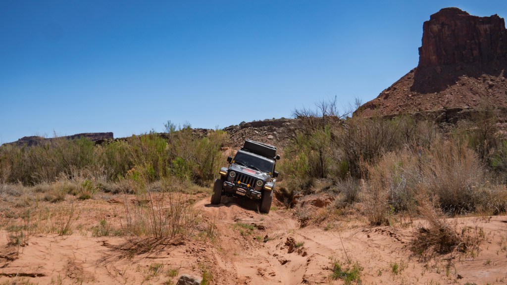
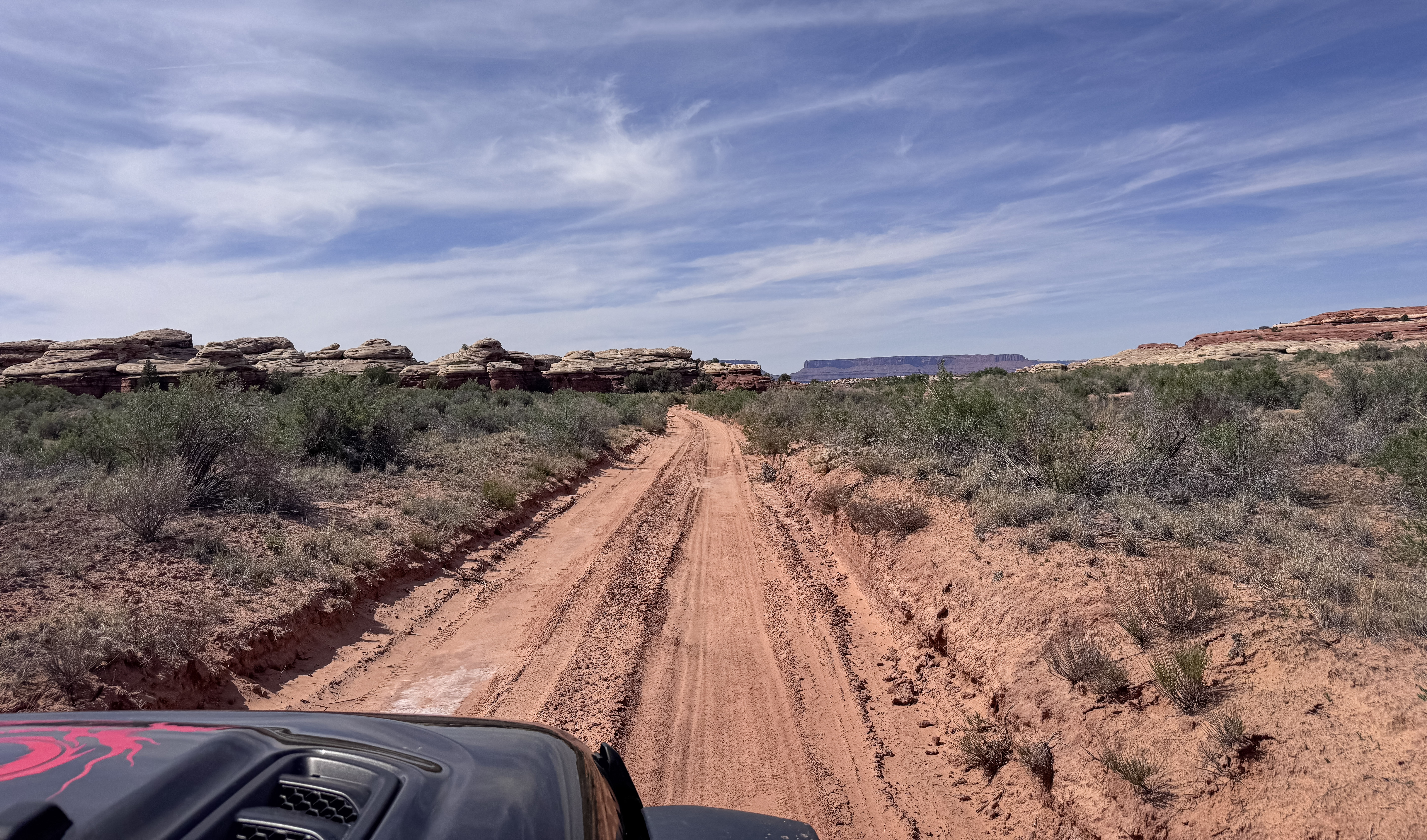
The road to Davis Canyon winds through the wide-open terrain of Bears Ears National Monument, a place that feels every bit as wild and storied as the park itself. We followed sandy tracks and shallow washes, the Jeep leaning gently into ruts and soft bends in the road while the country around us kept shifting — low shrubs, scattered rock, weathered canyon walls, and open space stretching endlessly toward the horizon.
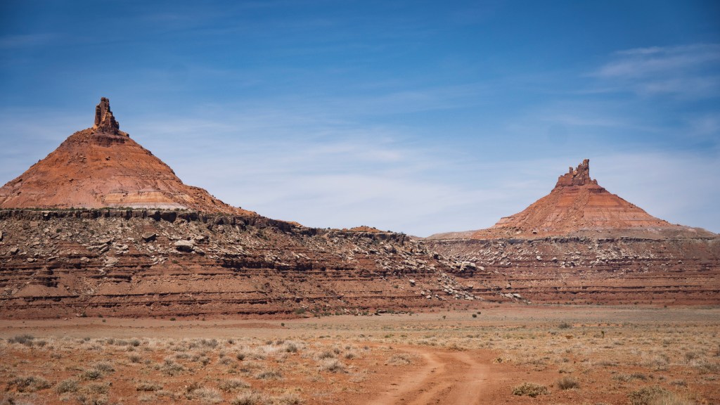
In the distance, the silhouettes of the North and South Sixshooter Peaks rose sharply from the desert floor, giving the wide-open terrain a sense of scale and drama that was hard not to admire.
Along the way, we passed a small group of cows resting in the heat, completely unbothered by our slow approach. A few calves lingered nearby, cute and curious and looking perfectly at home in the wide-open desert.
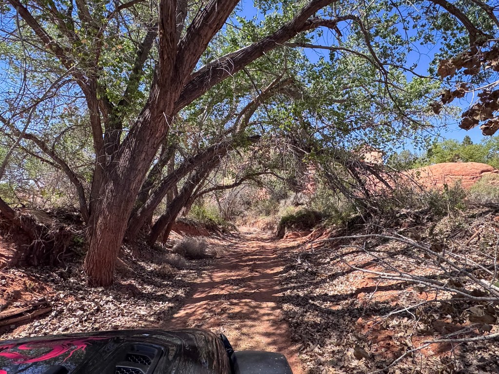
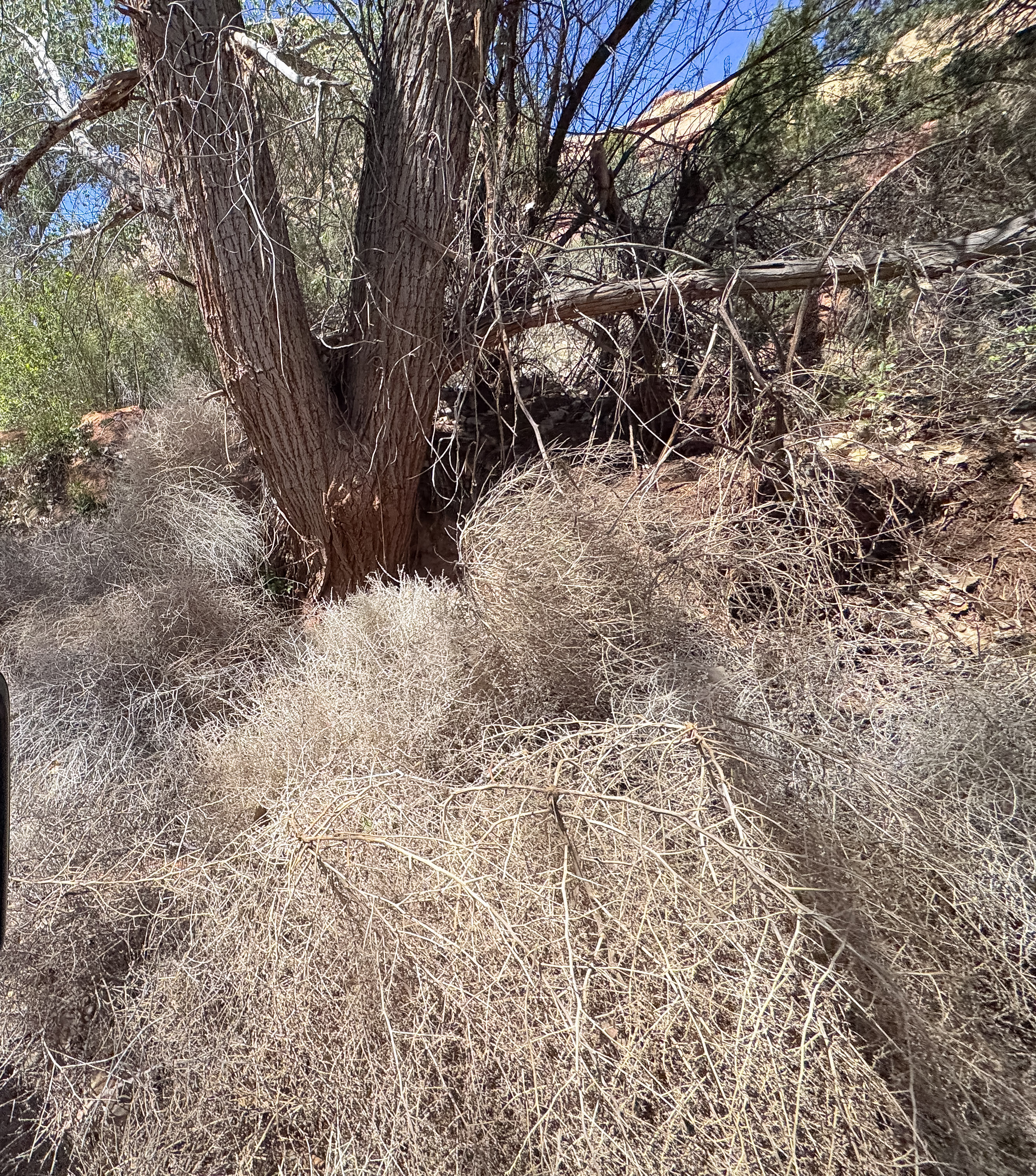
As we continued toward Davis Canyon, the road eventually dropped into a narrow wash. Cottonwoods arched overhead while clusters of tumbleweeds gathered along the edges like they had been caught mid-journey and simply decided to stay. Some tangled together in soft chaotic mounds; others wedged themselves against tree trunks and brush, quietly marking where wind and water had last moved through.
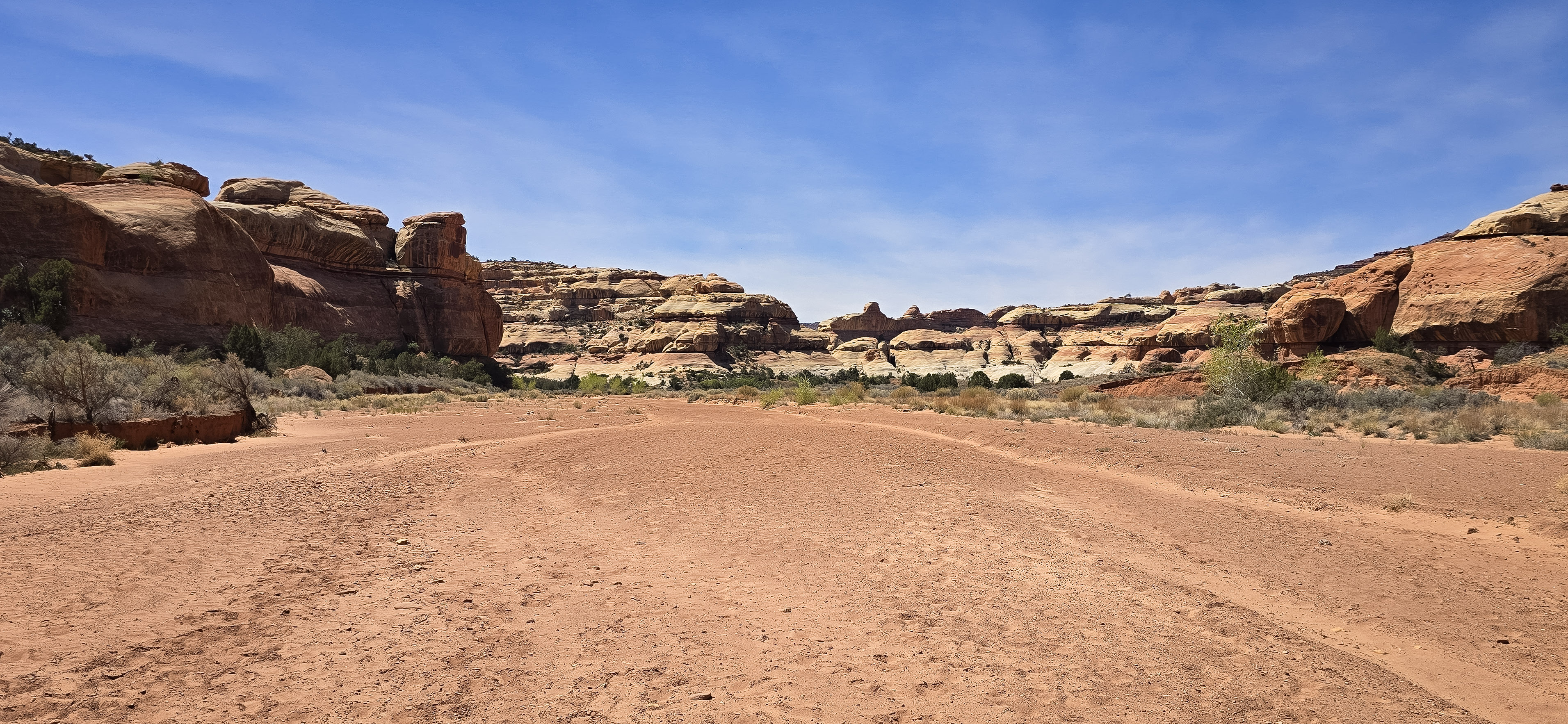
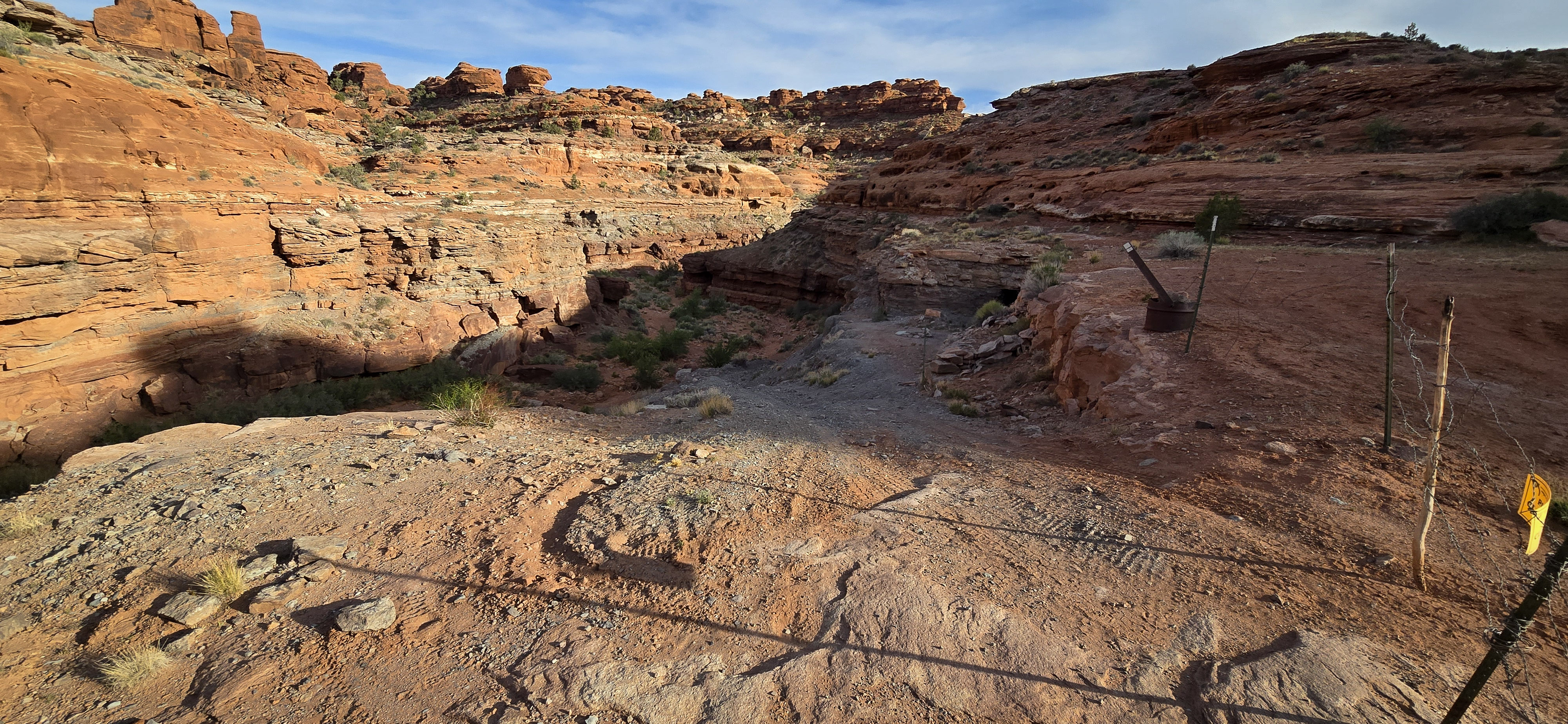
By the time we reached the end of the road, the canyon walls had crept closer, the colors had deepened, and the feeling of arrival finally settled in. A trailhead sign marked the start of the Davis Canyon hike. From here, we would continue on foot into a place shaped long before maps, trail markers, or national park boundaries.
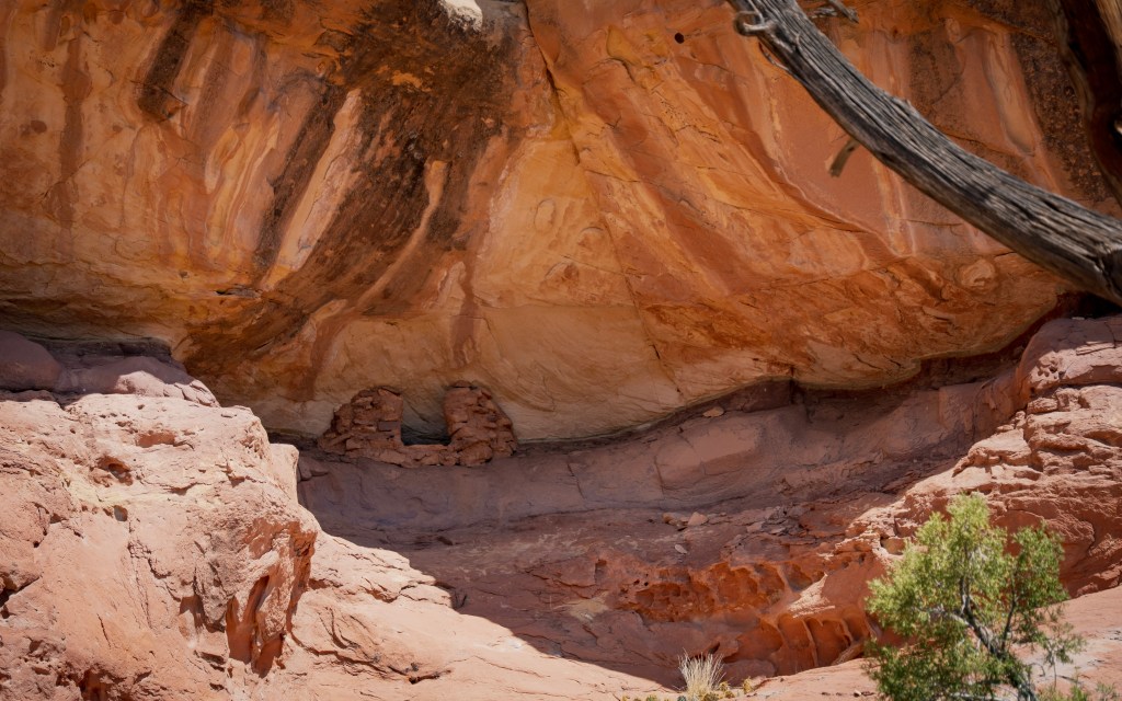
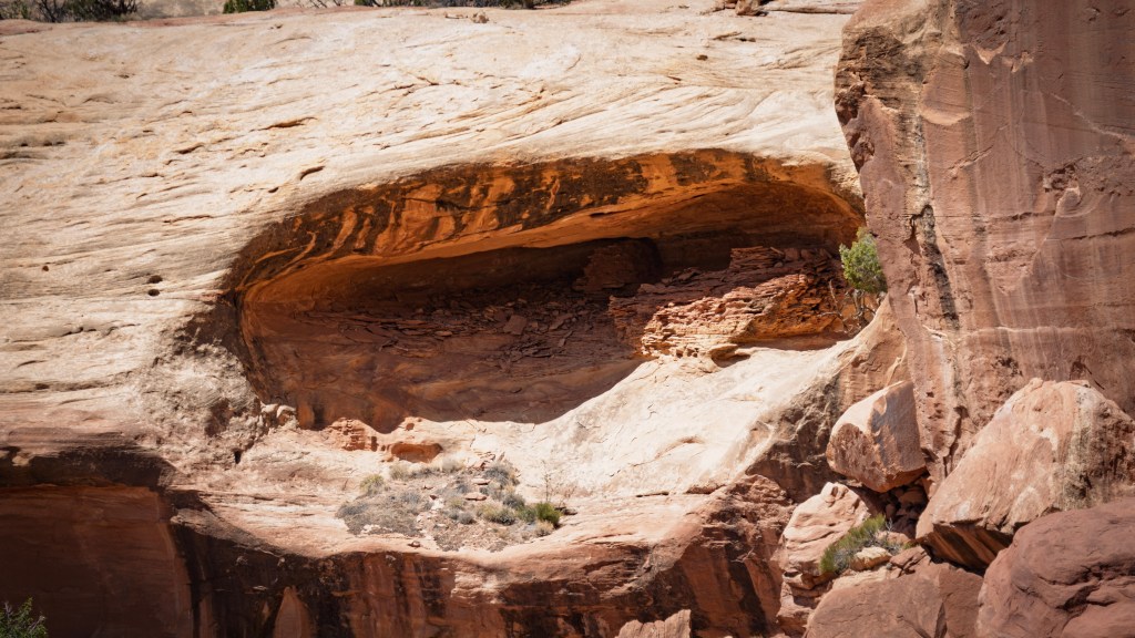
Traces of Life in the Canyon
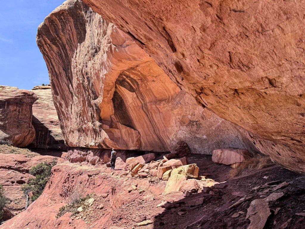
Davis Canyon didn’t feel like a single stop. It felt like a living map of how people once moved through this place.
The granaries, alcove structures, pictographs, and metate grooves each told part of the story. Together, they revealed something larger — a canyon that once offered shelter, storage, workspace, and home.
- Alcove structures built into the rock — offering shelter, shade, and space to live within the canyon walls
- Granaries tucked into high alcoves — carefully placed to store food and protect it from animals and the elements
- Pictographs painted onto sandstone — stories, symbols, or expressions still visible against the rock
- Metate grooves worn into stone — evidence of daily work where food was ground
Together, these traces reveal how the Ancestral Puebloans lived with the canyon — using its shade, stone, protection, and resources as part of daily life. Each feature offers a small piece of that story, leaving just enough behind for us to imagine how life once moved through this place.
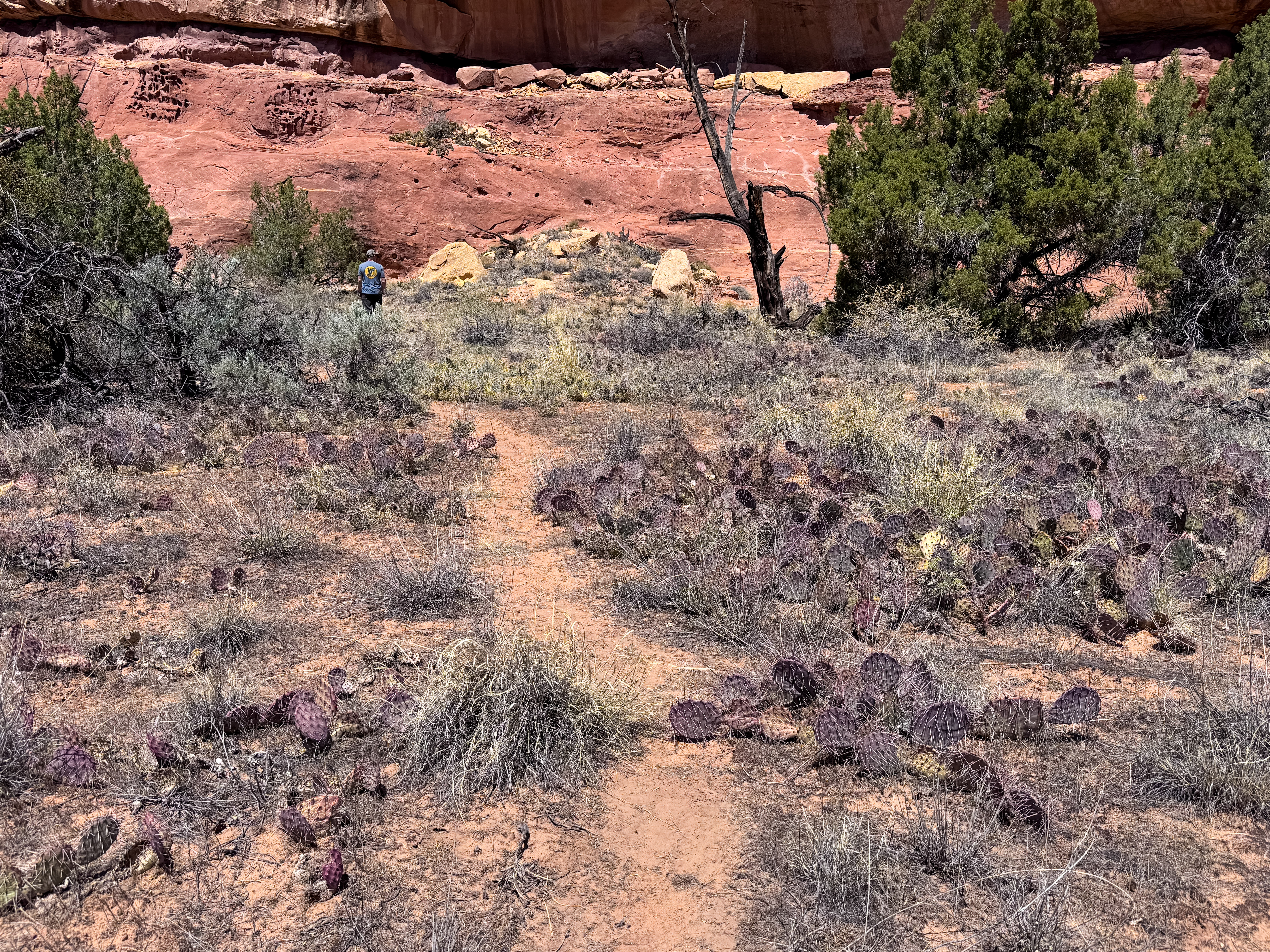
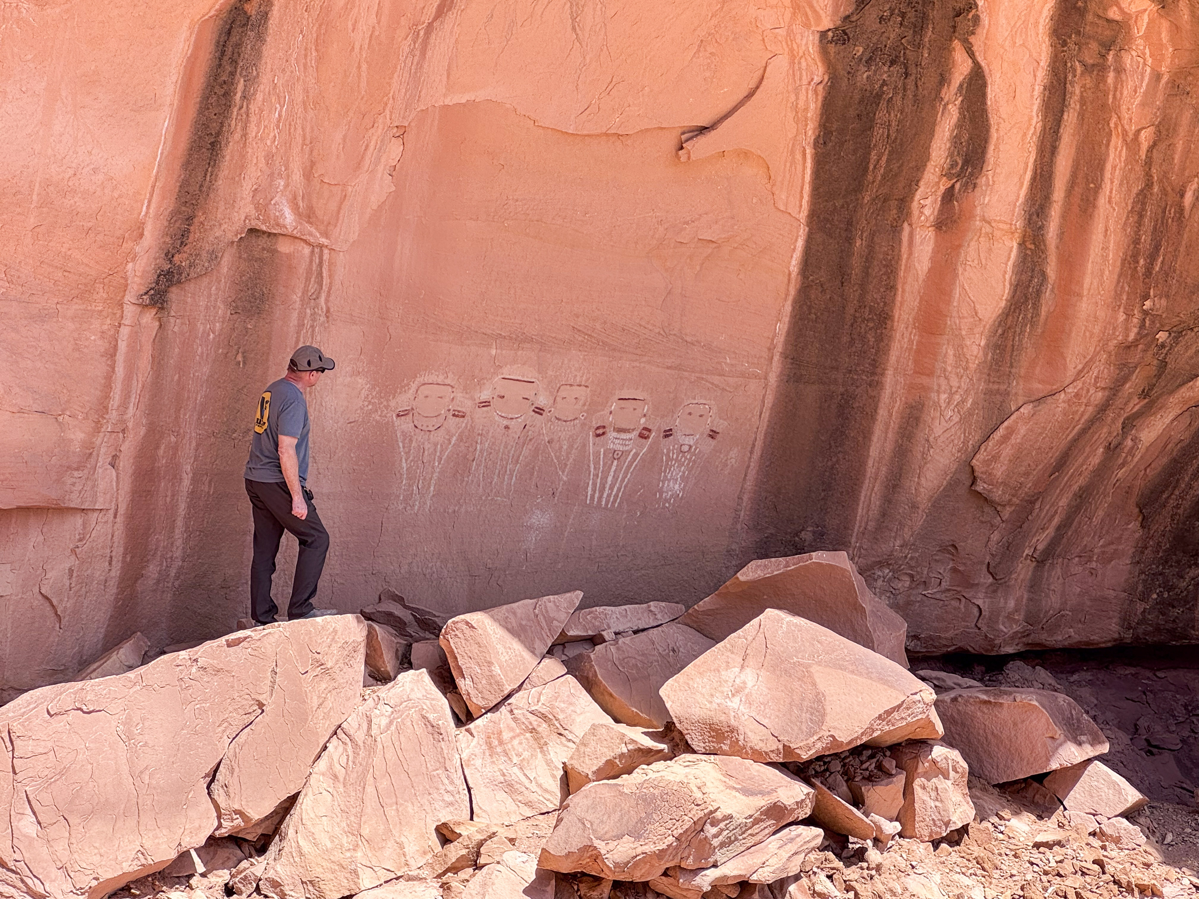
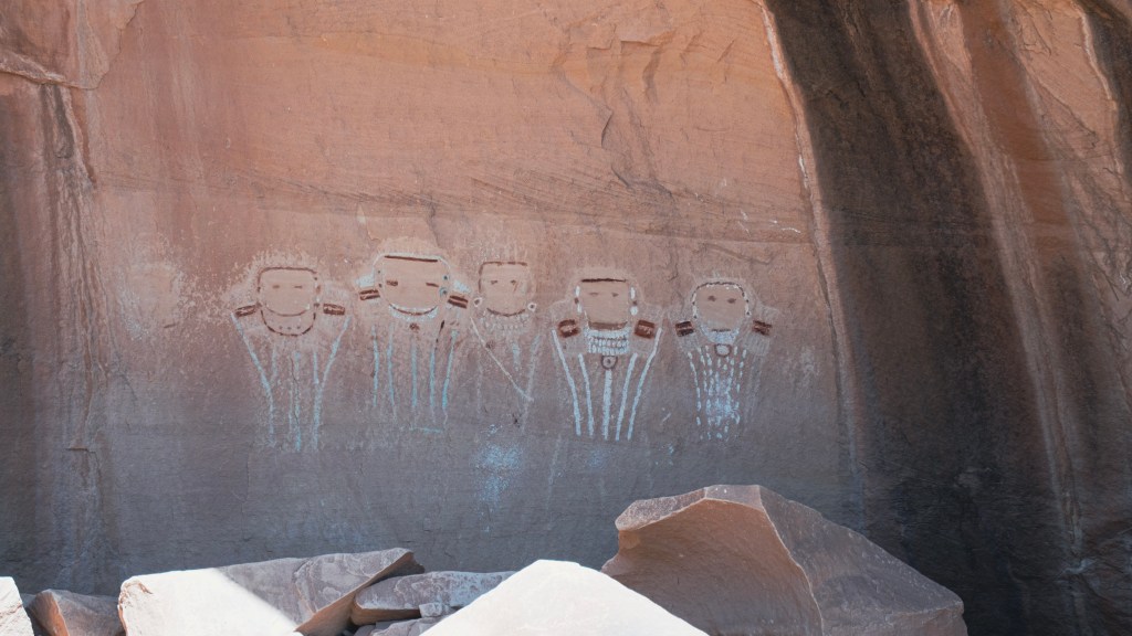
The Five Faces
The Five Faces pictograph panel was the reason we had driven into Davis Canyon in the first place, and I was excited to finally see it in person.
Tucked into the rock and almost blending into the canyon itself, the panel reveals itself slowly. Estimated to be roughly 700 to 1,000 years old, it is subtle at first — faded shapes and lines against sandstone — but the longer you stand there, the more it comes into focus.
Five figures, each slightly different, with rounded faces, simple features, and small markings that hint at identity, adornment, or meaning. There is a quiet intentionality to the panel: the spacing, the symmetry, and the way the figures seem to stand together rather than apart.
No one knows exactly what they represent, whether they tell a story, mark an event, or hold ceremonial significance. But standing there, it’s difficult not to feel like you’re looking at something deeply personal — something meant to be seen.
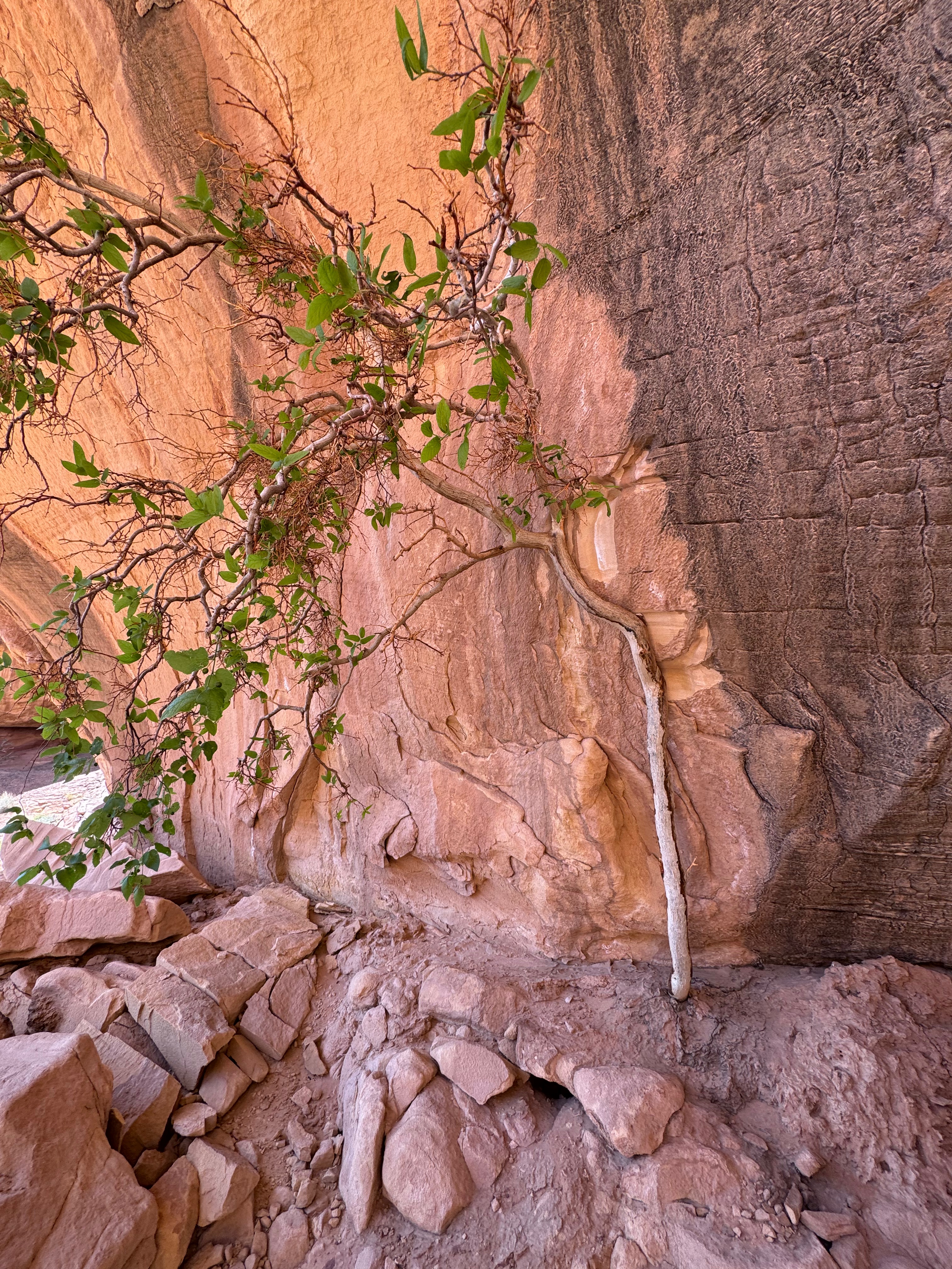
Nearby, another detail caught my attention in a completely different way: a single tree growing straight out of the rock, its roots gripping into cracks and seams that seemed impossibly small. In a canyon layered with ancient traces of human life, it felt like another reminder of how life finds a way here — adapting to stone, heat, and scarcity, and holding on.
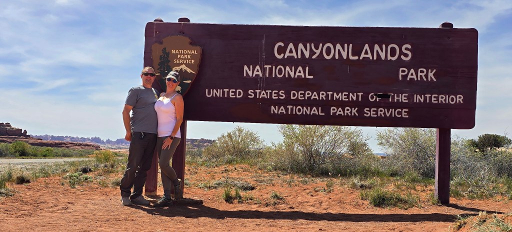
Crossing Into Canyonlands
Leaving the quiet openness of Bears Ears behind, we crossed into Canyonlands National Park, marked by the classic wooden sign and the feeling that we had reached a new stage of the trip.
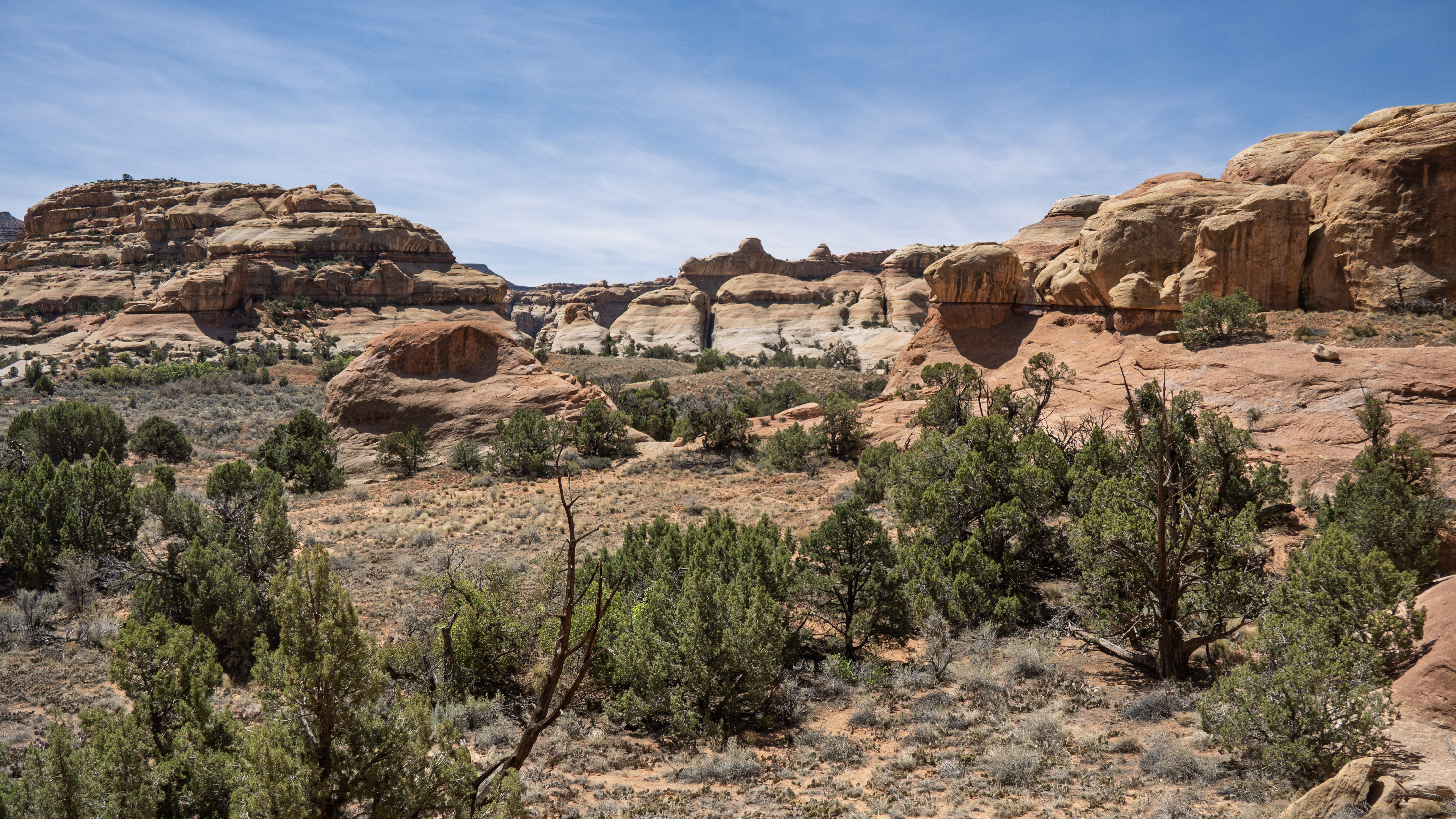
Canyonlands is divided into three land districts — Island in the Sky, The Maze, and The Needles — and this was the one we had been waiting to explore. After previous adventures in Island in the Sky and The Maze, The Needles had remained the missing piece. Finally arriving there felt like the beginning of a new chapter.
We stopped at the visitor center first to check in, confirm our backcountry permits for the following day, and wander through the small museum and gift shop. It was a brief pause, but an important one — a chance to look over maps, settle the logistics, and reset before heading deeper into the terrain that had drawn us here.
The Drive to the Colorado River Overlook
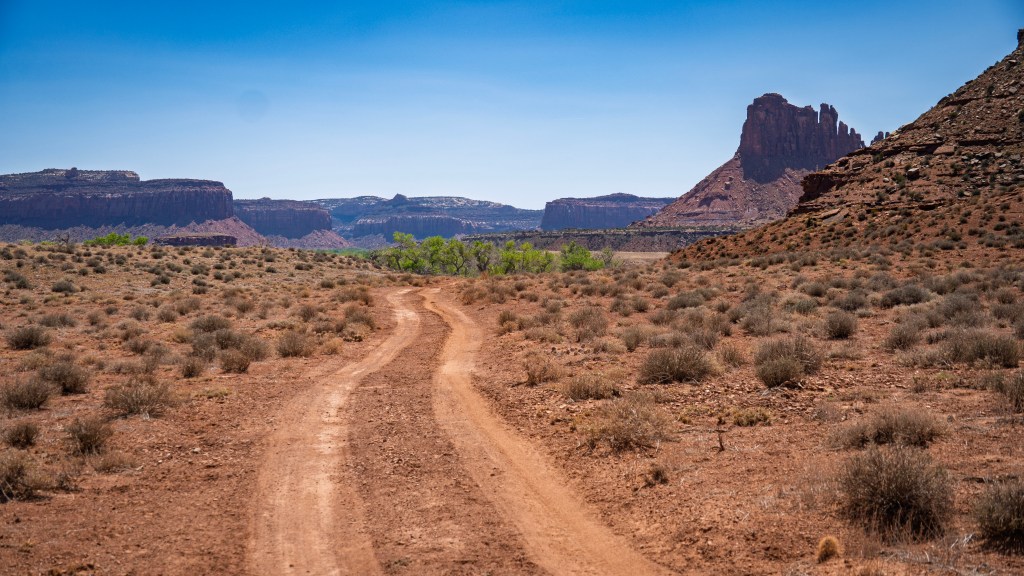
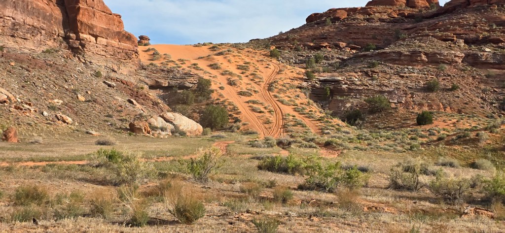
The road toward the Colorado River Overlook felt like an introduction to the Needles District itself.
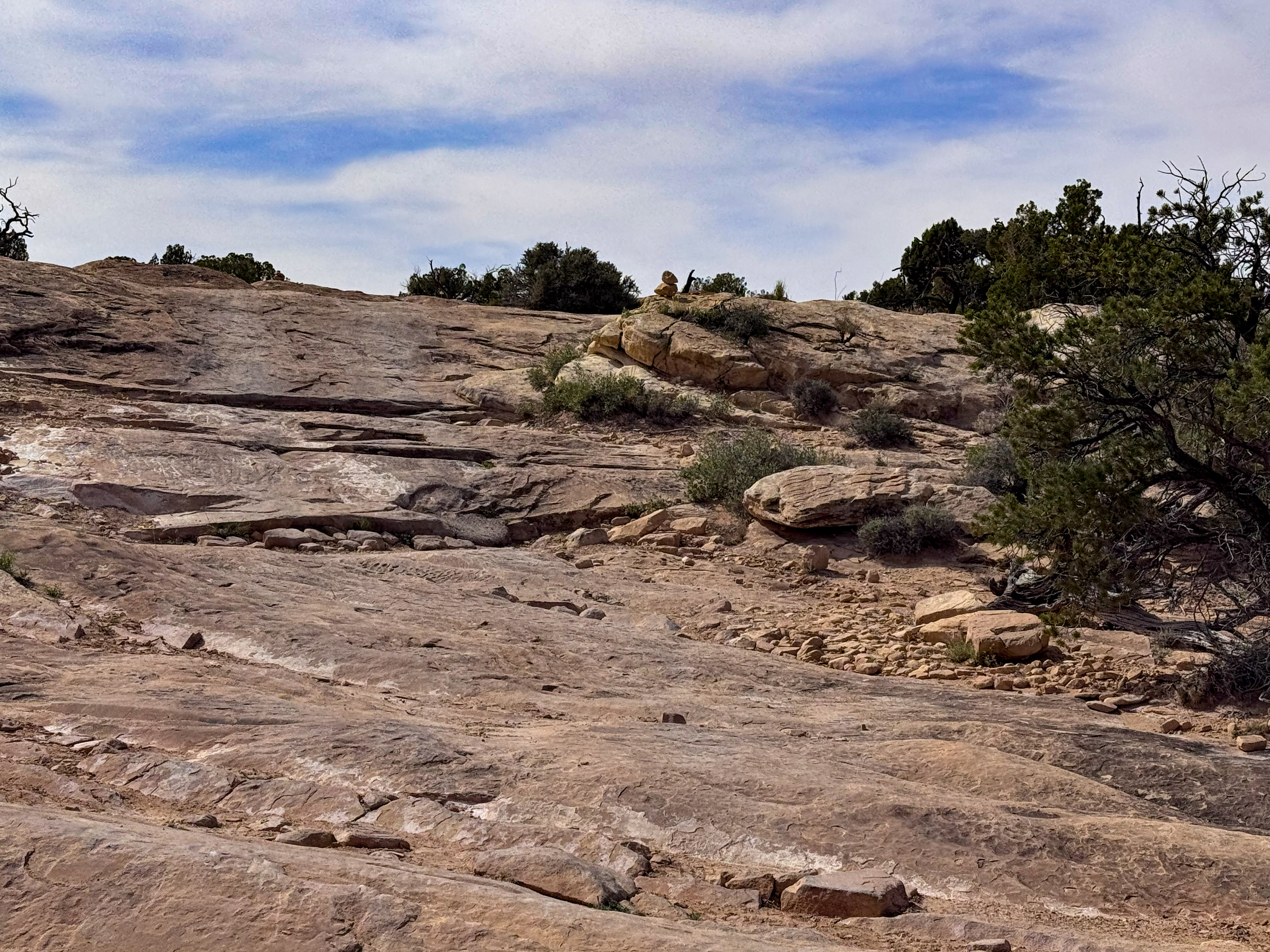
The sandy track stretched ahead in soft rust-colored ribbons, edged with low desert brush and scattered juniper. In some places, the road dipped into shallow ruts, the Jeep rolling gently with the terrain. In others, it climbed onto open slickrock where the ground shifted from soft sand to solid stone beneath us.
Out on the slickrock, the views opened in every direction — layers of mesas fading into soft blue distance beneath streaked desert clouds. The sky felt impossibly large here, the kind that forces you to slow down and look upward.
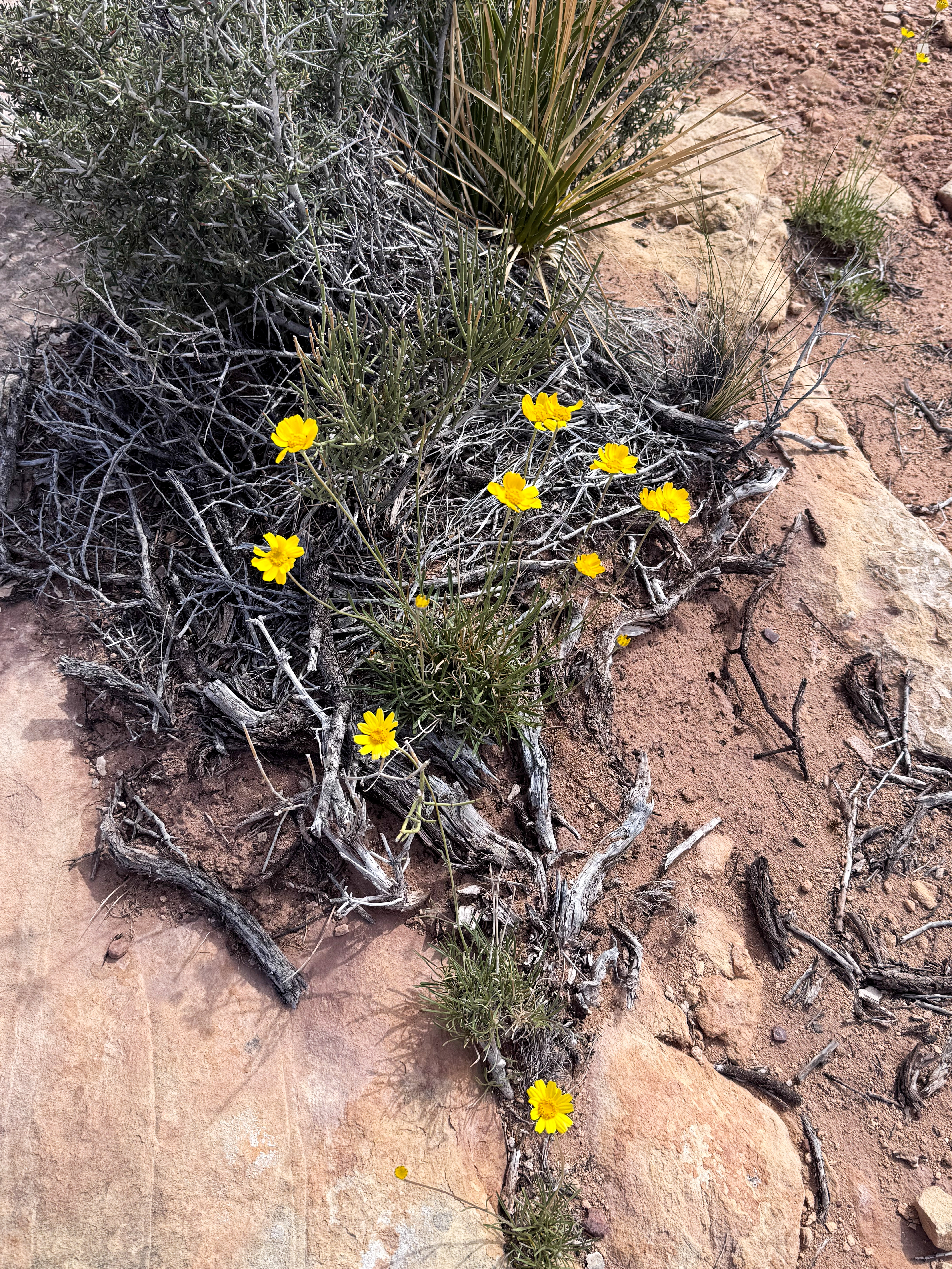
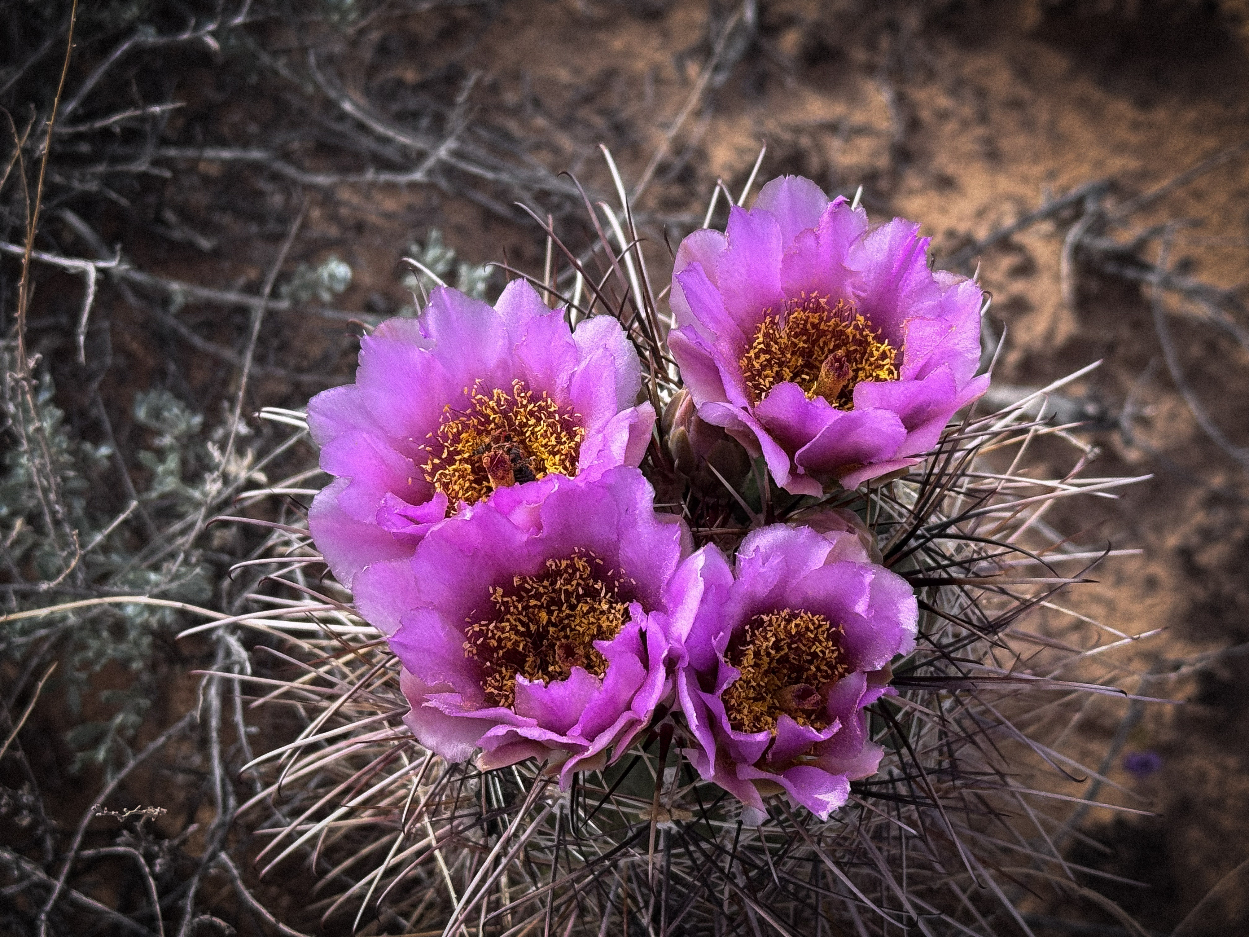
And then there were the small details: bright yellow wildflowers pushing through dry soil and clusters of cactus blooms glowing vivid purple against muted earth tones. Life, quiet but persistent, was tucked into every crack and corner of the desert.
It was the kind of drive where your eyes constantly shifted between the vast distance ahead of you and the tiny details right at your feet.
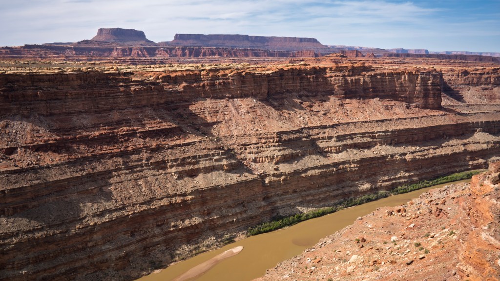
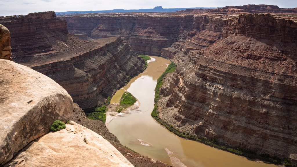
Colorado River Overlook
Once we arrived at the end of the road, we had a short hike to the overlook. Then, almost without warning, the land simply fell away.
One step closer to the rim, and the full scale of it came into view — the Colorado River carving through layers of stone far below. Canyon walls dropped away in textured bands, each layer holding part of a much longer story.
The river itself moved quietly in the distance, a muted ribbon of green-brown winding through the depths below, bordered by a thin strip of life along its banks. From above, it felt both calm and incredibly powerful, its force responsible for carving everything around us.
After miles of driving through canyon country, this was where we could finally see what the day had been building toward. Across the river, we could trace pieces of the White Rim area, bringing back memories of our trip there two years earlier, when we camped somewhere far beyond the opposite cliffs. Out here, the desert has a way of connecting trips across time.
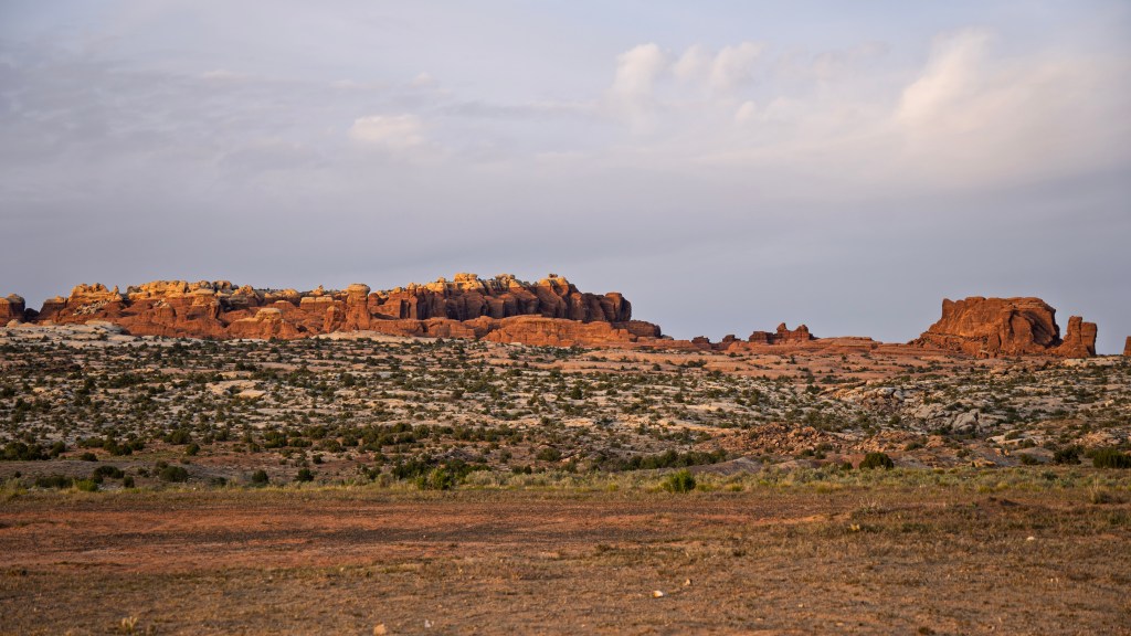
Sand, Stone & the Road to Lockhart Basin
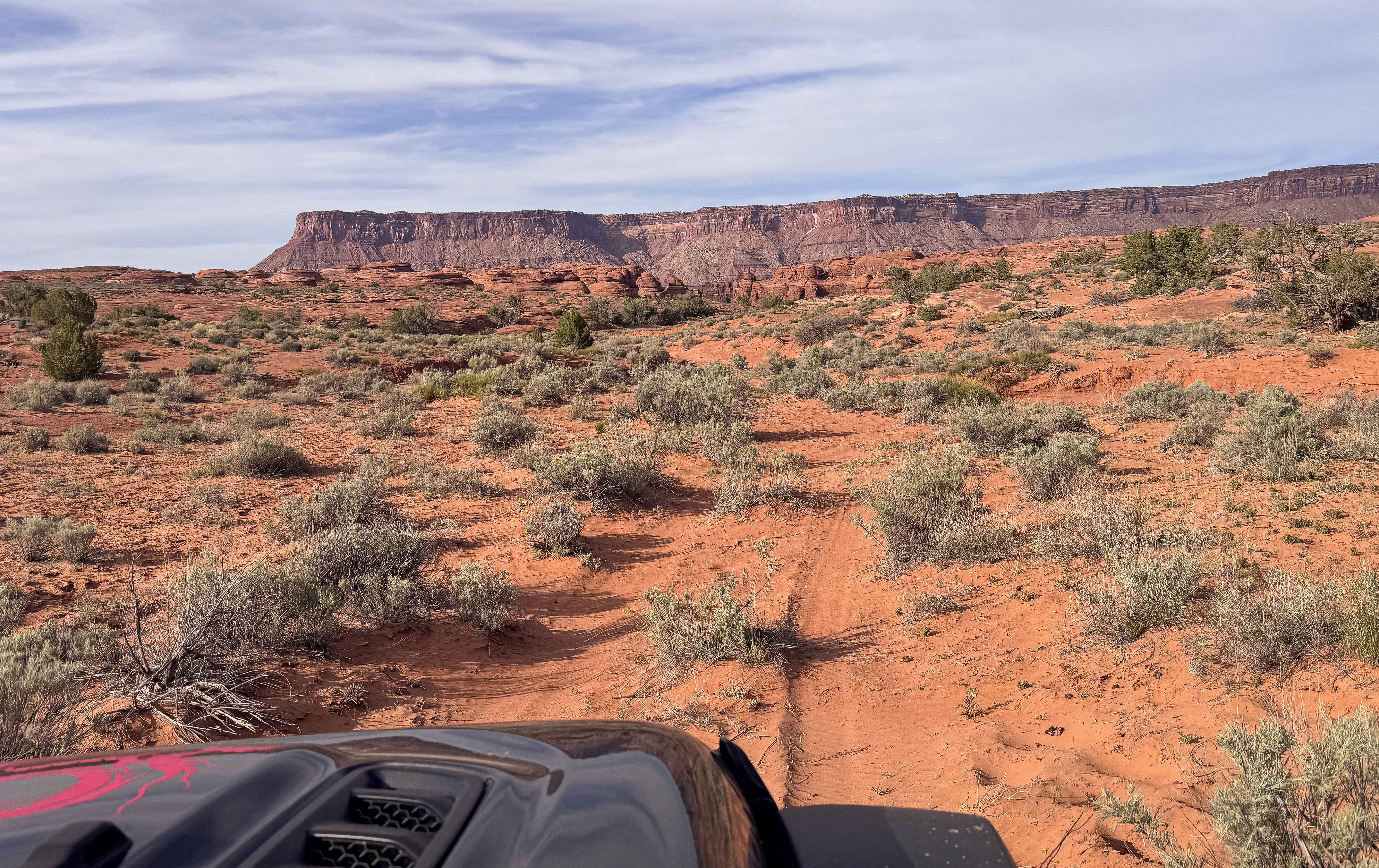
Leaving the Colorado River Overlook behind, the world felt wide open, layers of canyon country stretching endlessly in every direction. But instead of heading back toward pavement, we pointed the Jeep deeper into the terrain, trading overlook views for a route leading toward Lockhart Basin.
What followed was one of those trails that keeps you fully present. Coming from the south end, the road began to narrow, and almost without warning, we found ourselves on a UTV trail. At that point, the route felt committed, it was not a place to turn around easily, but one that pulled us forward.
Known as Missile Trail #25, the route winds through sandy washes, rock shelves, and narrow passages where the terrain shifts quietly around every bend. At times, it felt surprisingly mellow, with soft sand, shallow curves, and long stretches where the desert opened around us. But that rhythm never lasted for long.
Around one corner, the road suddenly tilted upward into a chute of loose sand pressed tightly between rock walls. This was the Sand Slide. The softness of the sand and the angle of the climb made it just challenging enough to demand our full attention. In terrain like this, momentum and line choice matter, and once the climb begins, there is no halfway commitment — only forward.
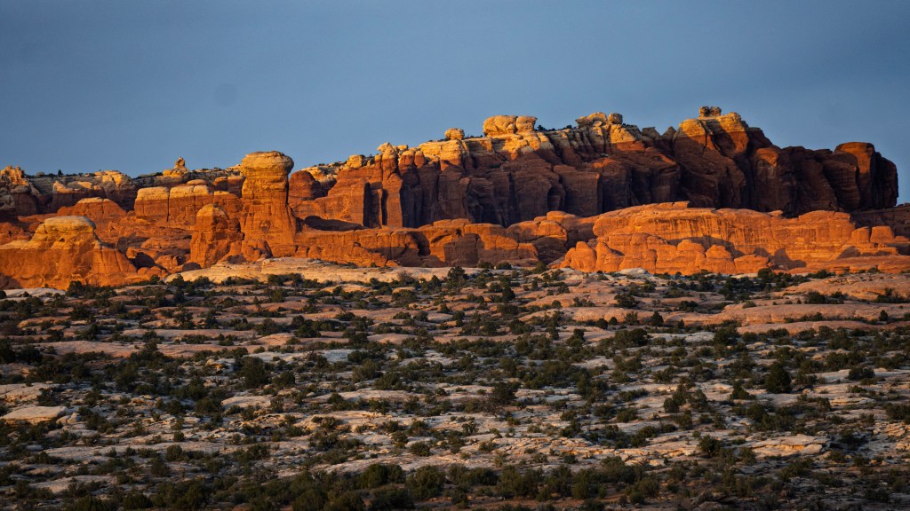
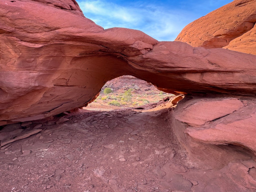
Beyond the Sand Slide, the trail settled back into its rhythm, moving deeper into the canyon through tighter corridors and enclosed passages. Small surprises appeared along the way, including Pelican Arch, tucked quietly into the red rock as though it had been watching over the trail for years.
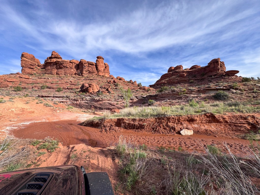
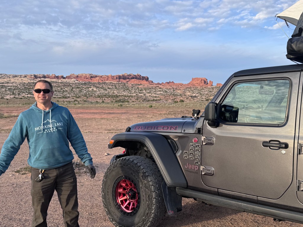
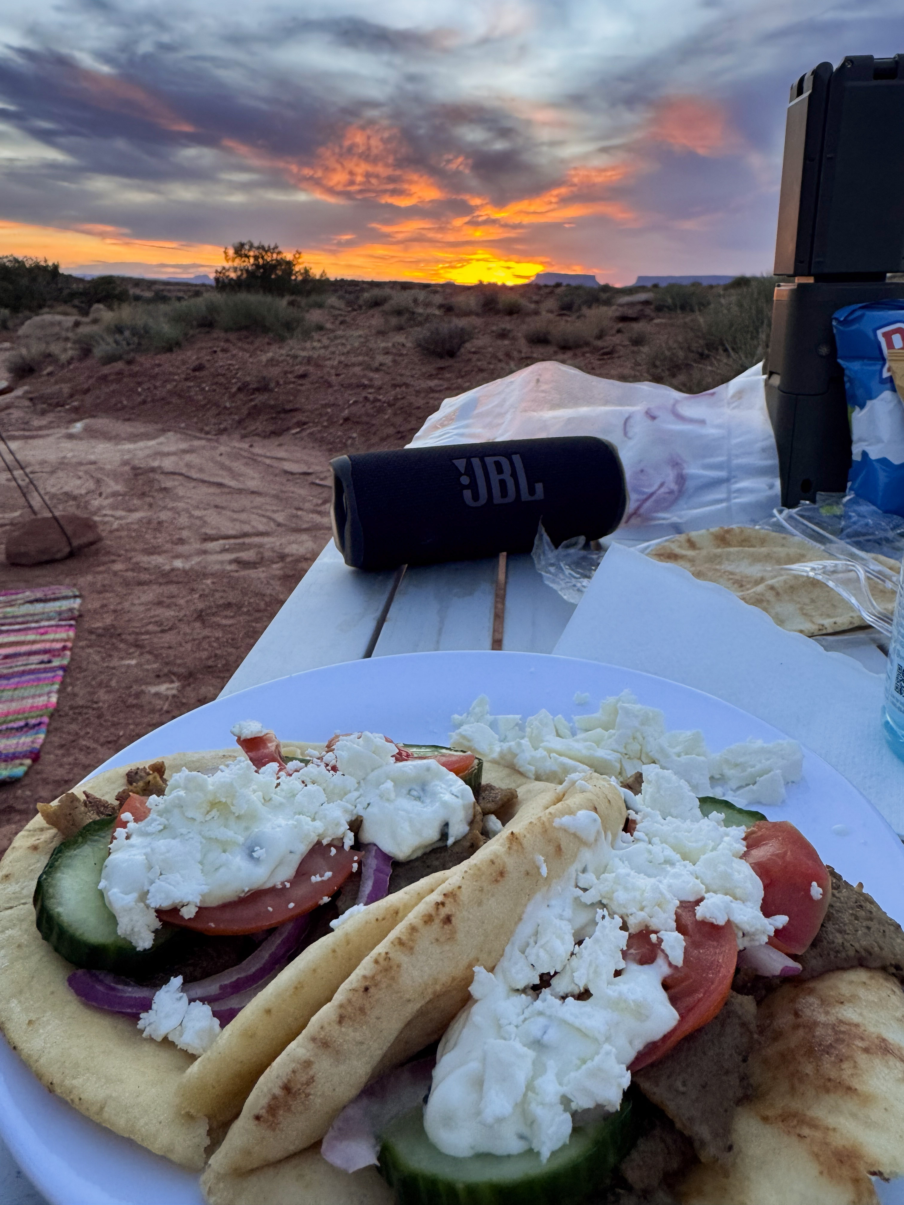
Eventually, the terrain softened again and the route spilled out onto Lockhart Basin Road, a subtle but satisfying transition from technical trail back into wide-open desert travel.
By then, the light had already begun to shift. We found a campsite tucked naturally into the land just as the sun dropped lower, casting long shadows across the sandstone and lighting the horizon in soft gold and orange. Dinner that night was gyros at camp, and it’s hard to beat a meal with sunset and canyon country views stretching endlessly in front of you.
Ahead of us waited the heart of the Needles.
Reflections
By the end of the second day, I was amazed by how much we had seen and how much ground we had covered.
What started as a drive south through familiar Utah scenery had slowly transformed into something deeper — moving from roadside stops and overlooks into places layered with history, silence, and scale. From the ancient markings at Newspaper Rock to the hidden traces of life tucked inside Davis Canyon, the trip had already become more than just miles traveled.
And somehow, we still hadn’t even reached the heart of the Needles.
That’s what makes this corner of Utah so unforgettable. The landscape never reveals itself all at once. It unfolds gradually through dusty roads, narrow washes, hidden alcoves, sweeping overlooks, and quiet moments where you suddenly realize how small you are within it all.
Looking back on those first two days, what stands out most isn’t any single destination. It’s the feeling of transition — the shift from pavement to dirt, from busy roads to silence, from familiar routes to places shaped over thousands of years.
By that evening in Lockhart Basin, with the last light fading across the sandstone and dinner cooking beside camp, it felt like we had fully crossed into canyon country.
And the real adventure was still waiting ahead.
Next, we would head deep into the Needles District — crossing Elephant Hill, weaving through towering sandstone fins, and stepping into the maze-like landscape that makes this place unlike anywhere else in the Southwest.


Leave a comment