
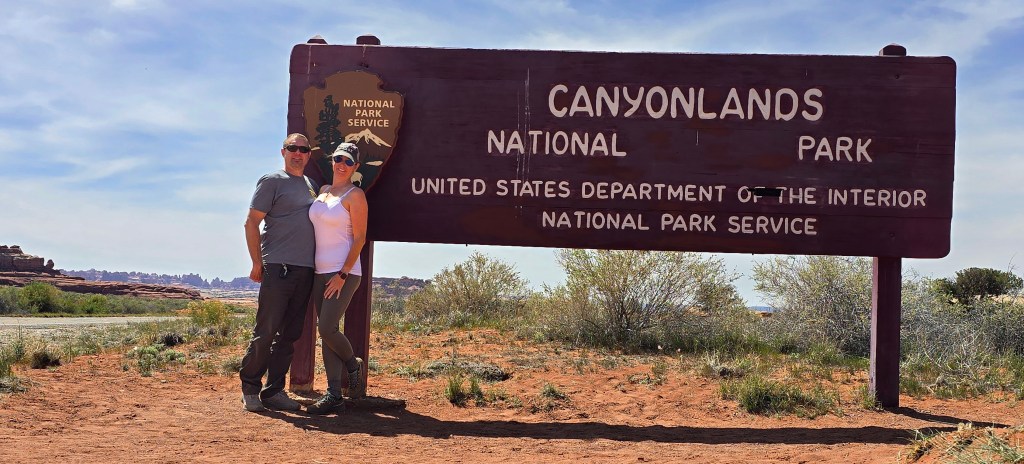
Confluence Overlook, Devil’s Lane & Horsehoof Camp
Needles & Beyond: Backcountry Series — Post 2
Some roads feel less like a way to get somewhere and more like part of the story itself.
In the first post of this series, Bill and I gradually made our way into canyon country — from a quiet camp north of Moab to Newspaper Rock, Davis Canyon, Colorado River Overlook, and Lockhart Basin. Those first two days felt like a crossing.
But Day 3 was when the trip changed rhythm.
With backcountry permits in hand and Horsehoof Camp waiting somewhere beyond the sandstone, we pointed the Jeep toward one of Canyonlands’ most iconic four-wheel-drive routes: Elephant Hill.
Monday, April 20
Waking Up in Lockhart Basin
Morning in Lockhart Basin came warm, with coffee in hand and sunlight already beginning to work across the red rock.
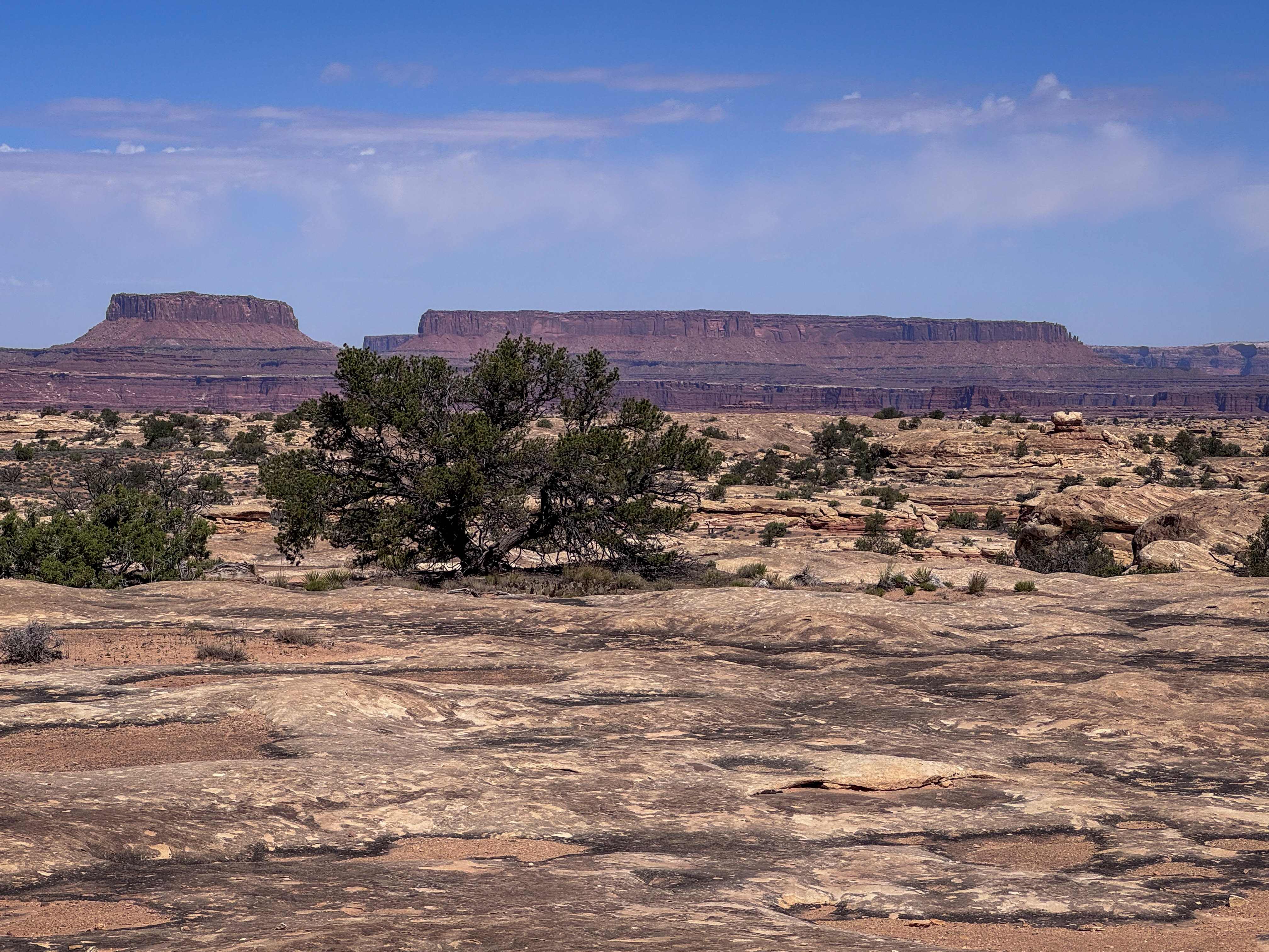
As we packed up camp, the basin revealed itself in layers — broken ledges, rust-colored walls, scattered desert brush, and a wash cutting through the middle of it all like a quiet seam in the land. Driving out, we passed broad views of weathered sandstone and open country that felt both rugged and spacious, the kind of terrain that doesn’t need to shout to leave an impression.
Lockhart Basin had only been a one-night stop, but it stayed with me — the broken ledges, rust-colored walls, open sky, and that wash cutting through the middle of it all like a quiet seam in the land. I already knew I wanted to come back.
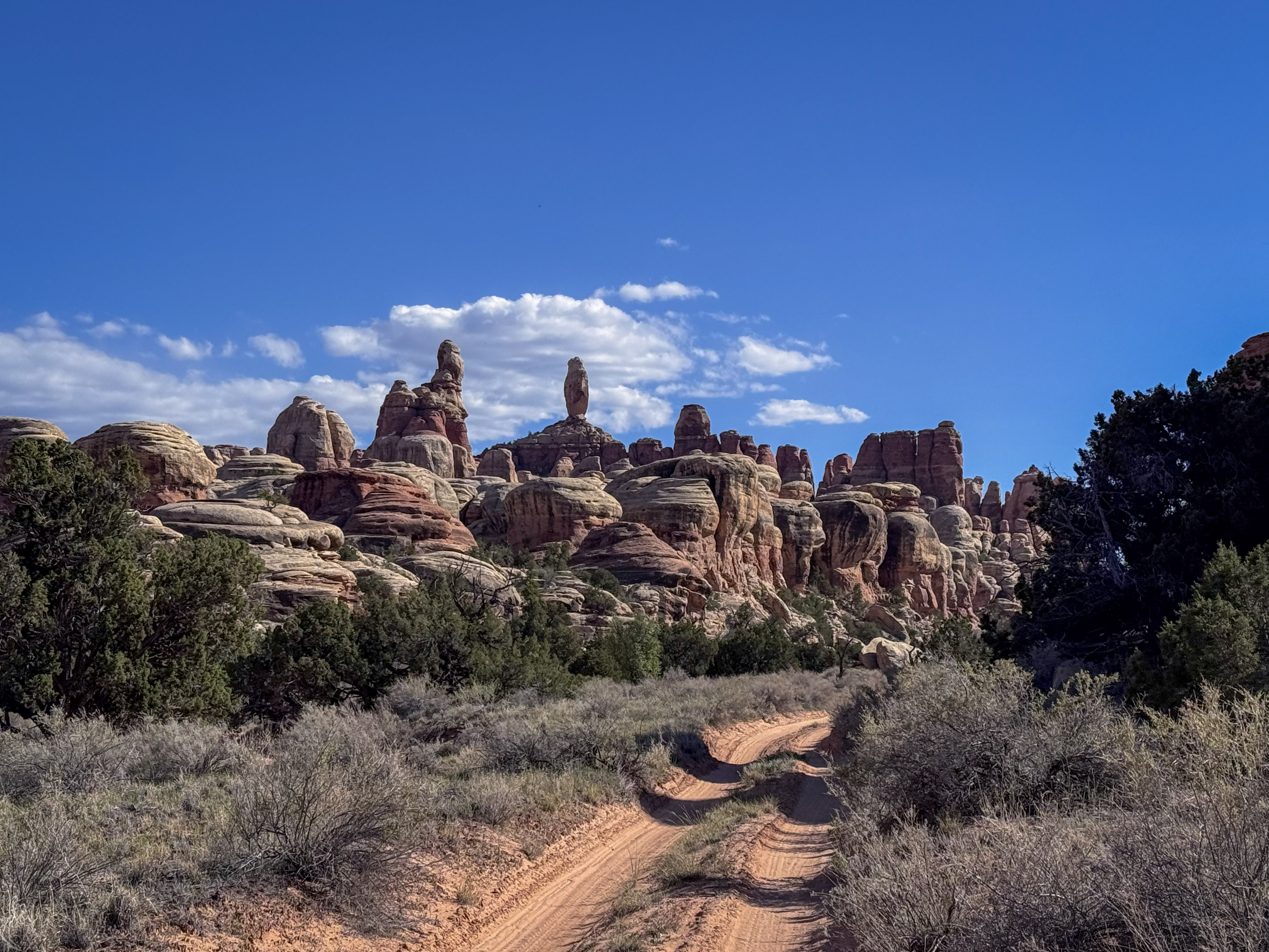
From there, we reentered Canyonlands and followed the main scenic road deeper into the Needles District. Along the way, Wooden Shoe Arch came into view from the road, perched in the distance like a small opening in the sandstone. We didn’t get a photo, but it was one of those quick roadside glimpses that reminds you how much is hidden in plain sight out here.
Pothole Point
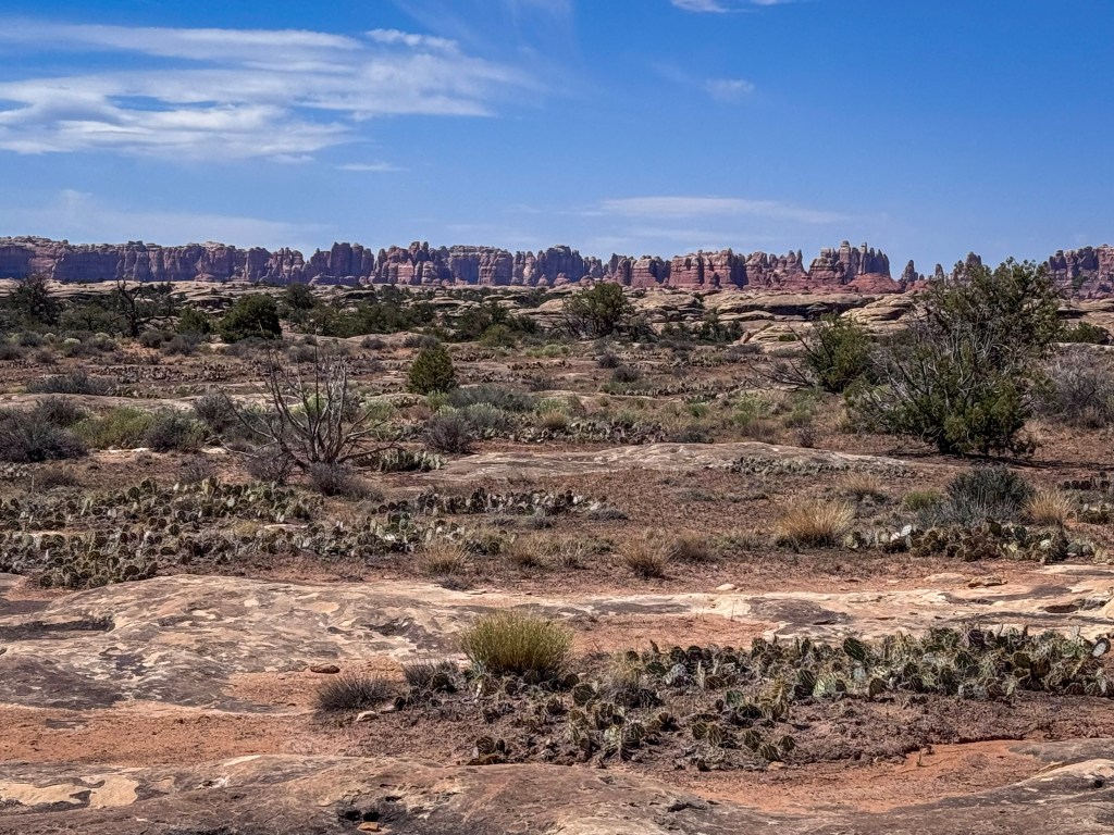
Our first stop of the day was Pothole Point, a short trail that turned out to be more interesting than its brief mileage might suggest.
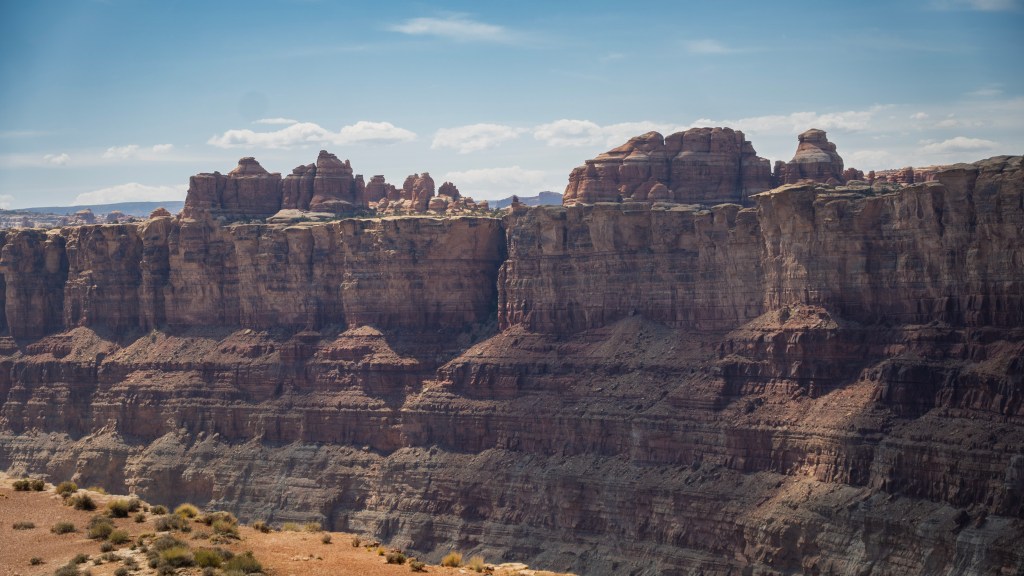
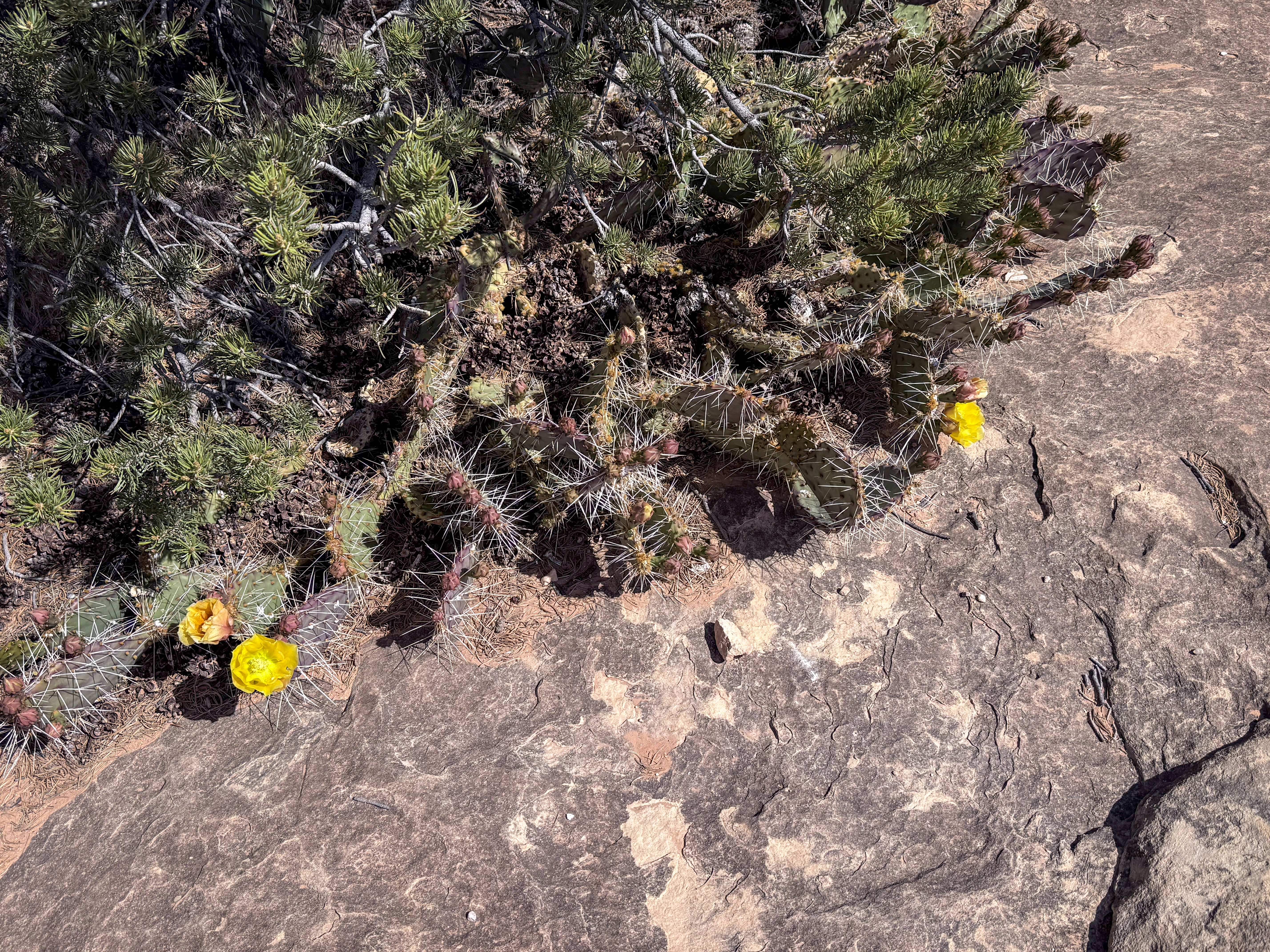
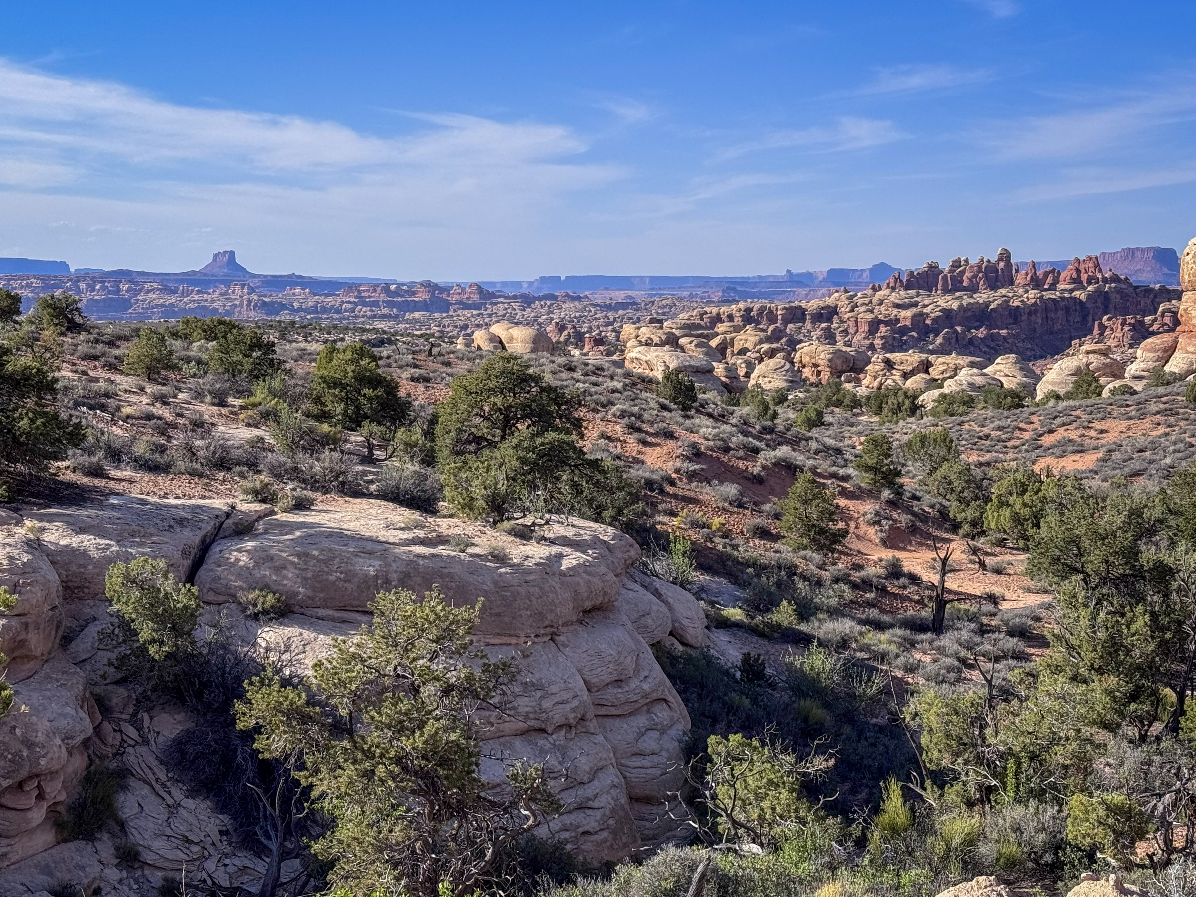
The 0.6-mile loop winds across open slickrock dimpled with shallow depressions — the “potholes” that give the trail its name. At first glance, the landscape felt spare and sunbaked, with dark stone underfoot, scattered cactus and juniper, and the Needles rising in the distance like a jagged wall across the horizon. But the closer we looked, the more detail the trail revealed.
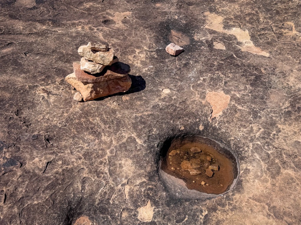
Some potholes were dry; others held a little water, each one like a tiny basin etched into the rock. According to the trail sign, rainwater collects in these depressions and creates miniature habitats where small creatures like snails, beetles, worms, and even shrimp can live or emerge when conditions are right. It was a reminder that even a place that looks harsh and bare can hold entire small worlds.
The trail also offered broad views of slickrock shelves, low desert vegetation, and the Needles rising in the distance — a brief but worthwhile stop before the day shifted toward Elephant Hill.
Elephant Hill
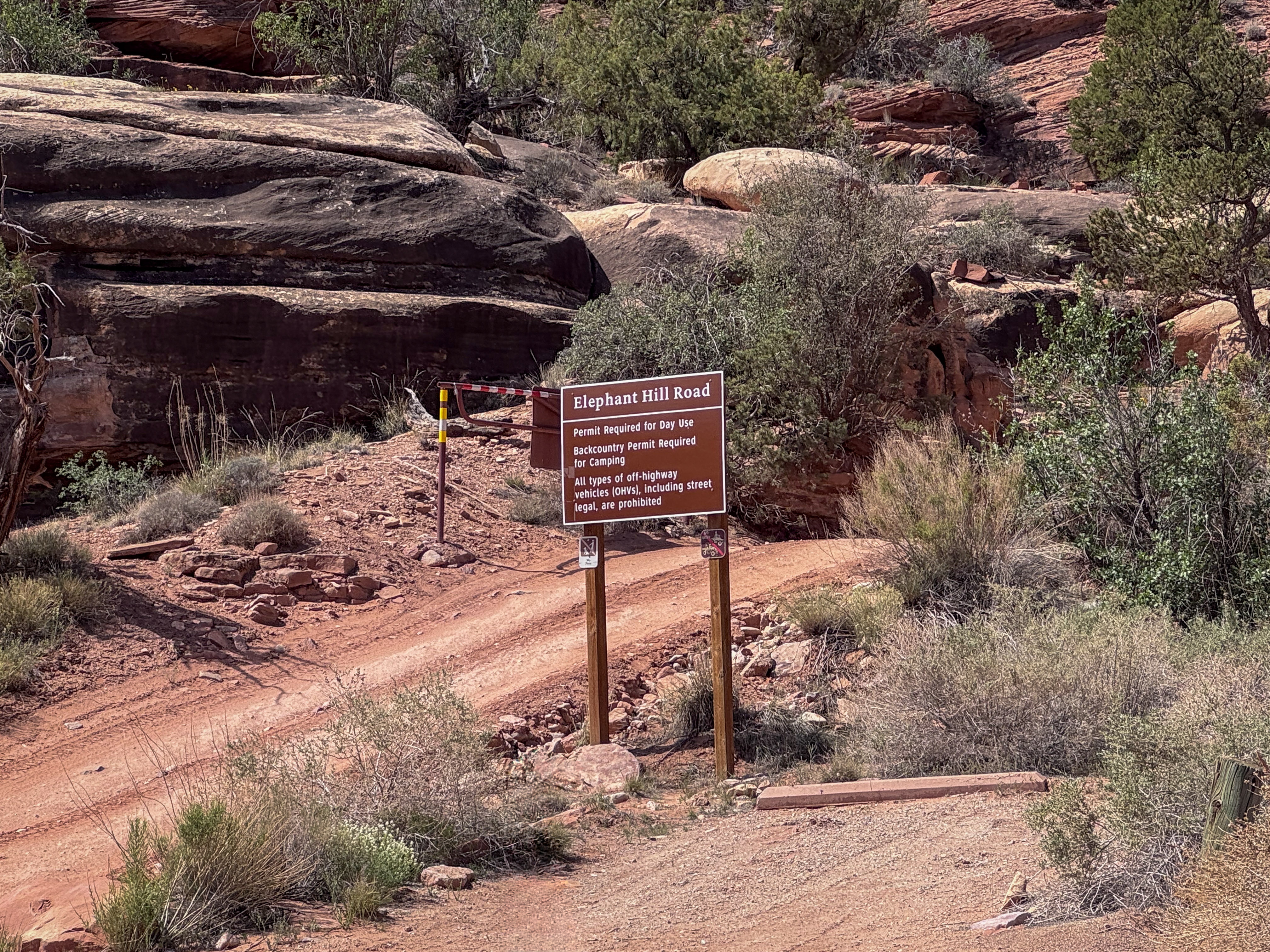
By late morning, we made our way to Elephant Hill with permits in hand.
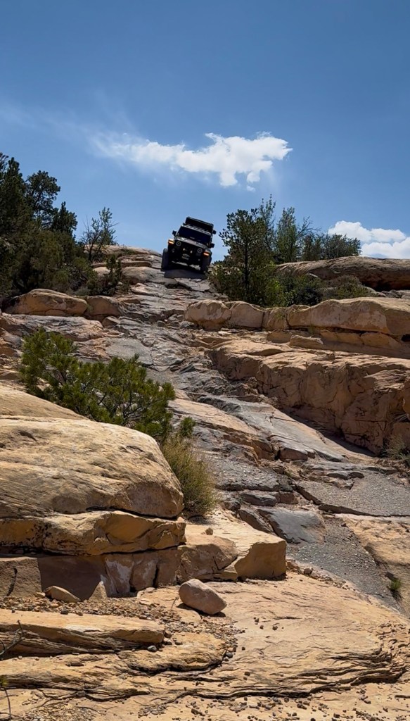
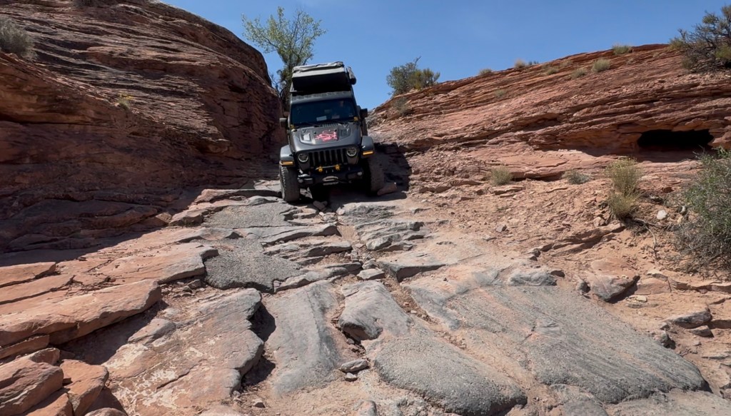
Elephant Hill is one of the most iconic four-wheel-drive routes in Canyonlands and part of the Jeep Badge of Honor program, known for its steep climbs, tight turns, rocky ledges, and sweeping views. At the trailhead, we aired down the tires, checked our permits, and paused at the sign marking the start of the route. It felt like the point where the day shifted from scenic driving to something much more technical.
The trail begins immediately with a steep, rocky climb through a series of tight switchbacks. There is no warm-up. Almost at once, the Jeep was crawling upward over slickrock and stone ledges while the route twisted tightly ahead.
As we climbed, we could see hikers on the Elephant Hill trail heading south across the hillside. Above them, the views opened wider with every turn — pale slickrock, rust-colored walls, and the broader sweep of the Needles country stretching outward.
At the top, we barely had time to take in the view before the trail tipped sharply down the other side. What goes up on Elephant Hill also comes down, and the descent felt every bit as dramatic as the climb. Our Jeep registered roughly 25-30 degrees of pitch going down, which confirmed what the trail already made clear: this section demanded full attention.
The descent brought more rock ledges and a sharper sense of exposure, the kind of terrain where photos never quite capture the angle of it. Standing below and looking back up, the Jeep looked small against the slickrock slope — one dark shape working its way carefully through a pale staircase of stone.
Partway down, the trail threw in one more twist.
At a particularly tight turn, the route required Bill to pull in then drive in reverse down the next switchback. It wasn’t difficult in a chaotic kind of way, just technical and unusual — one of those moments that makes you appreciate both patience and precision behind the wheel. Watching the Jeep reverse into position on the steep rock added yet another layer to the experience. Elephant Hill didn’t just ask you to drive it; it asked you to think your way through it.
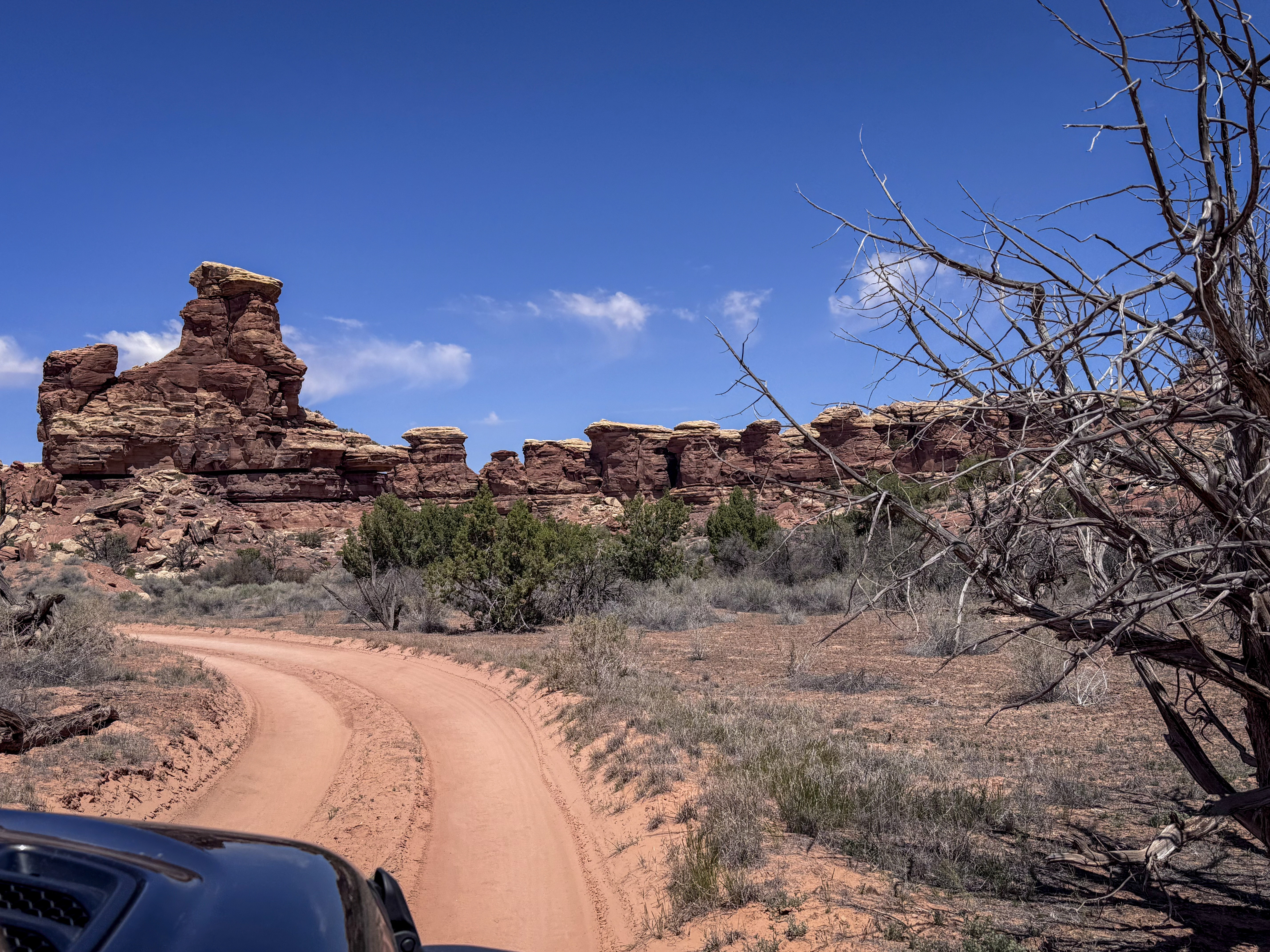
By the time we reached the bottom, the terrain opened into a broader desert landscape of slickrock benches, low shrubs, and layered canyon walls. The first test of Elephant Hill was behind us, and the route ahead stretched deeper into the Needles.
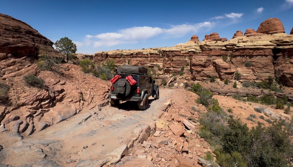
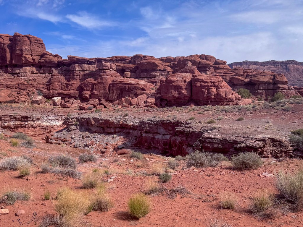
Devil’s Lane & Devil’s Pocket
Beyond Elephant Hill, the trail settled into a new rhythm. Devil’s Lane stretched ahead as a sandy track winding between desert brush, rounded sandstone shelves, and rock walls darkened with desert varnish. After the steep pitch and ledges of Elephant Hill, this section felt less like a climb and more like a passage — following tracks that seemed to disappear and reappear between the rock.
The road alternated between open views of distant spires and tighter corridors where the canyon walls pressed closer. For a while, the sandy stretches felt almost gentle.
But Devil’s Lane still had plenty of teeth.
Smooth sand gave way to rock ledges and uneven shelves — obstacles less about dramatic steepness and more about precision, careful tire placement, and reading the shape of the trail as it tightened around us.
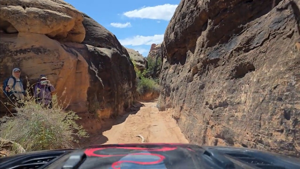
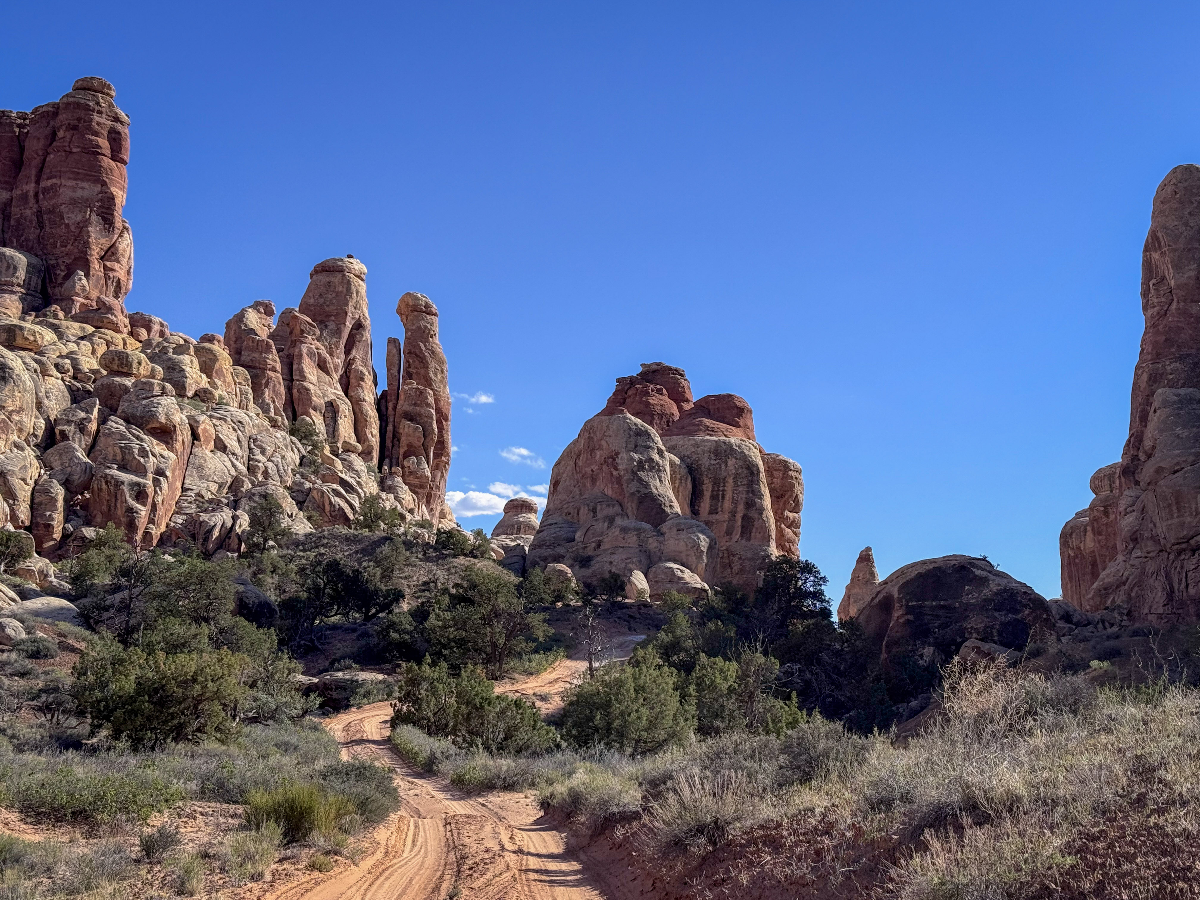
Then came Devil’s Pocket.
The route narrowed dramatically, slipping between sandstone walls that rose close on either side. Hikers appeared along the edge of the passage, tucked against the rock as we eased through, which made the scale of the corridor even more noticeable. From inside the Jeep, the walls felt close enough to touch, and the trail ahead seemed to thread through the canyon rather than simply cross it.
It was one of the most memorable sections of the route — not because it was the steepest or most technical, but because it felt so distinctly Canyonlands: sand under the tires, stone rising on both sides, blue sky overhead, and the Jeep moving slowly through a narrow seam in the desert.
By the time Devil’s Pocket opened back up, we had slipped another layer deeper into the Needles.
Toward the Confluence
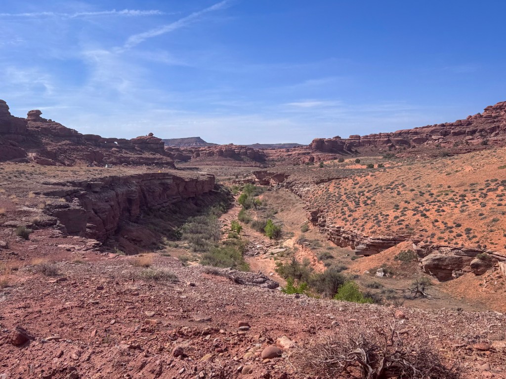
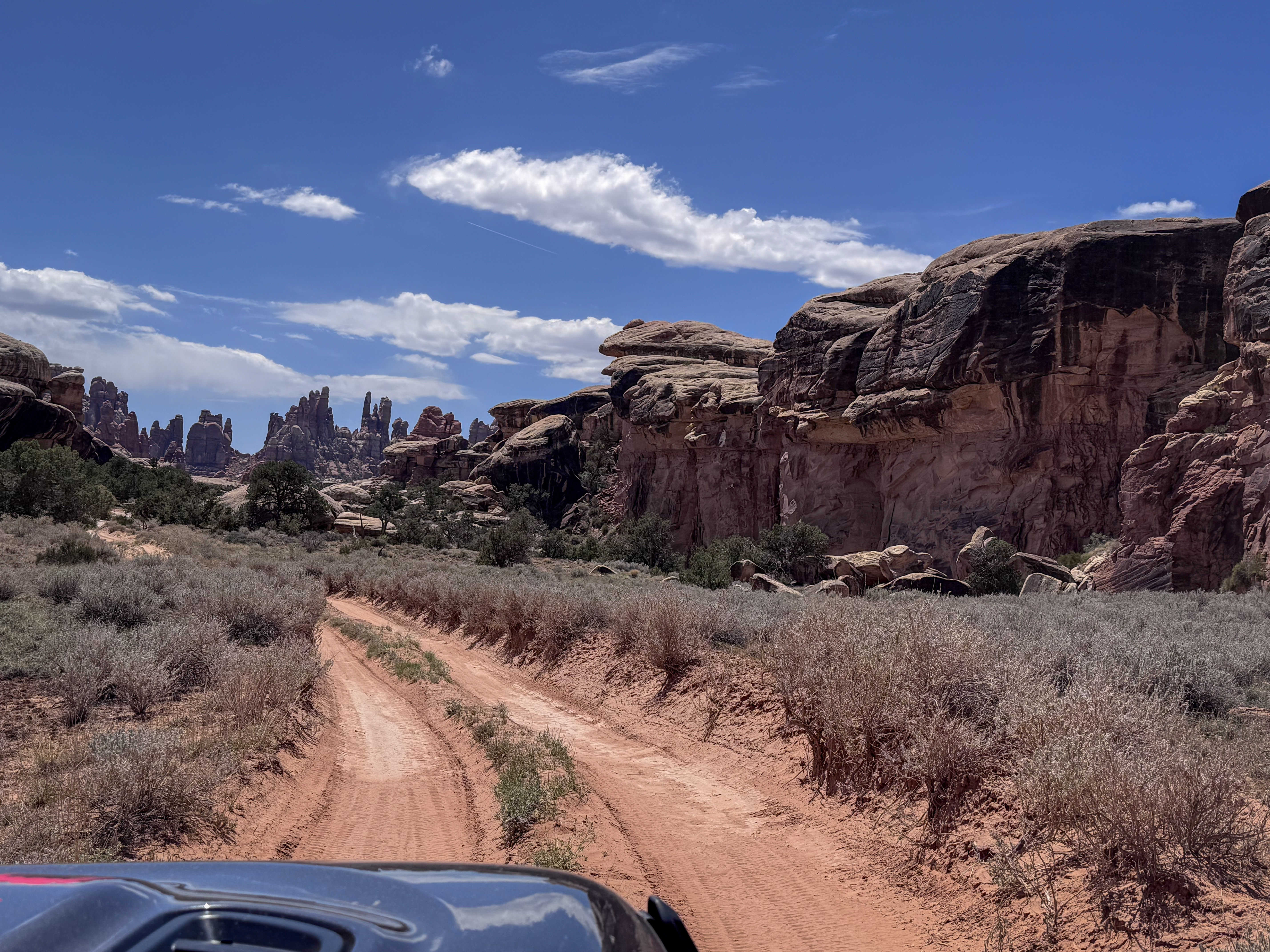
From Devil’s Lane, we continued toward the Confluence Overlook.
For a while, the road opened into sandy stretches, giving us a brief break from the tighter corridors and rock ledges behind us. Then the route passed through one of the Needles’ grabens — long, dropped sections of earth created by faulting that help give this part of Canyonlands its maze-like feel.
Before reaching the end of the road, we navigated the Silver Stairs, where the route drops through a short but challenging section of rocky shelves. It called for slow lines, careful tire placement, and steady patience behind the wheel — one more reminder that even the “in-between” sections of this route had their own challenges.
Beyond that, the road settled back into sandy track and open desert, carrying us farther north toward the end of the four-wheel-drive road.
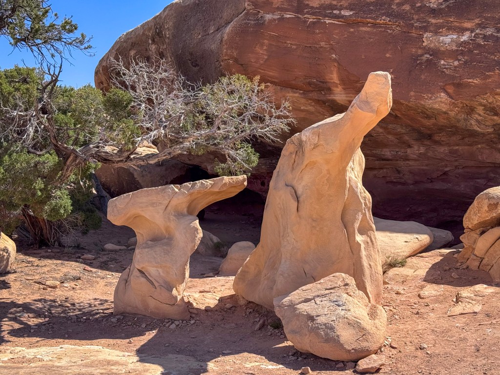
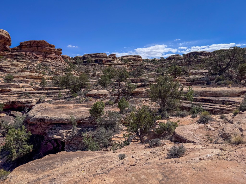
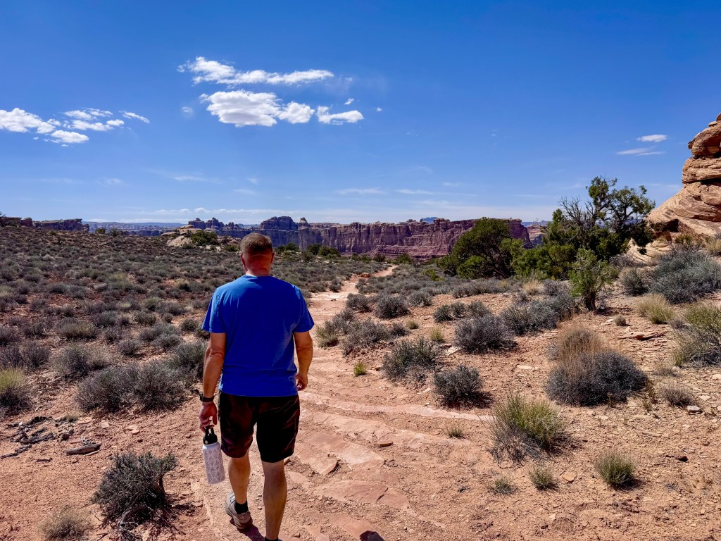
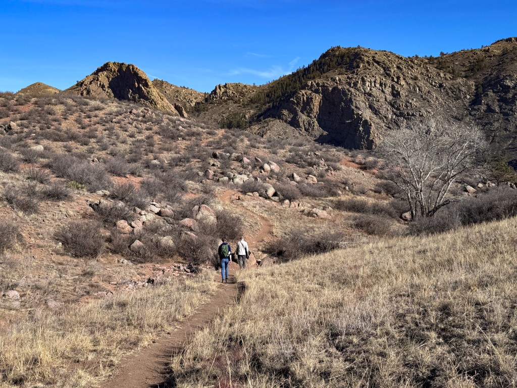
From the parking area, it was time to lace up our hiking shoes. The Confluence Overlook hike is short, about 0.3 miles each way from the end of the road. However, after the technical drive in, walking felt like a shift in pace. The trail crossed pale slickrock ledges and sandy patches, winding past juniper, and layered stone before leading us toward the rim.
After hours of reading the road from inside the Jeep, it felt good to move through the landscape on foot.
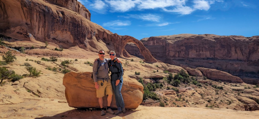
Confluence Overlook
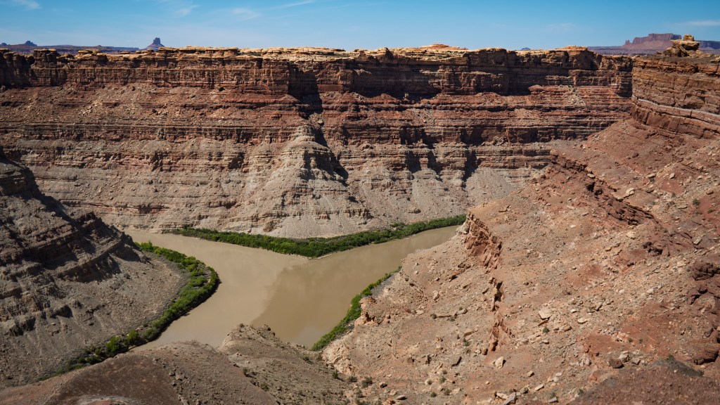
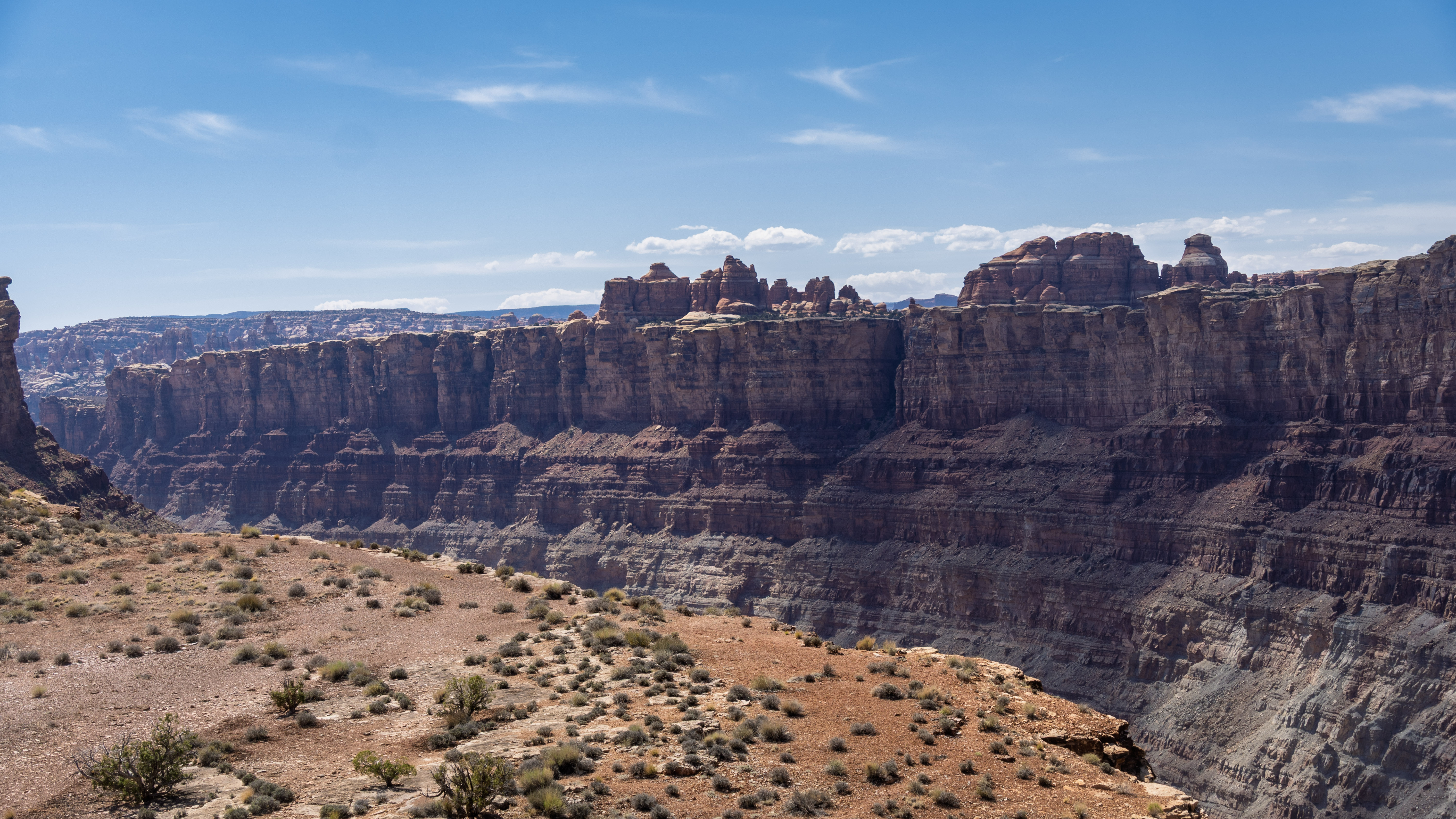
The overlook opened to one of the most unforgettable views in Canyonlands: the meeting of the Green and Colorado Rivers.
From the rim, the canyon dropped away in immense layers of stone, revealing the rivers far below as they curved through the desert. Their waters met in a broad bend at the base of towering cliffs — two ribbons of life moving through an otherwise harsh and rocky world, quiet from this distance but powerful enough to have carved everything around them.
We stood there for a while, letting the scale of it settle in.
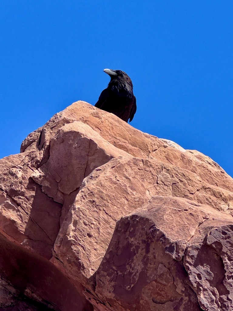
The air felt still and sun-warmed, with that desert quiet that makes every movement seem more noticeable. A raven appeared nearby and perched on the rocks behind us, glossy black against the sandstone and blue sky. It carried itself with that calm, watchful confidence ravens always seem to have.
Across the river, we could pick out the Doll House area in the Maze District, where Bill and I had been back in 2022. Seeing it from here felt surreal — one more piece of canyon country suddenly linked to another. We were standing in the Needles, looking across to a place that held its own kind of remote desert beauty.
That is one of the things I love most about Canyonlands. Its districts feel separate, each with its own personality and difficulty of access, yet from certain viewpoints they begin to connect — the Maze, the rivers, the White Rim, the Needles — places visited years apart suddenly lining up within the same view.
Standing there, it felt like another piece of Canyonlands had clicked into place.
Climbing Back Out
Eventually, we left the overlook and returned to the Jeep, ready to retrace part of the route before continuing south toward camp.
This time, the Silver Stairs were waiting in the opposite direction. What we had come down, we now had to climb back up — ledge by ledge, with the Jeep working slowly over each rocky shelf. The technical sections felt different in reverse: familiar, but still demanding enough to keep our full attention.
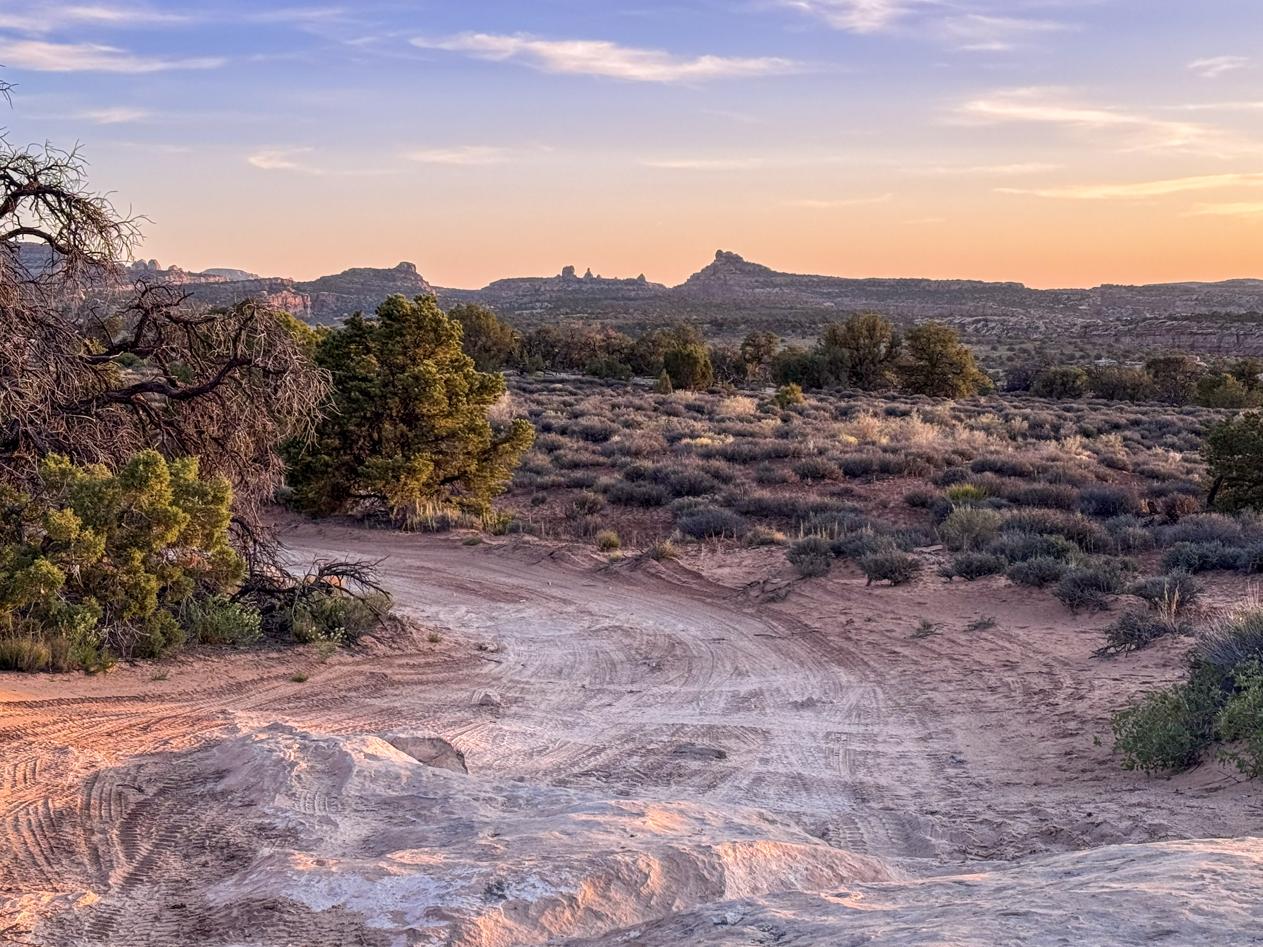
From there, we continued back along Devil’s Lane, the sandy road winding between brush, rock walls, and sculpted sandstone as we made our way toward Horsehoof Camp.
After a day full of obstacles, there was still one more challenge waiting for us: SOB Hill. By that point, the name felt fitting.
The turn required patience and precision, and Bill handled it with an impressive four-point turn that somehow made the awkward angle work. We didn’t make it through completely unscathed, though. We had forgotten to remove the mud flaps, and during the turn, one of them got ripped off.
It was one of those moments where all you can do is laugh, shake your head, and make a mental note for next time. Lesson learned. Elephant Hill had officially left its mark.
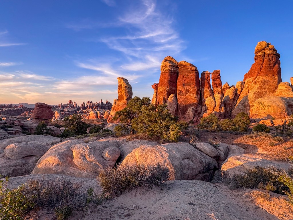
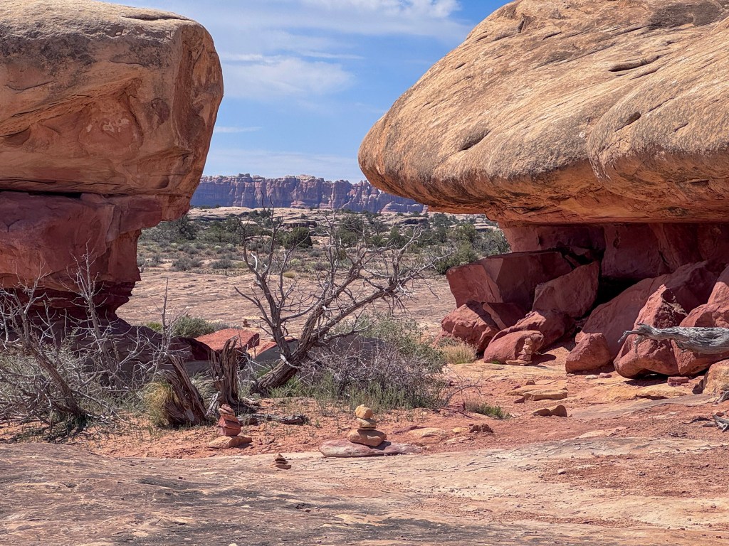
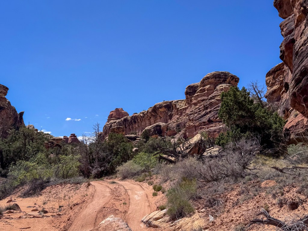
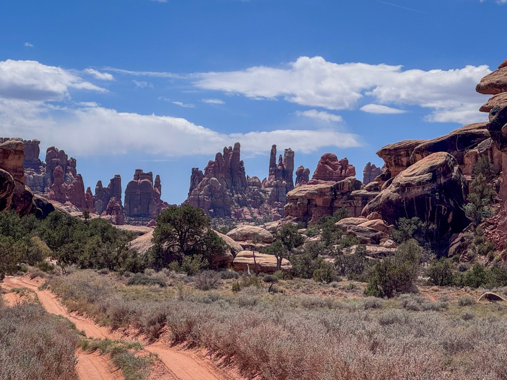
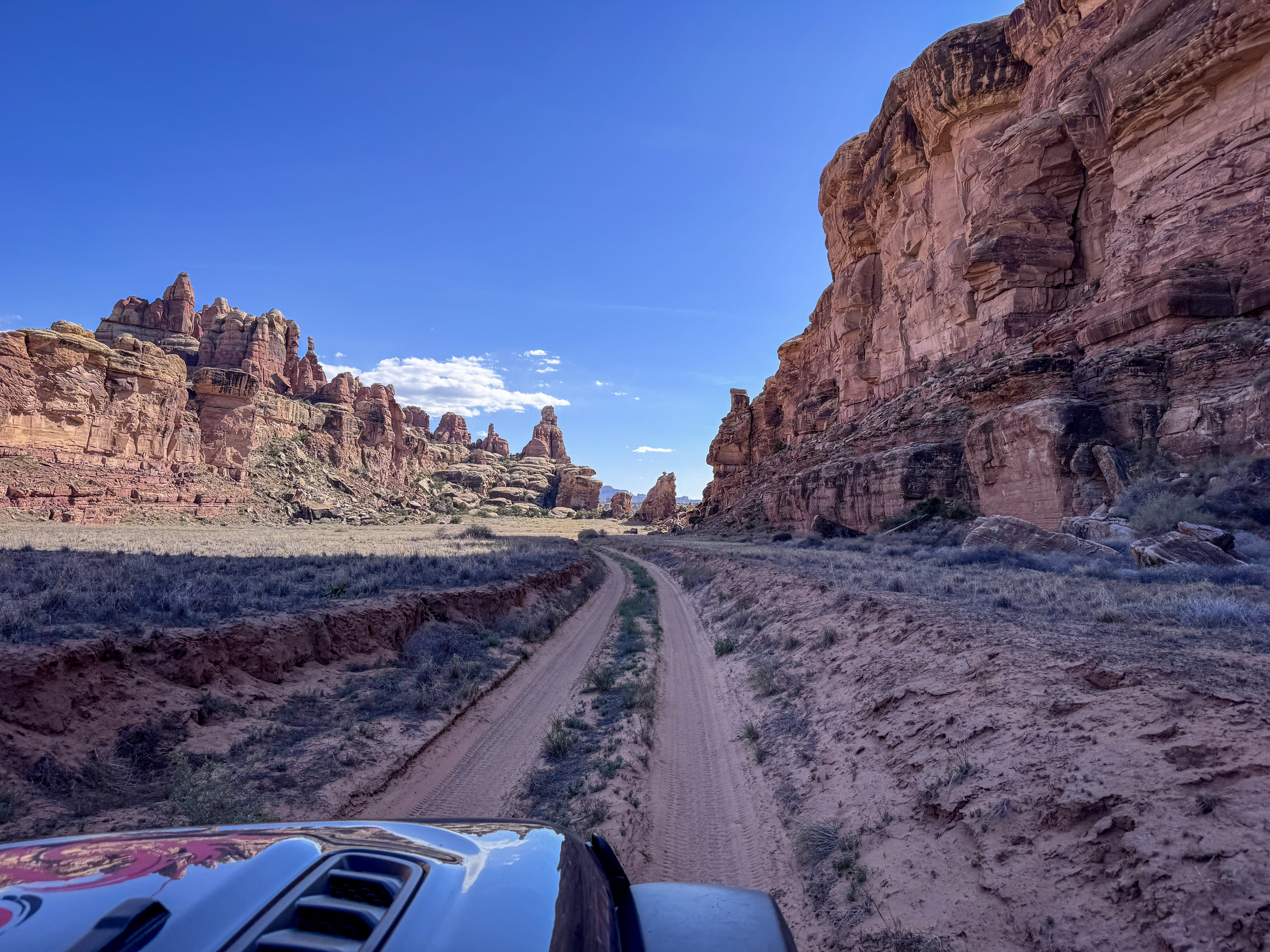
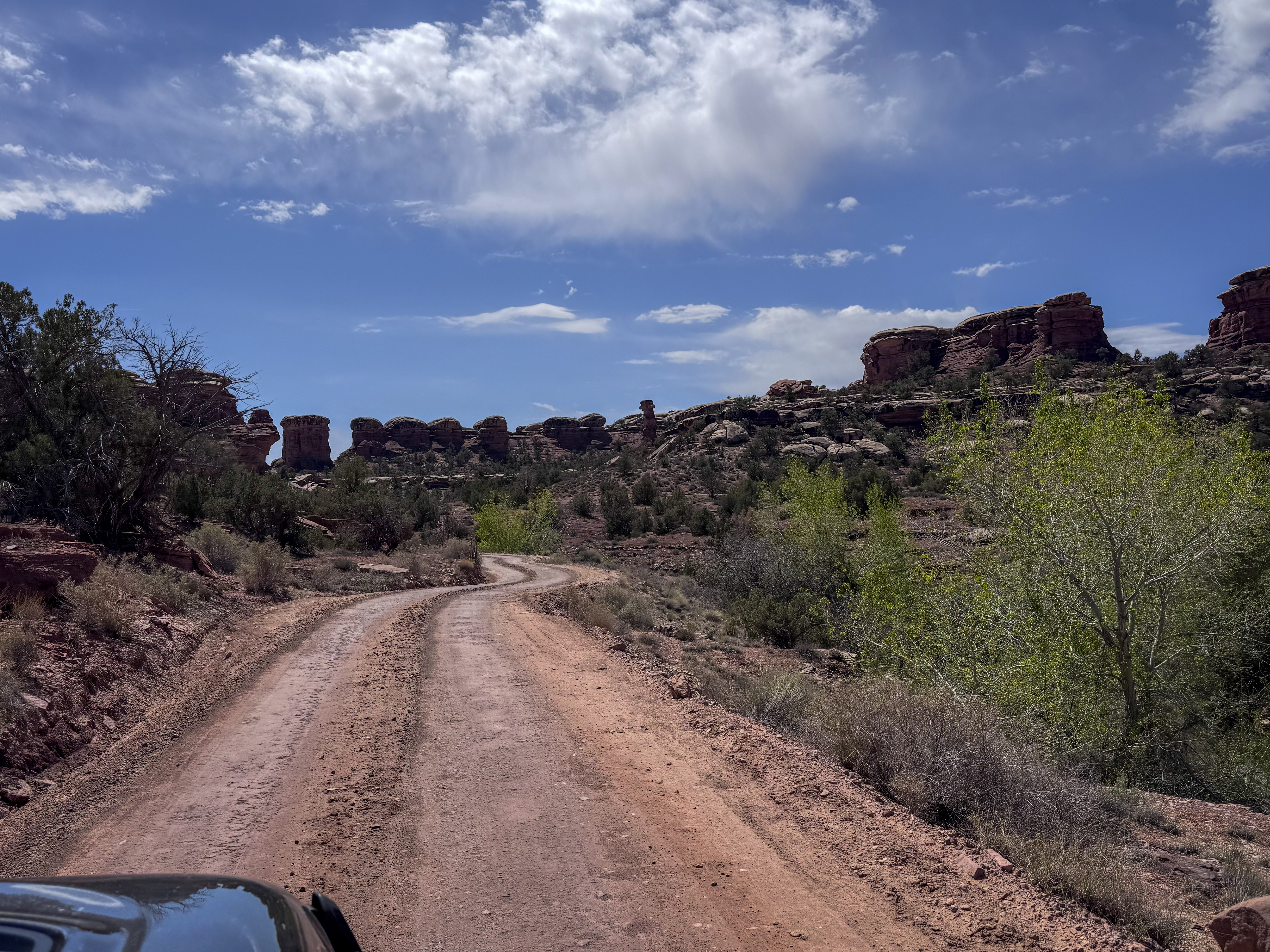
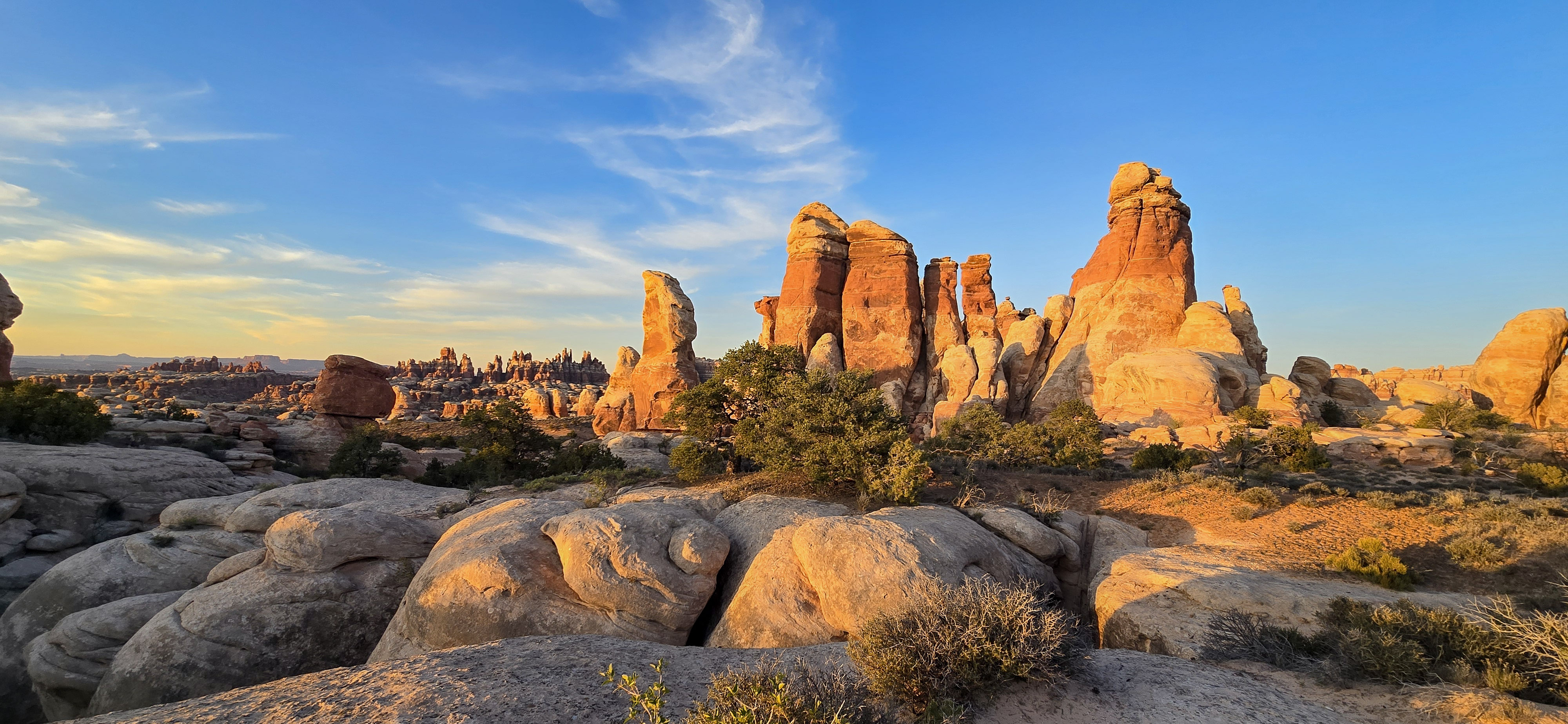
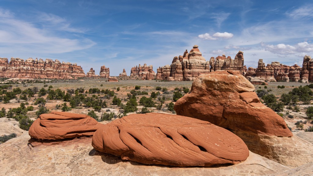
Beyond SOB Hill, the route began to feel less like an obstacle course and more like a passage into camp. The road curved through sandy stretches of Chesler Canyon, framed by towering sandstone fins, rounded domes, and spires rising out of the desert like a stone skyline. With every mile, the formations became more mesmerizing — sandstone rising in strange shapes, and making the approach feel like entering a natural amphitheater.
By the time we turned toward Horsehoof Camp, it was late afternoon. The formations around us felt like a preview of the landscape we would call home for the next few days. It was a bumpy road in, but after hours of careful driving, reaching camp felt quiet and earned.
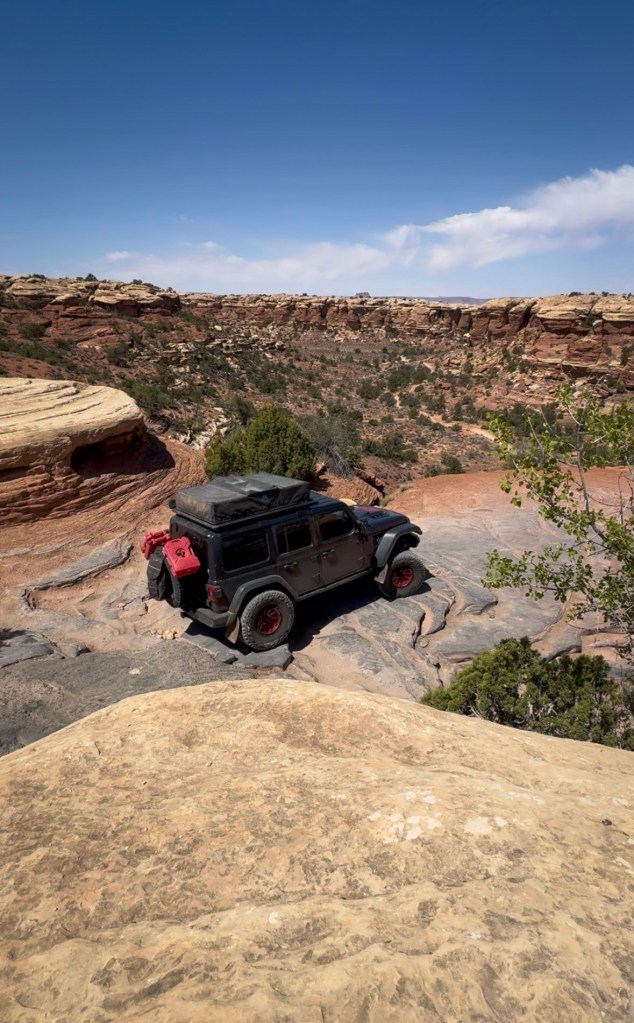
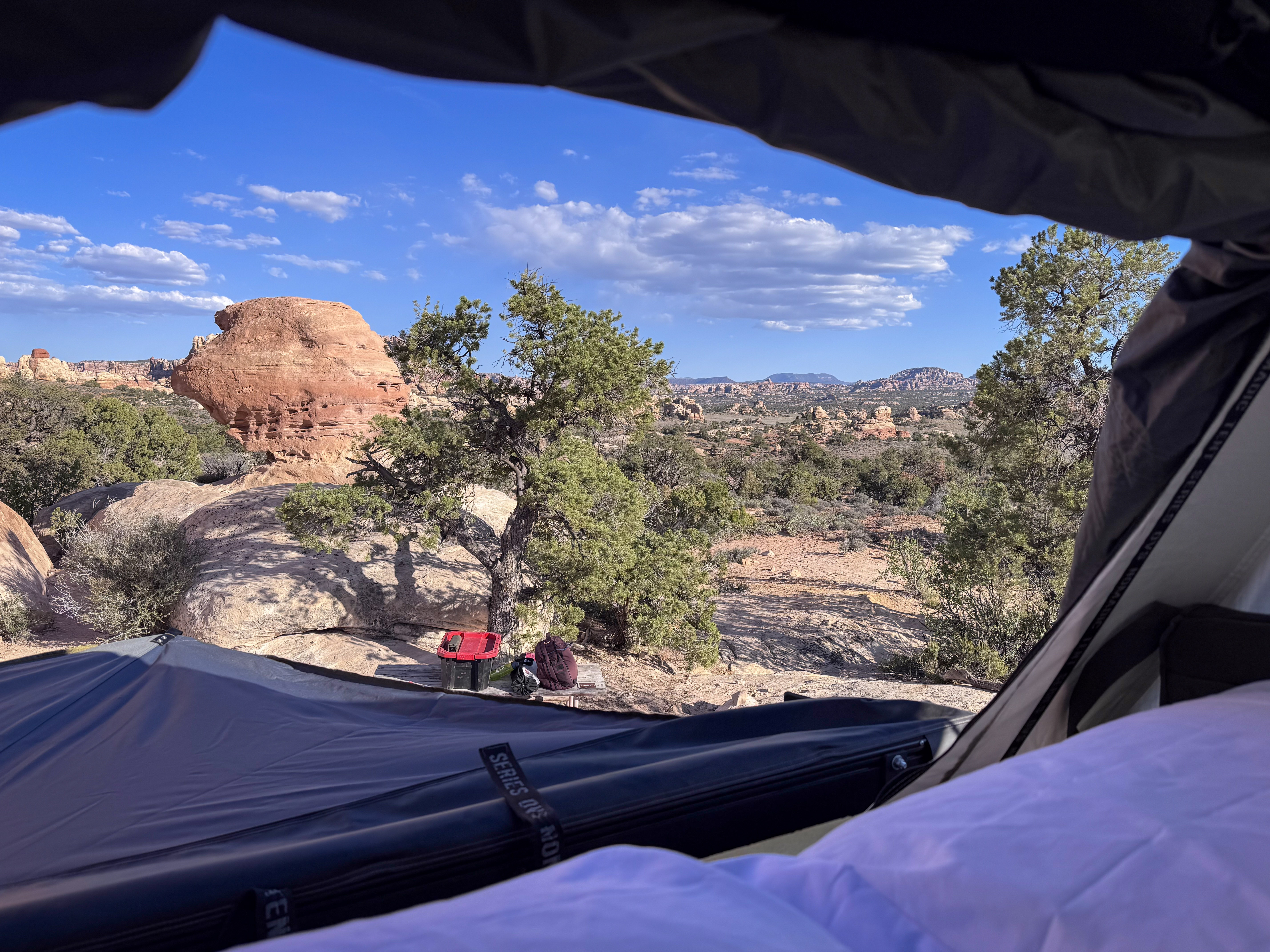
Horsehoof Camp
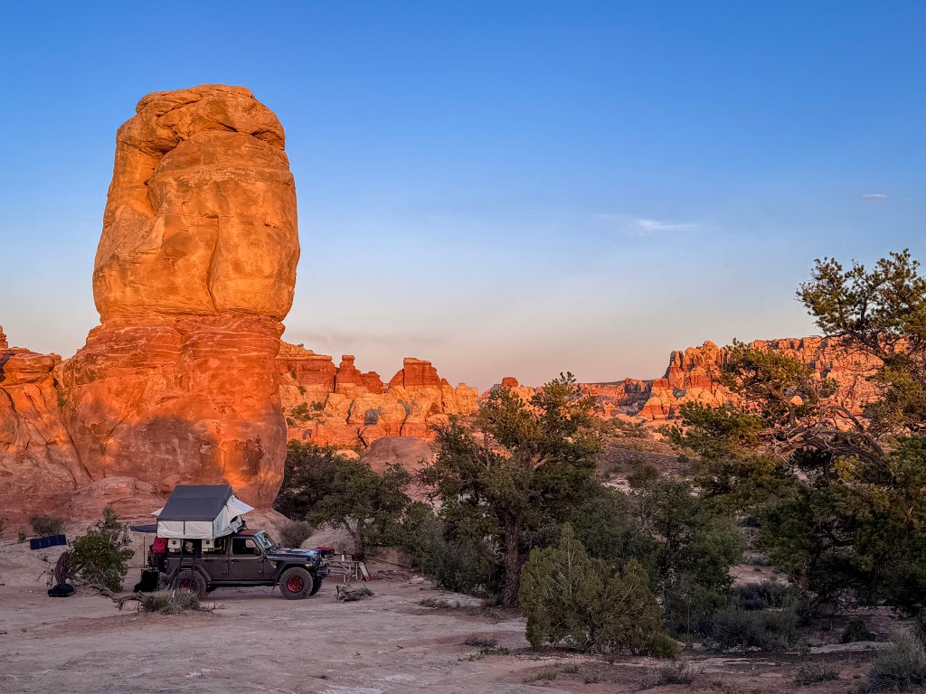
Horsehoof Camp was incredible.
For the next few days, this would be home — our Jeep and rooftop tent tucked beneath towering sandstone, with juniper scattered across the slickrock and the Needles rising all around us.
The silence felt different here. Not empty, but layered — bird calls moving through the trees, a faint breeze through desert brush, the scrape of shoes on stone, and the small sounds of camp settling into place.
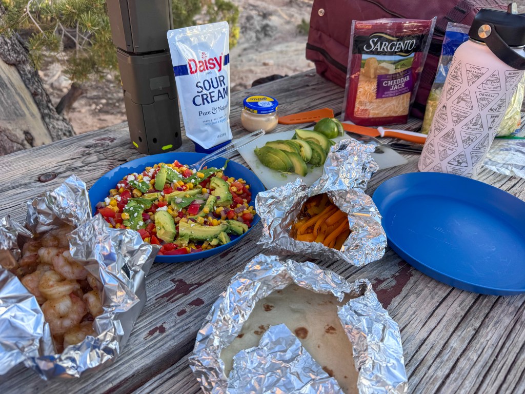
Dinner that night was shrimp tacos, and after the day we had just had, they tasted perfect. Warm tortillas, shrimp, avocado, peppers, and all the little camp-kitchen pieces spread across the picnic table — simple, colorful, and exactly what we needed.
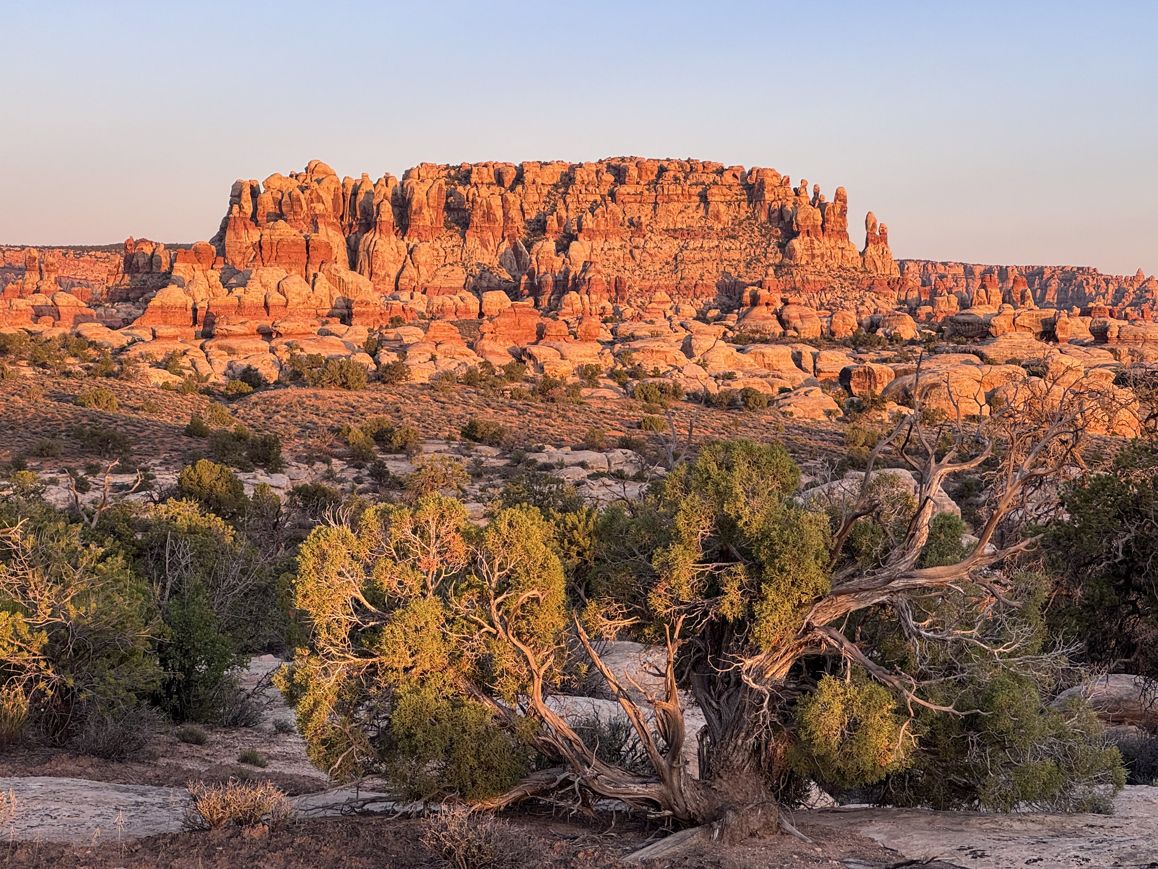
Once dinner was finished and the camp chores were done, the real show began.
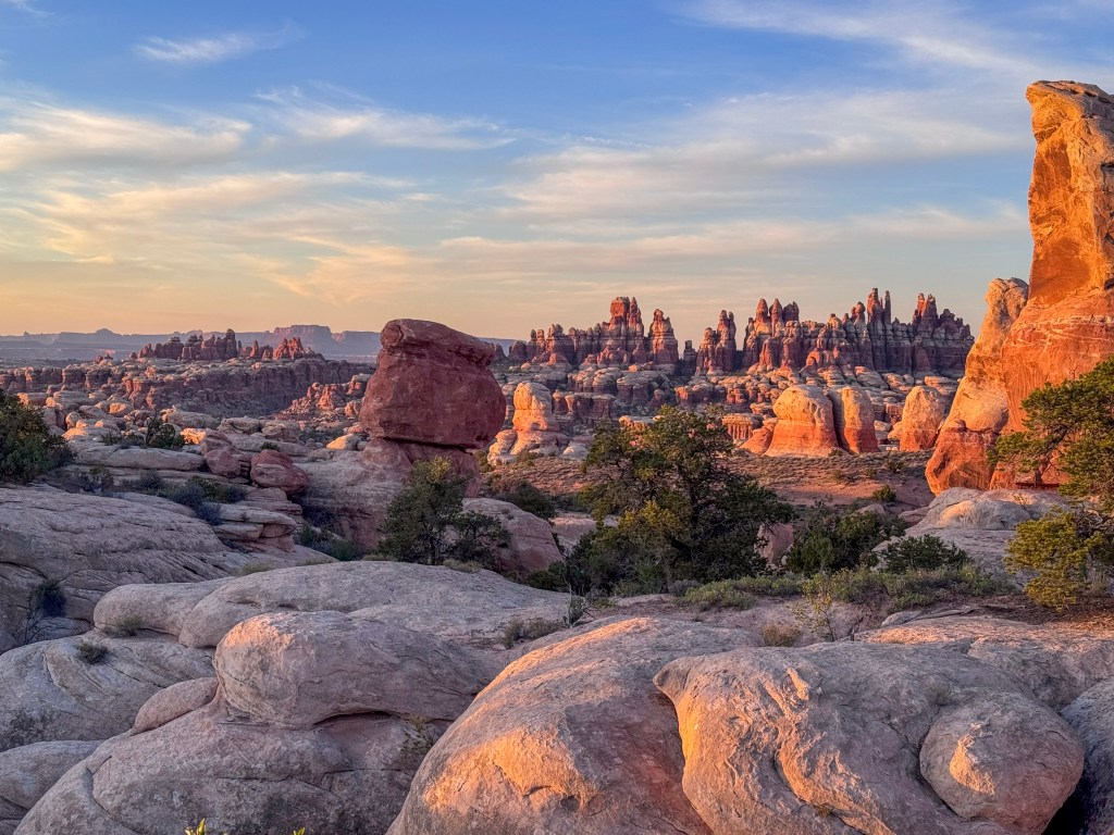
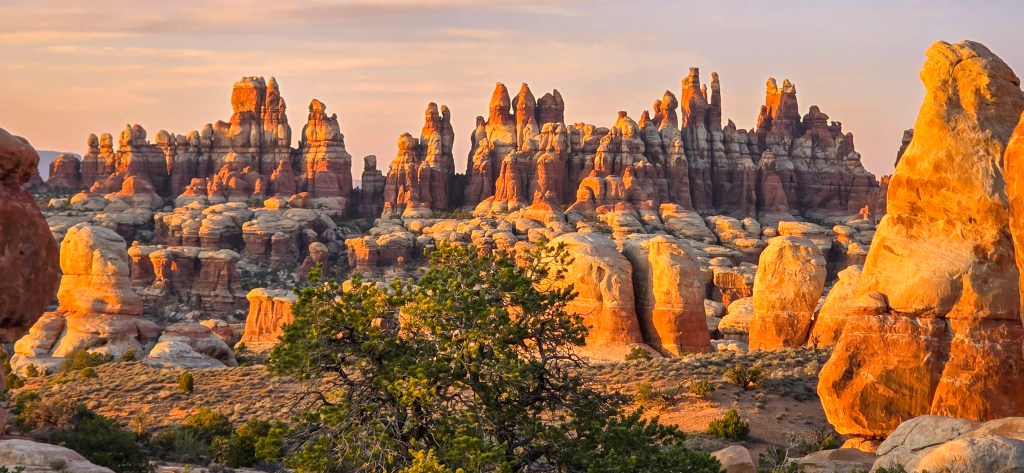
As the sun lowered, the Needles started to glow. At first, the light moved softly across the sandstone, brushing the tops of the formations in gold. Then the color deepened, spilling down the rock faces until the spires looked lit from within.
Pictures never quite capture that kind of light. They can hold the color, maybe even the shape of it, but not the feeling of standing there while the whole desert shifts around you.
It was our first sunset in the Needles, and it felt impossible to look away.
By the time the light faded, the long day finally began to settle around us. We were tired, dusty, and completely happy.
We were finally here.
Surrounded by the Needles.
Reflections
The first two days had carried us gradually toward Canyonlands — through roadside arches, ancient rock markings, hidden canyon walls, overlooks, and sandy roads. But Elephant Hill changed the rhythm. It required attention, patience, trust, and a willingness to let the trail set the pace.
This was not a day of rushing. It was a day of crawling up sandstone, easing down ledges, reading the road, and pausing long enough to take in where we were. Mile by mile, the landscape closed around us until we were no longer looking toward the Needles from a distance — we were fully inside them.
What stands out most isn’t only the challenge of the trail, though Elephant Hill certainly earned its reputation. It is the way the day slowly delivered us into the heart of the district: from morning coffee in Lockhart Basin to the confluence of two rivers, from narrow passages and technical turns to that quiet arrival at Horsehoof Camp.
By evening, with the last light spreading across the sandstone and shrimp tacos at camp, it felt like we had crossed another threshold.
We were no longer on the way to the Needles.
We were in them.
Next, we would leave the Jeep behind for a while and explore on foot — following trails into the narrow passages of the Joint Trail and toward the wide sandstone beauty of Chesler Park. But that part of the story deserves its own space.


Leave a comment