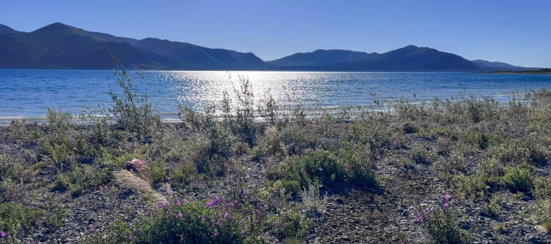
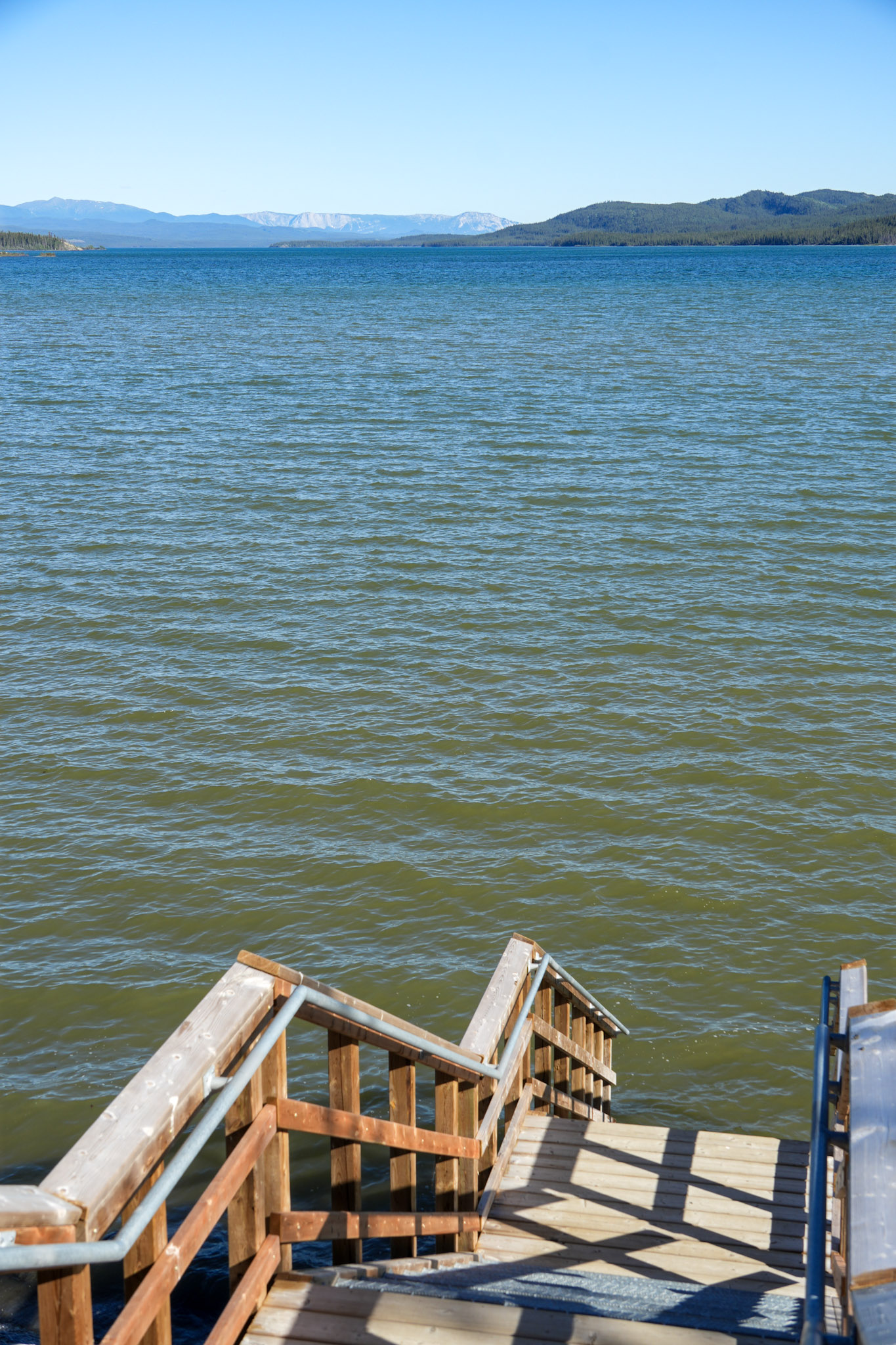
Morning came bright and blue over Kluane Lake. After the wind of the evening before, there was something almost leisurely about sitting beside the water with a cup of coffee, watching waves roll onto the rocky shoreline. Mountains stretched across the opposite side of the lake beneath a nearly cloudless sky, and for a little while, there was no reason to hurry.
Eventually, though, the road was waiting. We packed the rooftop tent, loaded the Jeep, and said goodbye to the place that had given us our first night in the Yukon. Our route would eventually carry us to Whitehorse and then south toward British Columbia, but before we returned to the highway, Bill had another idea.
Apparently, we had not yet done enough off-roading in the Yukon.
The Road That Didn’t Quite Go Through
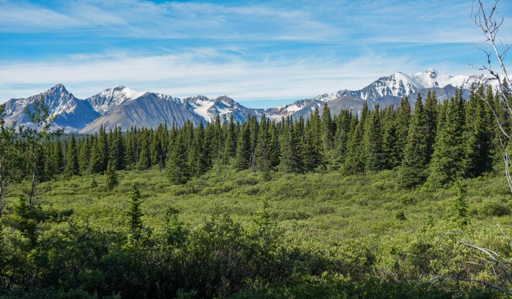
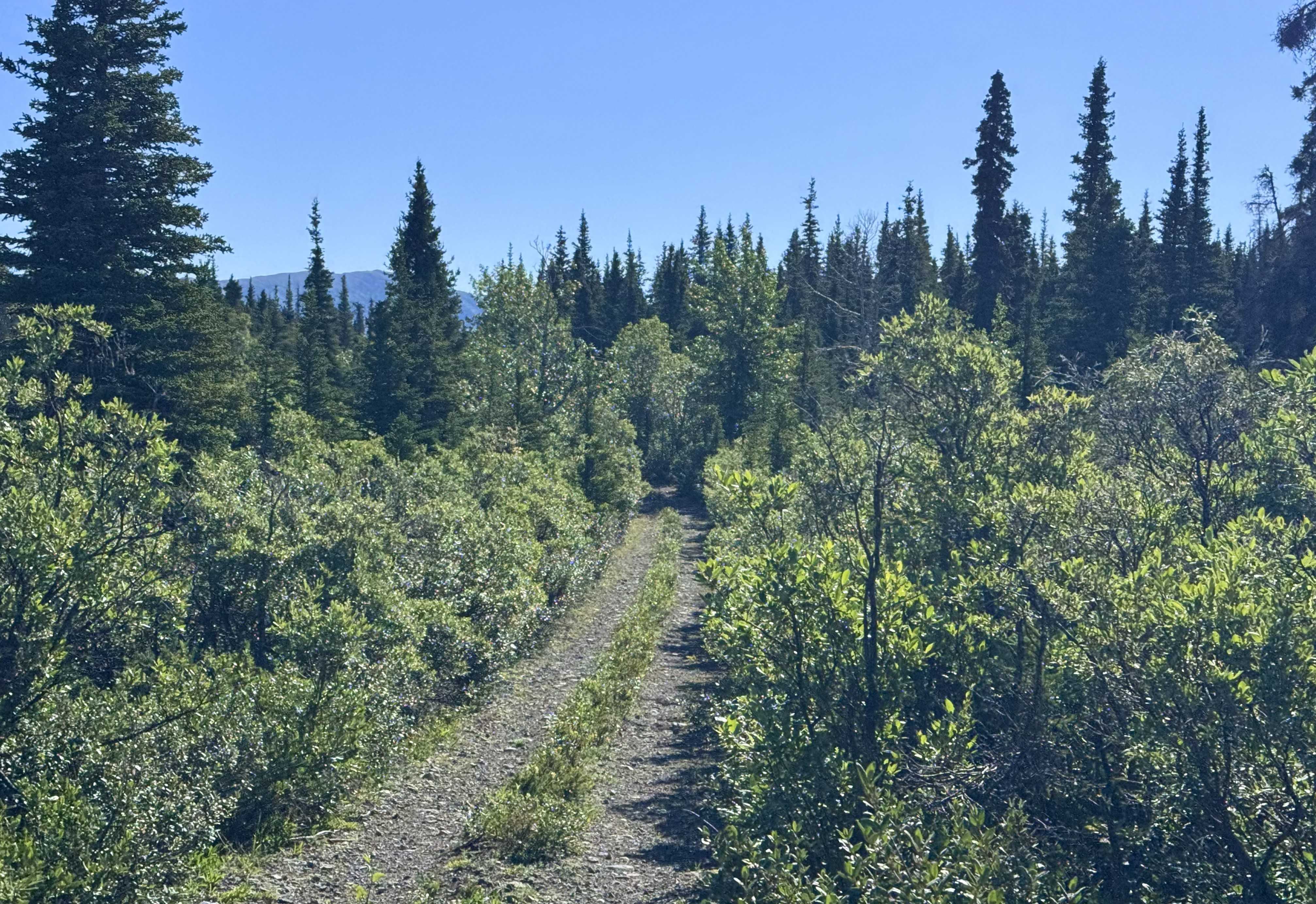
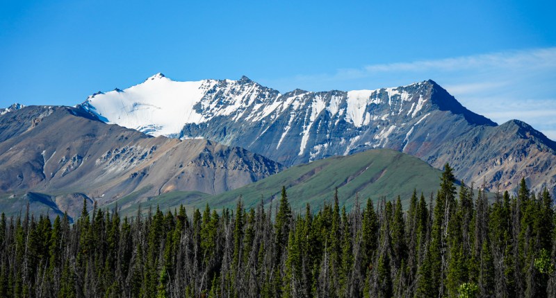
A narrow track disappeared into the forest not far from Kluane Lake, and naturally, we had to see where it went. The trail quickly left the highway behind, winding through dense willow and spruce before opening to views of the mountains. Ahead, the rugged faces of Outpost Mountain and Mount Cairnes rose above the forest, their upper slopes streaked with lingering snow. In places, the road narrowed to little more than two tire tracks, exactly the kind of route that makes you wonder what might be around the next bend.
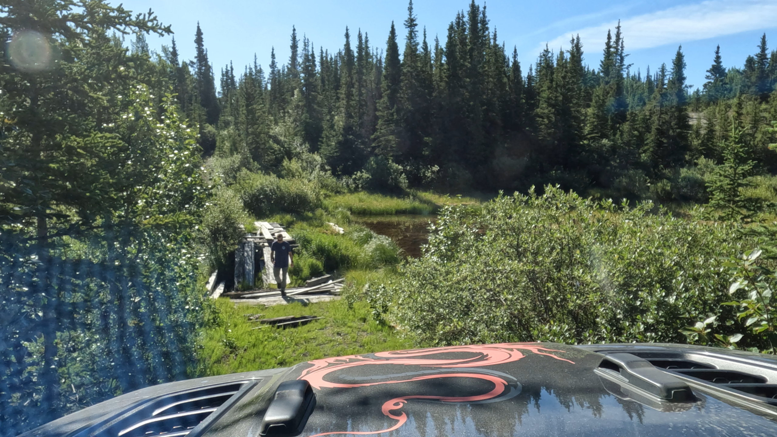
For several miles, the answer was more mountains. Then, with only about a mile and a half left before the trail supposedly reconnected with the highway, we discovered why no one seemed to be using it: an old wooden bridge had collapsed.
There was no creative Jeep line around it, no shallow creek crossing, and definitely no way across. After Bill stood for a moment looking at what remained of the bridge, we accepted defeat and turned around. Our little shortcut had just become an approximately 17-mile out-and-back detour.
Still, it was difficult to complain. The return trip gave us another look at the mountains, forest, and broad Yukon landscape we might never have seen from the highway. Sometimes the road that goes nowhere still takes you somewhere worthwhile.
A Different Side of the Yukon
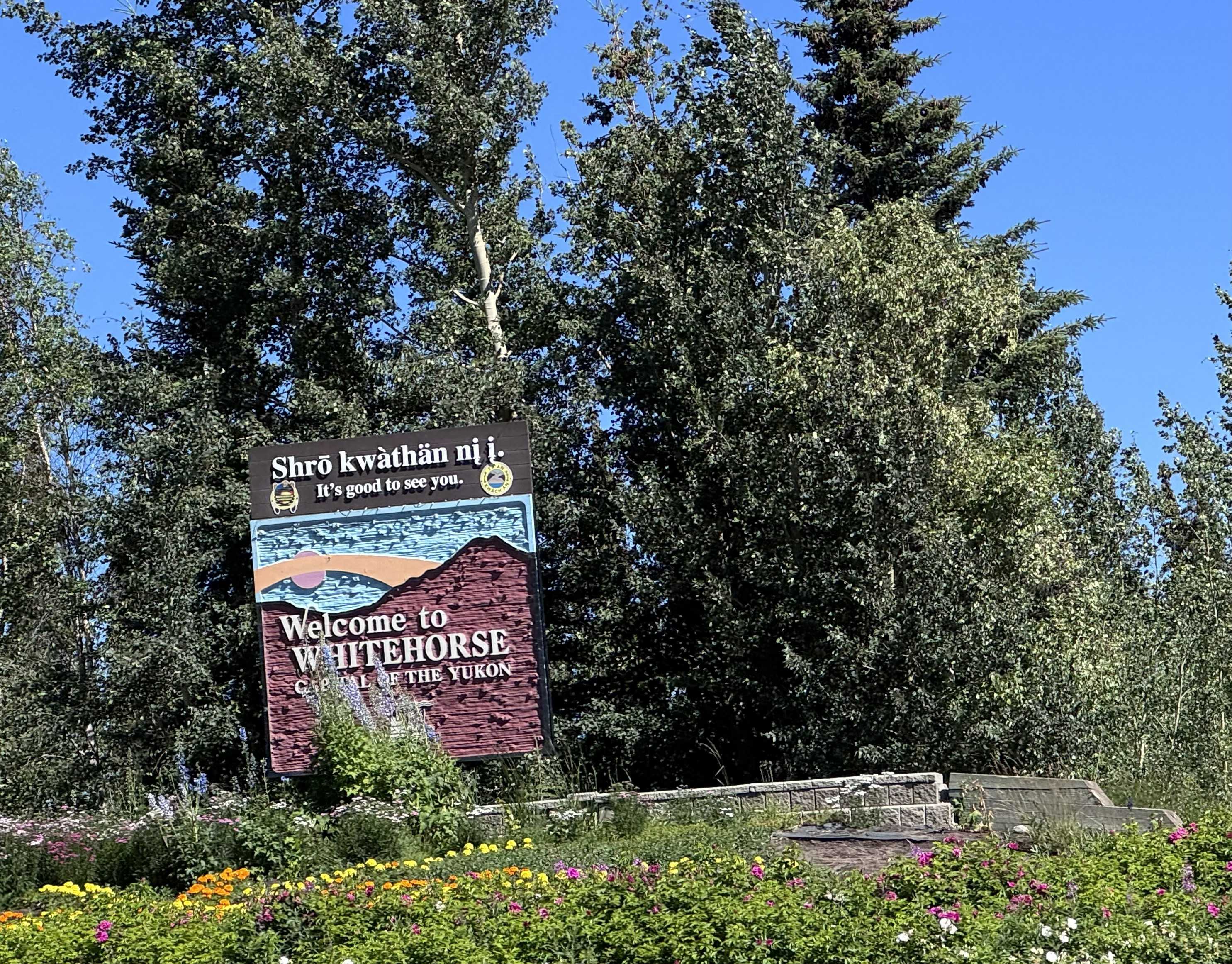
Back on the Alaska Highway, the landscape gradually shifted as we made our way toward Whitehorse. Snow-streaked peaks rose beyond thick forests, while wide valleys opened between the ranges. After days of remote camps and small communities, arriving in the territorial capital felt almost surprising.
Whitehorse sits along the Yukon River and serves as the territory’s main travel hub, yet even here the wilderness never feels far away. It is a small northern city surrounded by forests, rivers, trails, and mountains, making it feel less like leaving the wilderness behind and more like briefly stepping into its urban center.
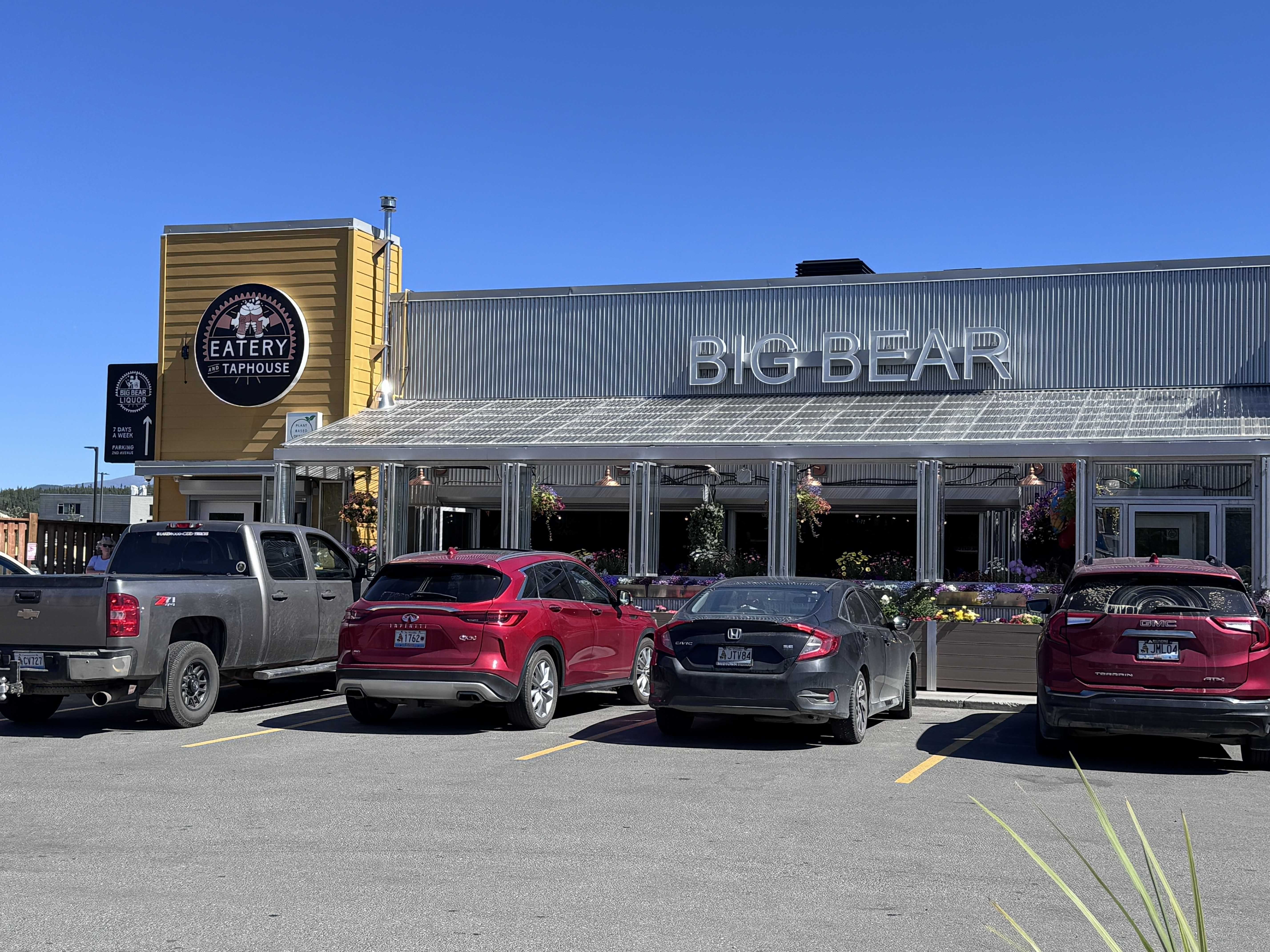
We weren’t in town for long. Lunch came first at Big Bear Eatery & Taphouse, where we traded trail snacks and camp meals for Mediterranean-inspired food, followed by a quick stop to resupply before heading back out.
Then came the stop I had been looking forward to most. After ten days of long drives, rain, cold coastal weather, hikes, campgrounds, and more miles than I could count, we were about to spend the afternoon doing almost nothing—or at least nothing strenuous.
A Yukon Reset
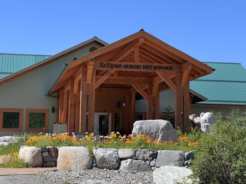
A short drive outside Whitehorse brought us to Eclipse Nordic Hot Springs. I had pictured something fairly simple—a few mineral pools, maybe a sauna, and a relaxing soak before we continued down the road. I seriously underestimated the place.
Eclipse blends natural hot-spring bathing with Scandinavian thermotherapy and Japanese onsen influences. Mineral-rich water feeds pools kept at different bathing temperatures, while the larger complex includes saunas, steam rooms, relaxation spaces, heated loungers, Japanese-style ceramic tubs, and cold-plunge pools for anyone wanting to follow the full heat-cold-rest cycle.
Once inside, it quickly stopped feeling like a roadside hot-springs visit and became something closer to an entire afternoon retreat. We moved between pools at different temperatures, relaxed in the ceramic tubs, and explored the sauna and steam areas, lingering wherever felt best rather than worrying about following a particular routine.
The heated tile loungers surprised me most. I expected them to be relaxing; I did not expect to start sweating while doing absolutely nothing. My favorite, though, was the eucalyptus steam room. Warm, fragrant steam filled the space until the outside world seemed to disappear, and after days of wet weather in Alaska and countless hours in the Jeep, it felt ridiculously good. So good, in fact, that I went back a second time.
For once, there was no wildlife to chase, viewpoint to photograph, or trail pulling us farther down the road. We simply slowed down. By the time we stepped back outside, every muscle felt looser and the pace of the trip seemed to have softened with it. Before leaving, we stopped at the café for ice cream—a perfectly indulgent finish to the afternoon.
One More Crossing of the Yukon
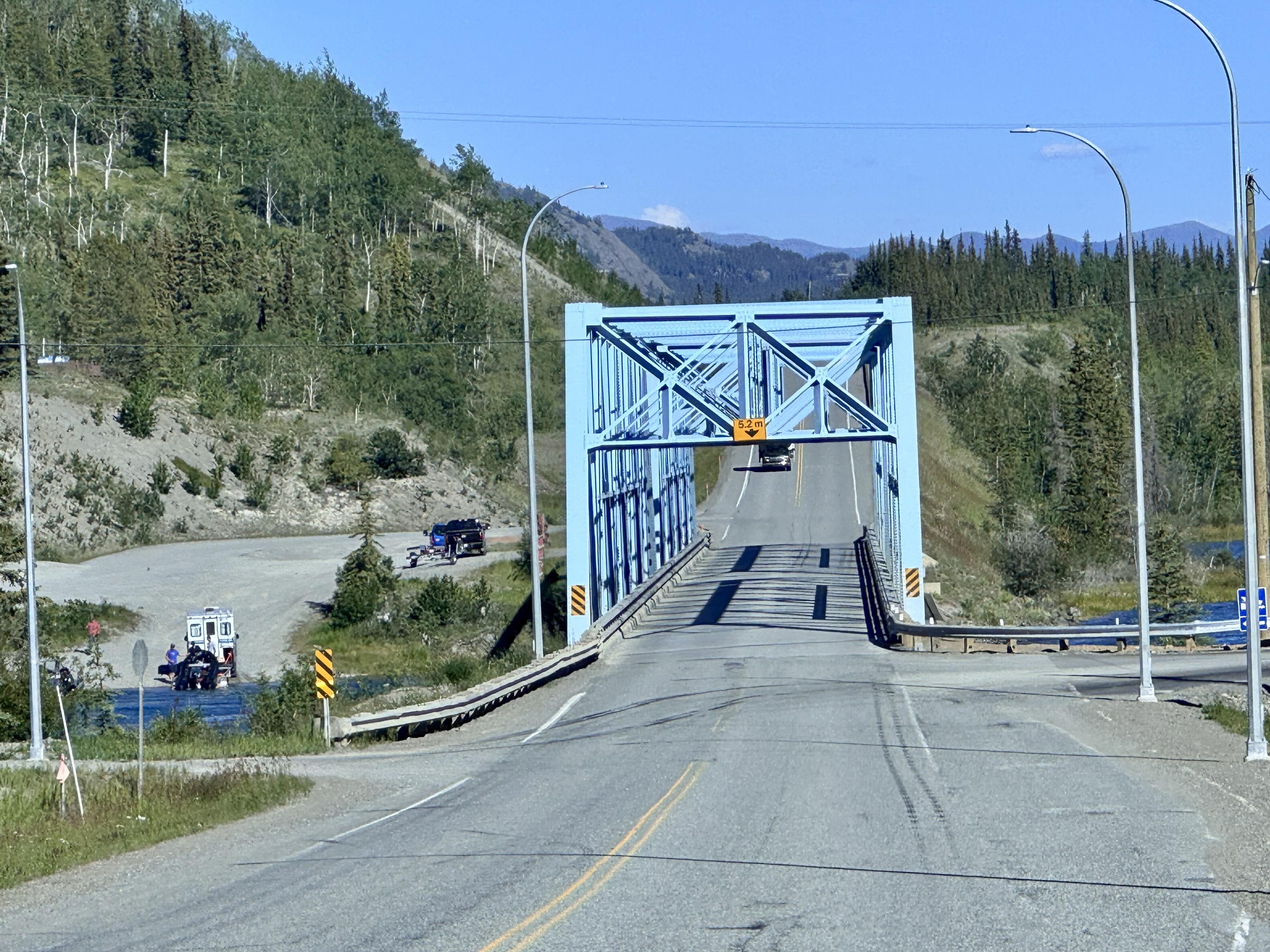
Eventually, we had to leave Whitehorse behind. The Alaska Highway carried us southeast, and before long we crossed the Yukon River once again. By this point, the river had become one of those geographic threads quietly following our journey—first in Alaska, then again here in the territory that shares its name.
Farther down the highway, we stopped briefly at Swan Haven on Marsh Lake. There were, somewhat ironically, no swans, but we did watch a crow aggressively chasing a hawk through the sky, which was entertaining enough to make the stop worthwhile.
From there, the road continued toward Teslin, where an enormous stretch of water gradually opened ahead of us.
Across Nisutlin Bay
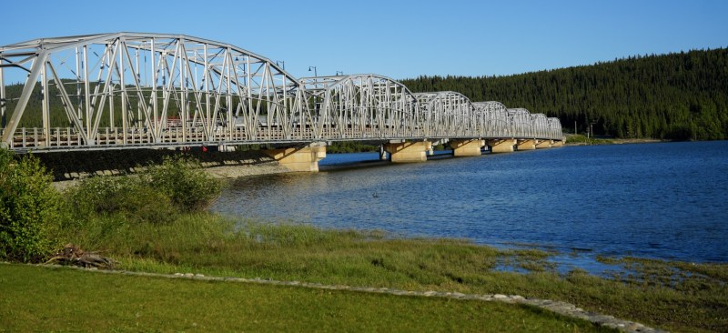
Teslin Lake seemed to stretch far beyond what I expected, filling the valley between forested hills and distant mountains. Near Teslin, the Alaska Highway crosses Nisutlin Bay on the seven-arched Nisutlin Bay Bridge, the longest bridge on the Alaska Highway.
After so many miles through forest and mountains, the broad expanse of water made the crossing feel especially dramatic. The pale steel arches stretched across the bay while Teslin Lake opened far beyond them, blue water reaching toward forested ridges and mountains on the horizon. It was another reminder that the Alaska Highway was never simply pavement connecting towns; again and again, it crossed the rivers, lakes, forests, and mountain systems that define the North.
Beyond Teslin, the highway continued southeast through another long stretch of forest and mountains, briefly carrying us across the British Columbia border before returning to the Yukon. Somewhere along that portion of the road, the wildlife gave us another reason to stop.
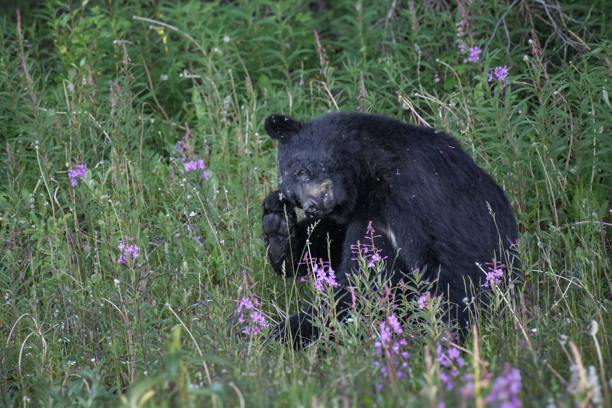
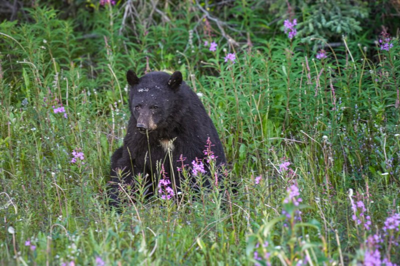
A black bear appeared among brilliant pink fireweed beside the highway. We watched as it wandered through the flowers, seemingly unconcerned by anything around it. Then it sat down, lifted a back paw, and began scratching around its head and ear with the wonderfully ordinary manner of an oversized puppy. After so many wildlife encounters that had us quickly reaching for cameras, there was something especially fun about simply watching a bear behave like a bear.
Eventually, the highway carried us back into the Yukon and toward Watson Lake, where our route was about to change again. After hundreds of miles on the Alaska Highway, we were finally turning away from it and toward another road whose name had been on our trip plan for months: the Cassiar Highway.
Turning onto the Cassiar
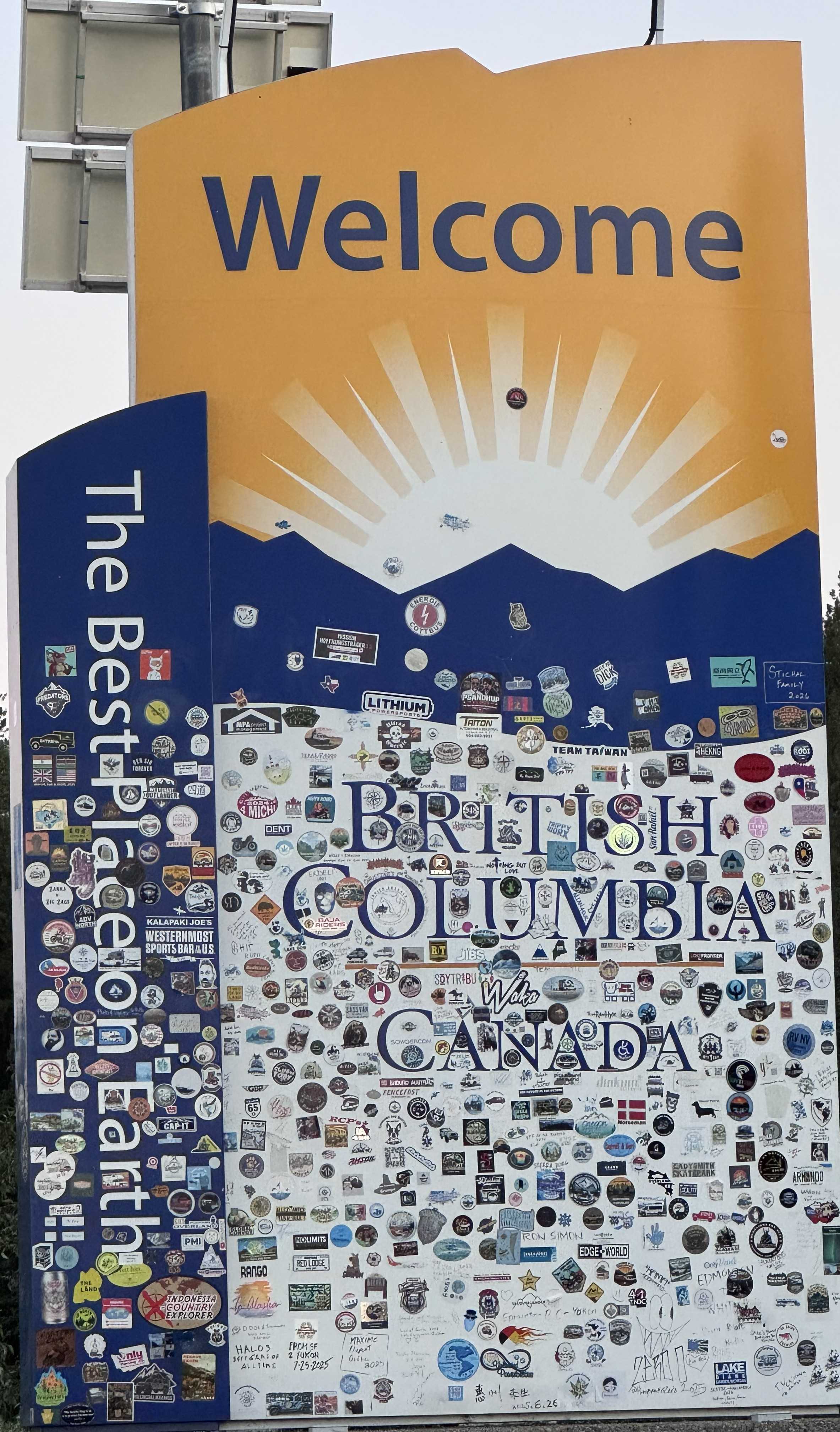
At the junction before Watson Lake, we turned south onto Highway 37—the Stewart-Cassiar Highway—and crossed into British Columbia. The Cassiar stretches through a sparsely populated landscape of boreal forest, lakes, mountains, and long distances between communities and services, and almost immediately, the road felt different.
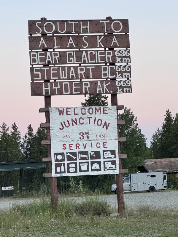
Traffic thinned, the forest pressed closer to the pavement, and mountain ranges appeared and disappeared beyond the trees. Near the start of the highway, a weathered sign pointed the way “South to Alaska,” a reminder that this road would eventually lead toward Hyder. We would be following that direction soon enough, though not until the next day.
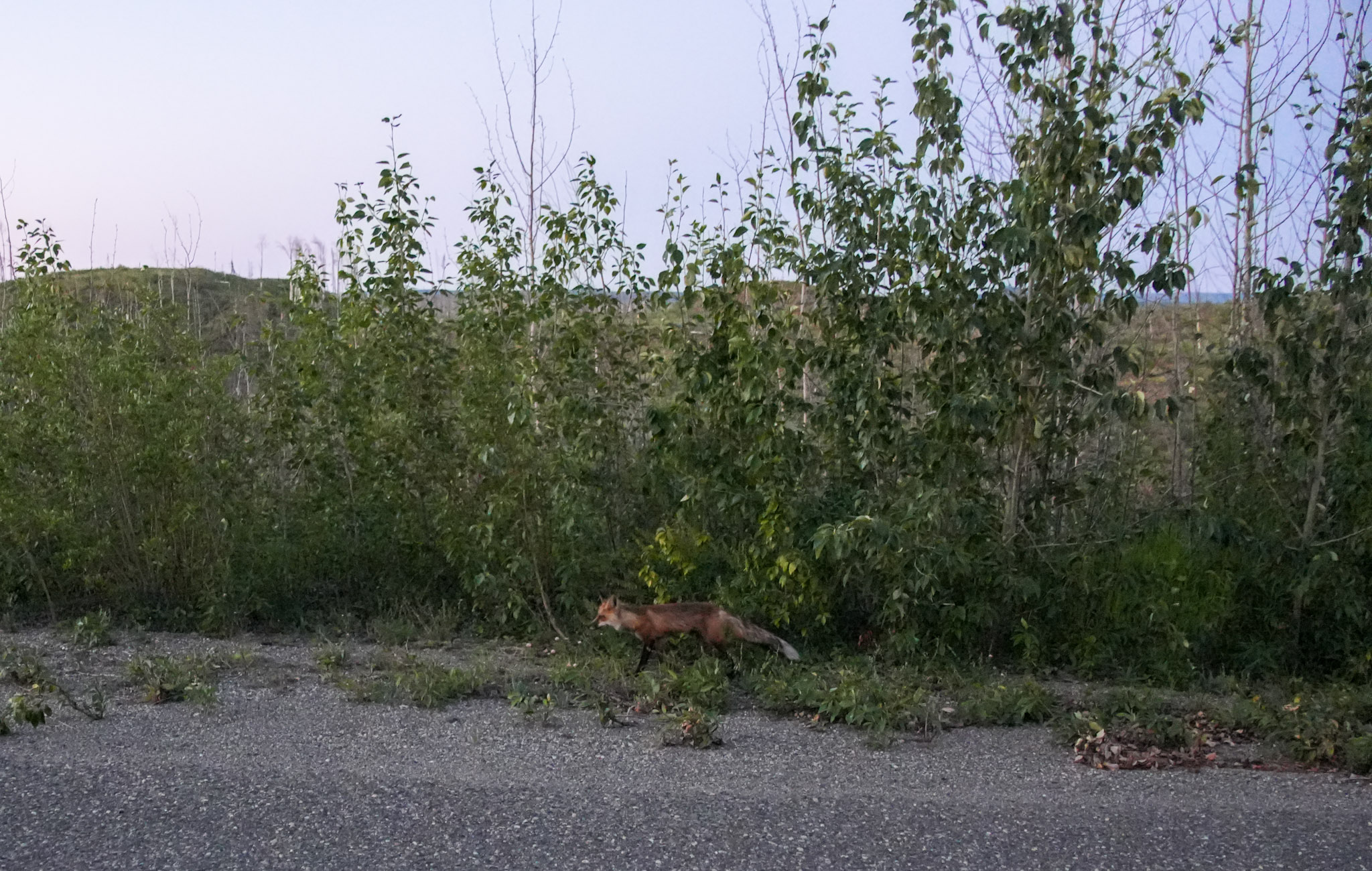
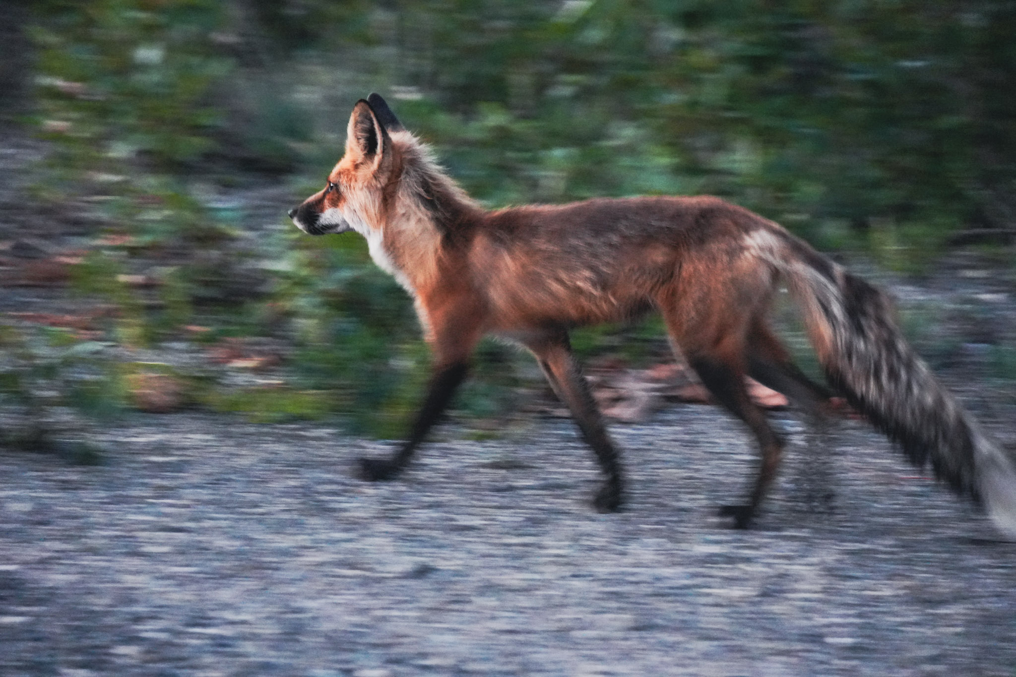
This was exactly the kind of road our expedition had repeatedly gravitated toward—fewer towns, fewer people, and more reasons to keep scanning the shoulders for wildlife. A red fox trotted along the roadside in the fading light, its rusty coat standing out against the muted greens and grays of the forest.
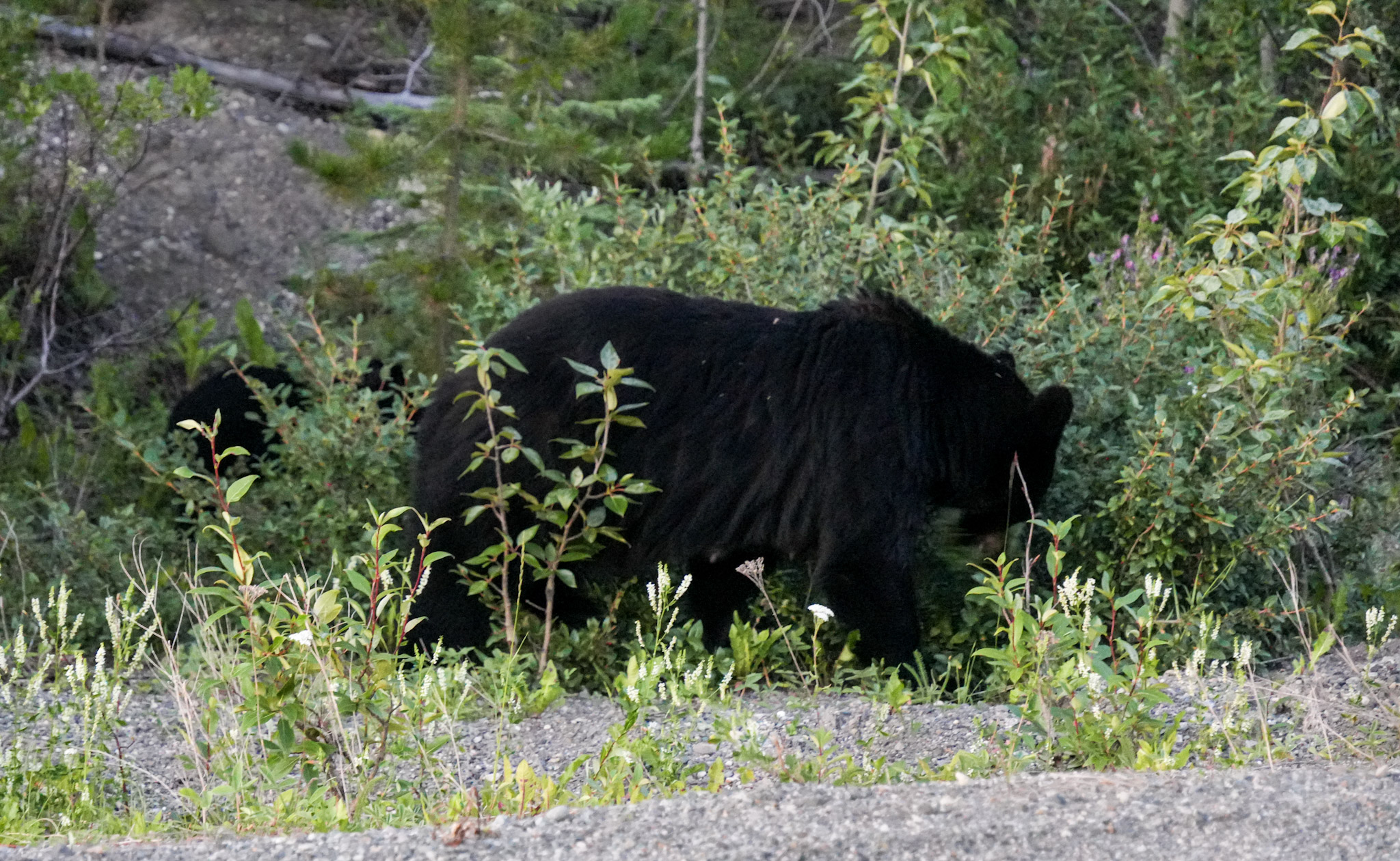
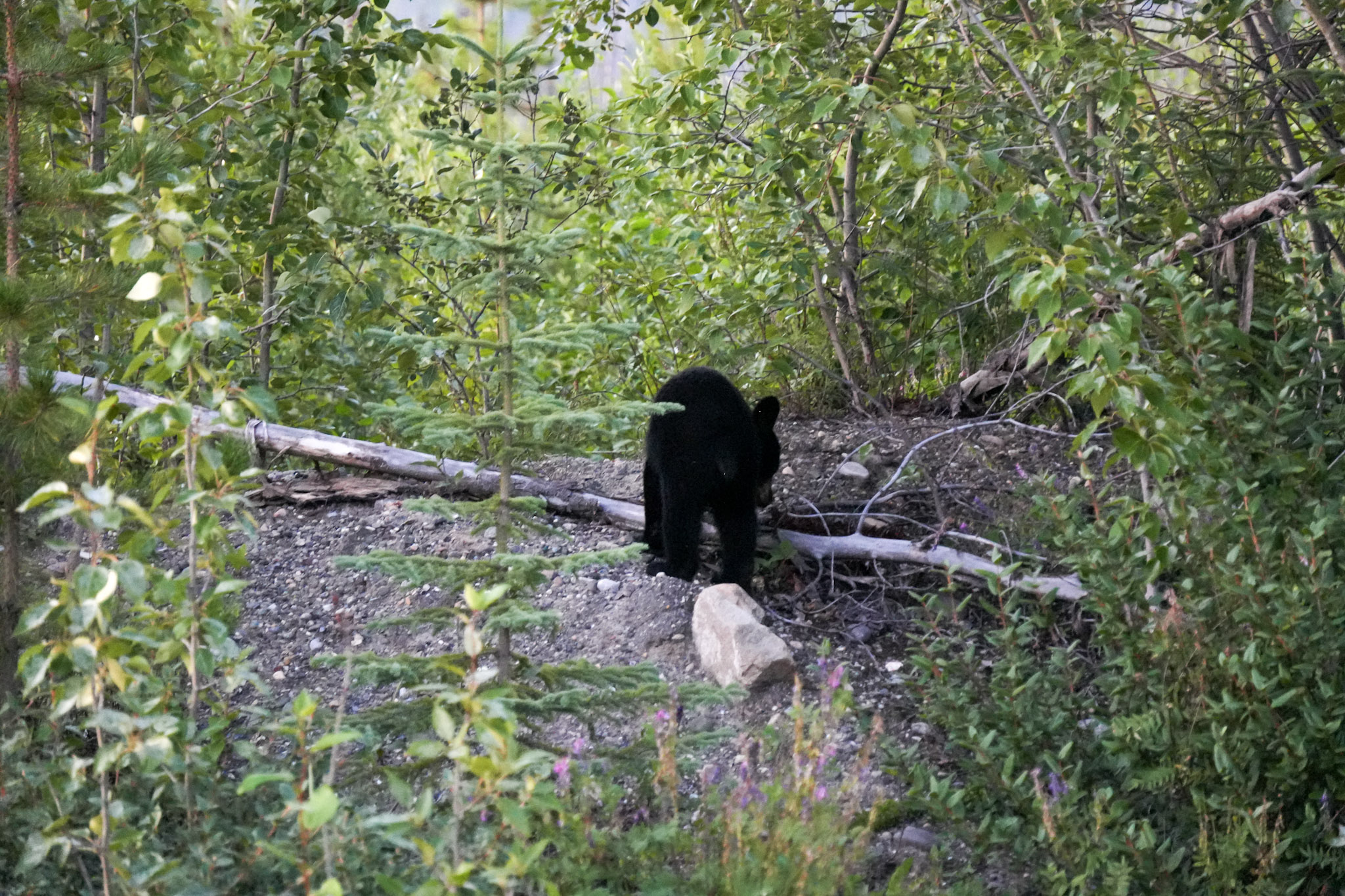
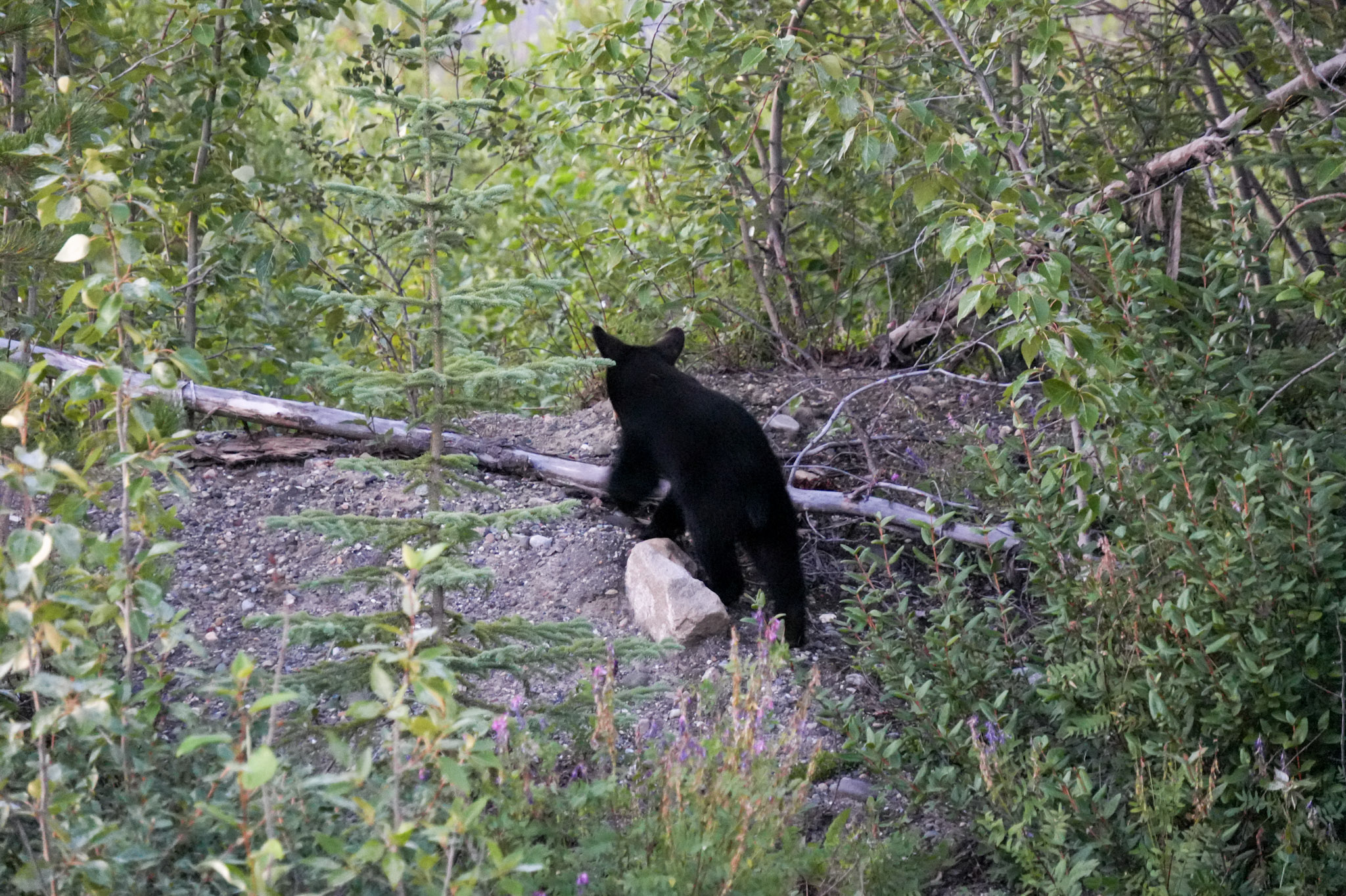
Not long afterward came an even better sighting: a black bear sow with two cubs. While the mother fed beside the road with one cub staying close, the other seemed determined to investigate the world on its own. It climbed partway up a small gravelly slope, paused among the brush, and looked around with the kind of curiosity that made it hard to stop watching before wandering back toward the trees.
As evening settled over the Cassiar, the light began to change in a way we had hardly seen in days. Near Wheeler Lake, I watched the sun drop toward the horizon, casting soft evening light across the water and surrounding forest. After so many nights beneath the lingering glow of the northern summer, simply watching a true sunset again felt surprisingly memorable.
Jade at the Edge of the Road
By the time we reached Jade City, it was late. We had lingered longer than planned at Eclipse Nordic Hot Springs, and after a full day of driving, off-roading, wildlife stops, and another long stretch of highway, camping suddenly sounded much less appealing than a real bed and a hot shower.
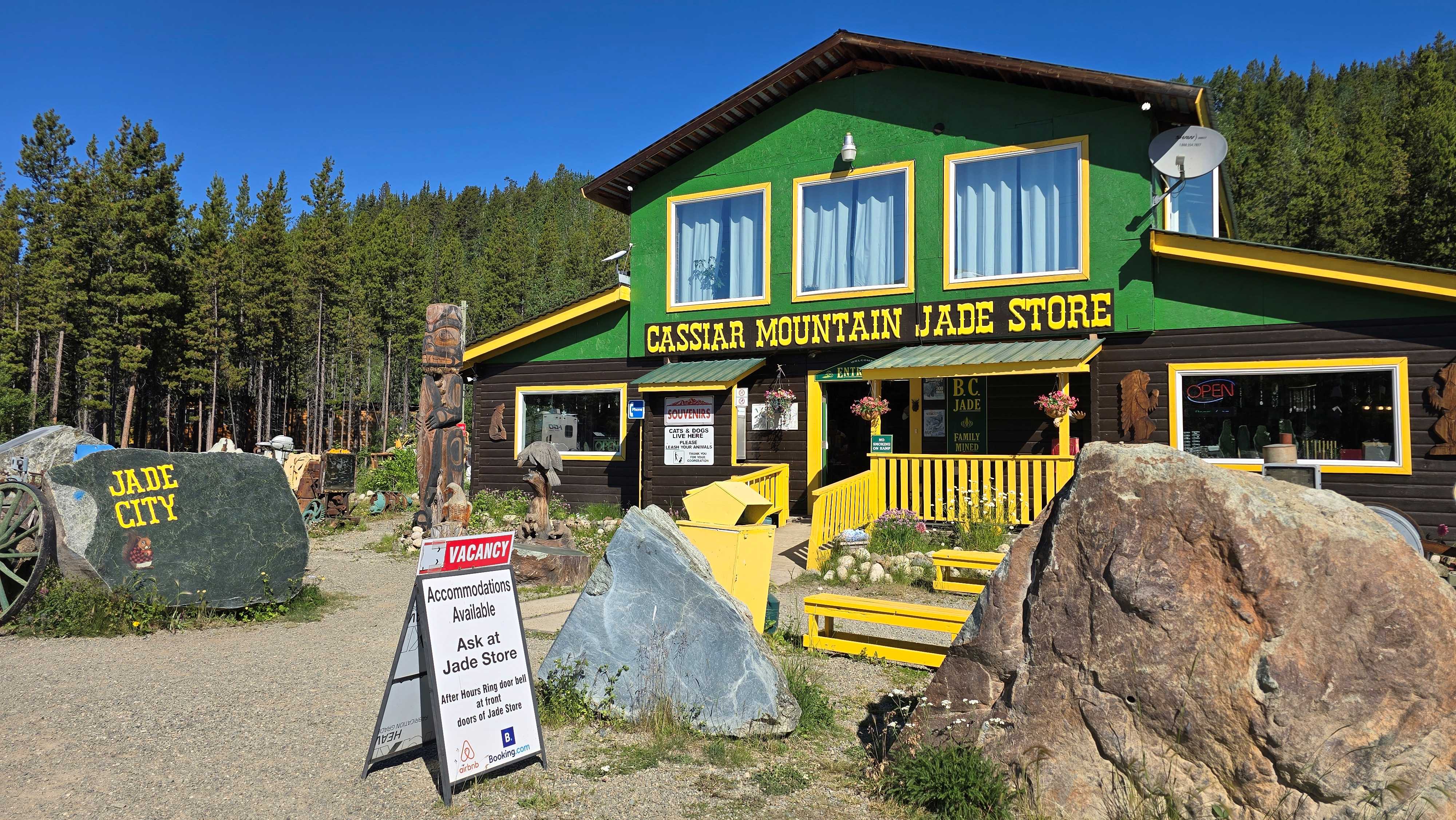
Calling Jade City a “city” might create the wrong impression. It is a tiny roadside community along the Cassiar Highway, but even arriving after dark, there was little doubt about what gave the place its identity. We decided to save the exploring for morning.
That night, we were simply grateful for the room. After days of rooftop tents, campgrounds, long drives, and changing weather, a shower and a real bed felt wonderfully luxurious. Something else had changed too: for roughly ten days, summer in Alaska and the Yukon had kept the sky glowing deep into the night. Here, farther south on the Cassiar, darkness had finally returned—and with it, the moon.
After so many nights of near-endless northern light, seeing the moon hanging in a genuinely dark sky felt almost unfamiliar. It was a small thing, but somehow it marked the journey just as clearly as crossing another border or turning onto a new highway.
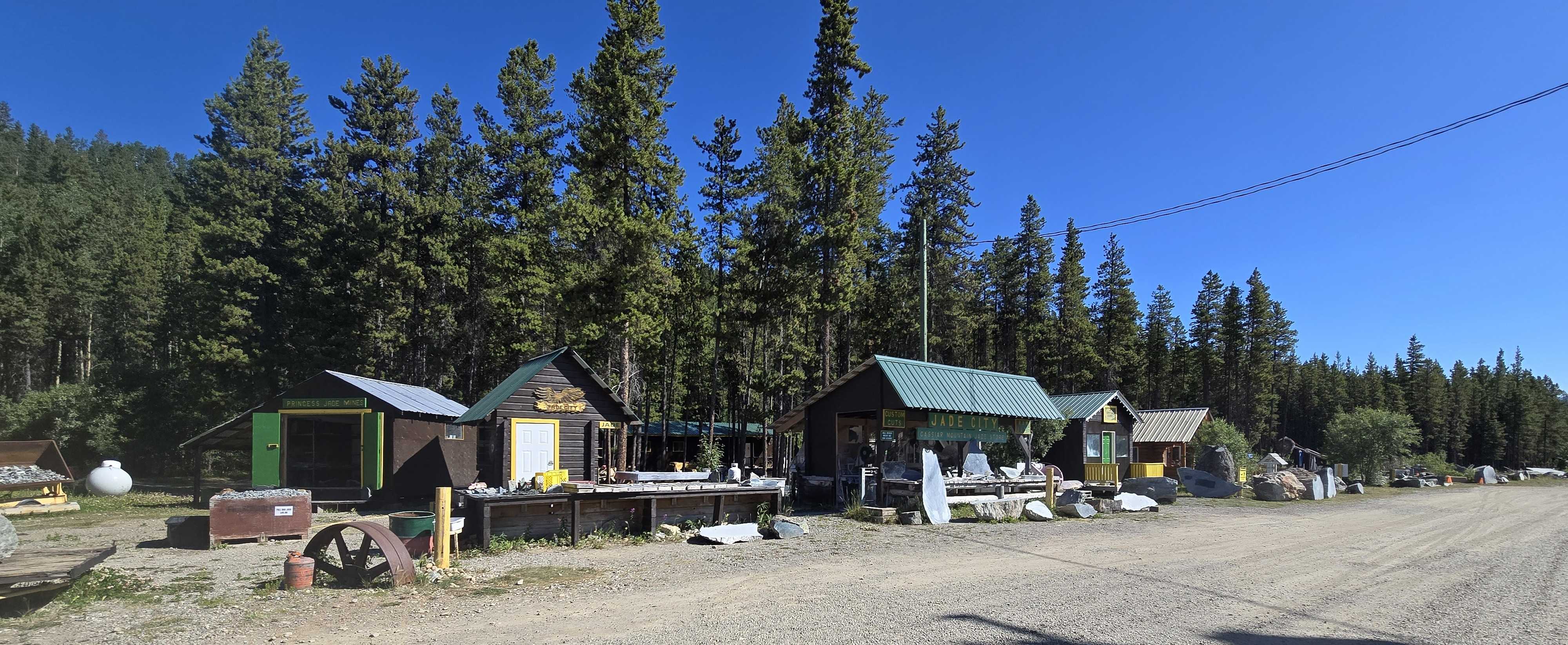
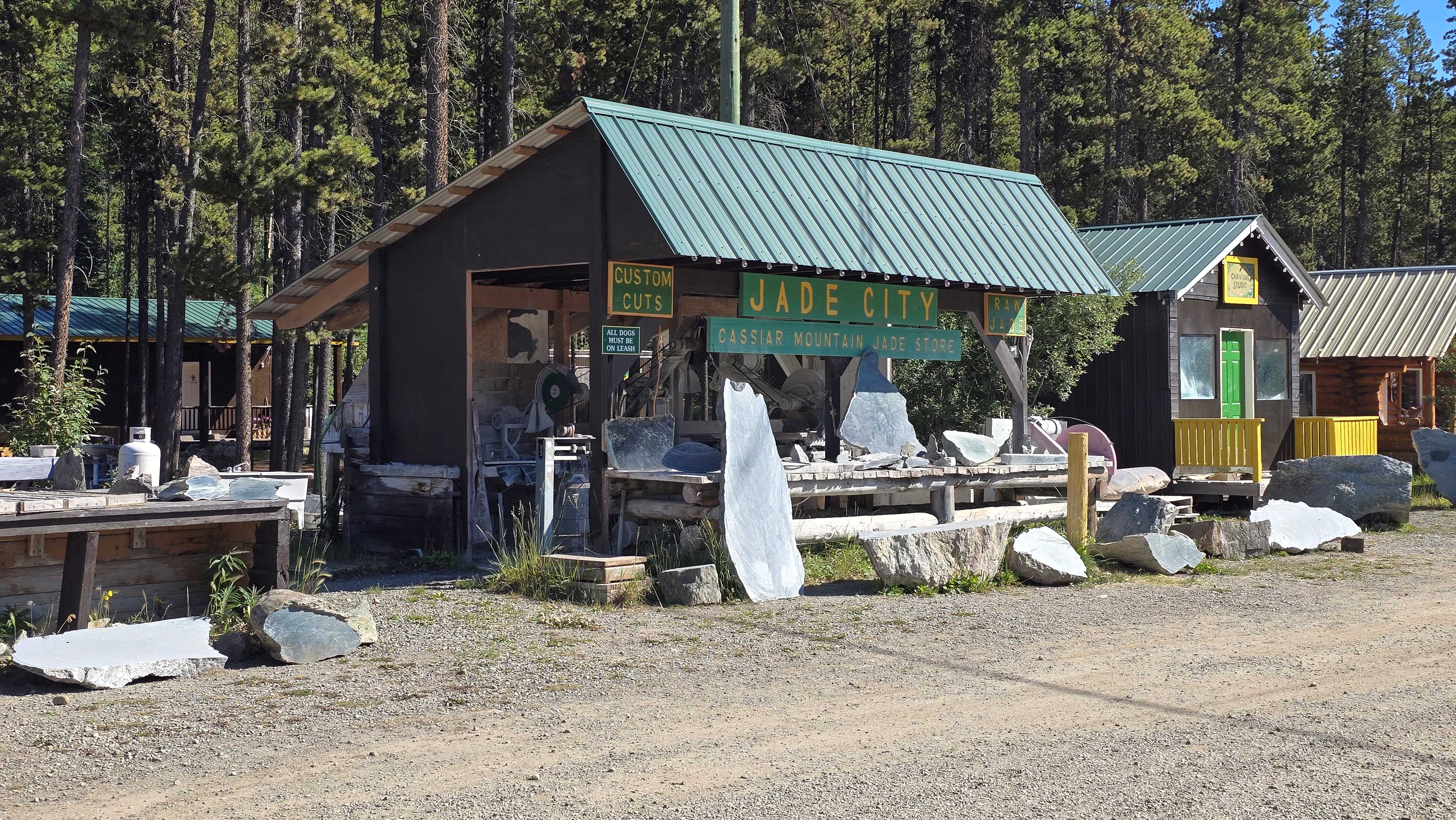
The following morning, Jade City revealed itself properly. Huge slabs of jade sat outside the buildings, some rough and unpolished, others cut into enormous pieces waiting to become something else. Inside the Cassiar Mountain Jade Store, the stone took on an entirely different form as artists transformed it into sculptures, jewelry, hanging pieces, carvings, and other works of art. I loved the contrast between the massive raw stone scattered outside and what skilled hands could create from it.
The Road Keeps Changing
That morning had begun beside the blue waters of Kluane Lake. Since then, we had followed an off-road trail to a bridge that no longer existed, spent an afternoon slowing down in Whitehorse, crossed Nisutlin Bay, watched bears and foxes along the highway, and finally turned south onto the Cassiar.
By the time we reached Jade City, the expedition felt as though it had shifted again. Alaska was behind us, the Yukon was beginning to recede in the rearview mirror, and the road was carrying us steadily south through northern British Columbia.
Yet one small sign along the Cassiar had already hinted that Alaska was not quite finished with us. Somewhere ahead, a road marked “South to Alaska” would lead toward a tiny town tucked against the mountains at the end of a fjord.
From My Field Journal
July 20, 2026 · Evening · Jade City, British Columbia
Today felt like a reset in more ways than one. We started beside Kluane Lake, took an off-road detour that ended at a collapsed bridge, and then spent the afternoon slowing down at the hot springs outside Whitehorse.
The Cassiar already feels different—quieter, more remote, and full of wildlife. We saw foxes, a black bear with her cubs, and watched the sun finally drop toward the horizon again.
Tonight we are in Jade City, and for the first time in days, the sky is truly dark. I even saw the moon. It feels strange after so much northern light, but also like another sign that the journey is changing.
EXPEDITION SNAPSHOT
THE ROUTE Kluane Lake → Whitehorse → Teslin → Stewart-Cassiar Highway → Jade City
ROADS TRAVELED Alaska Highway and Stewart-Cassiar Highway
LANDSCAPE Kluane Lake shoreline, Yukon mountain valleys, Teslin Lake and Nisutlin Bay, boreal forest, and the remote northern British Columbia landscape of the Cassiar
OFF-ROAD DETOUR A rugged Yukon side road with views of Outpost Mountain and Mount Cairnes—until a collapsed wooden bridge forced a 17-mile out-and-back turnaround
REST & RECHARGE Eclipse Nordic Hot Springs — mineral pools, saunas, steam rooms, heated loungers, Japanese-style ceramic tubs, and an ice cream stop before getting back on the road
WILDLIFE Red foxes, black bears, two bear cubs, a hawk, and a very determined crow
STAYED Jade City, British Columbia
MEMORABLE MOMENTS Morning coffee beside Kluane Lake, the failed off-road shortcut, a relaxing afternoon at Eclipse, crossing Nisutlin Bay, watching a curious bear cub explore, and seeing the sunset and moon again after days of northern summer light
CHAPTER HIGHLIGHT From a quiet morning beside Kluane Lake to hot springs, wildlife, and the first true darkness in days, the road south was already proving that leaving Alaska did not mean leaving the adventure behind.
Next Chapter
The Cassiar had carried us south through northern British Columbia, but one roadside sign had already hinted that Alaska was not quite finished with us.
The next day, we would follow that promise toward Stewart and Hyder, crossing back into Alaska for a very different kind of return—one tucked between mountains, glaciers, and the narrow edge of a coastal fjord.





Leave a Reply